收稿日期:2007-04-02
基金项目:河北省地震局2006年青年地震基金项目资助.
基金项目:河北省地震局2006年青年地震基金项目资助.
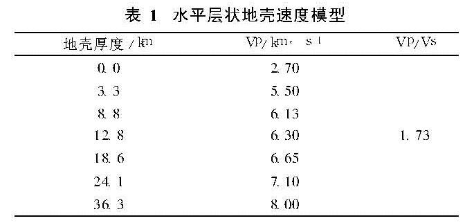
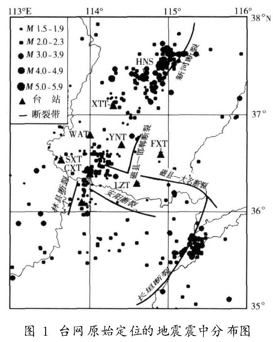
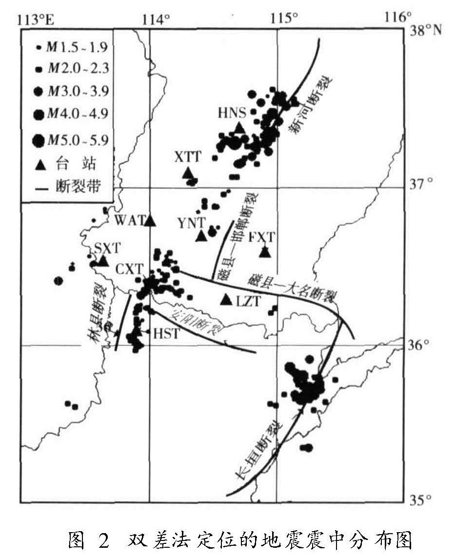
采用双差地震定位方法,利用2001~2006年间邯郸数字台网记录到的413次ML≥1.0地震的P波和S波震相到时资料,对邯郸—邢台地区(35.0°~38.0°N,113.0°~116.0°E)的地震进行了重新精确定位。经重新定位后得到其中295次地震的基本参数。重新定位结果显示了比较精细的震中分布图像和有所收敛的震源深度剖面图像,震源深度的优势分布为12~18 km,平均深度为14.9 km,部分震中位置与震源深度变化较大的地震向断裂带靠近。
We use double-difference location method and P-wave and S-wave data of 413 earthquakes with b>L≥ 1.0 recorded by the Handan-Xingtai regional digital seismic network to precisely relocate the places in Handan-Xingtai region( 35.0°-38.0°N,113.0°-116.0°E).The basic parameters of 295 earthquakes have been obtained after the relocation.The results of relocation show the finer image of the earthquake distribution and the profile section of the convergen focal depth,which distribute in 12-18km,averaging 14.9 km.The partial earthquakes with larger variations of epicentral locations and focal depths are close to the fault zone.