收稿日期:2007-03-07
基金项目:国家自然科学基金项目(40571104)和测绘遥感信息工程国家重点实验室开放研究基金资助.
基金项目:国家自然科学基金项目(40571104)和测绘遥感信息工程国家重点实验室开放研究基金资助.
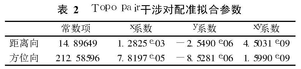
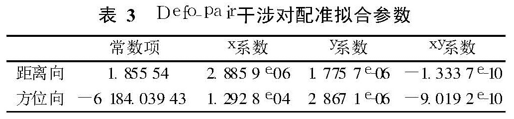
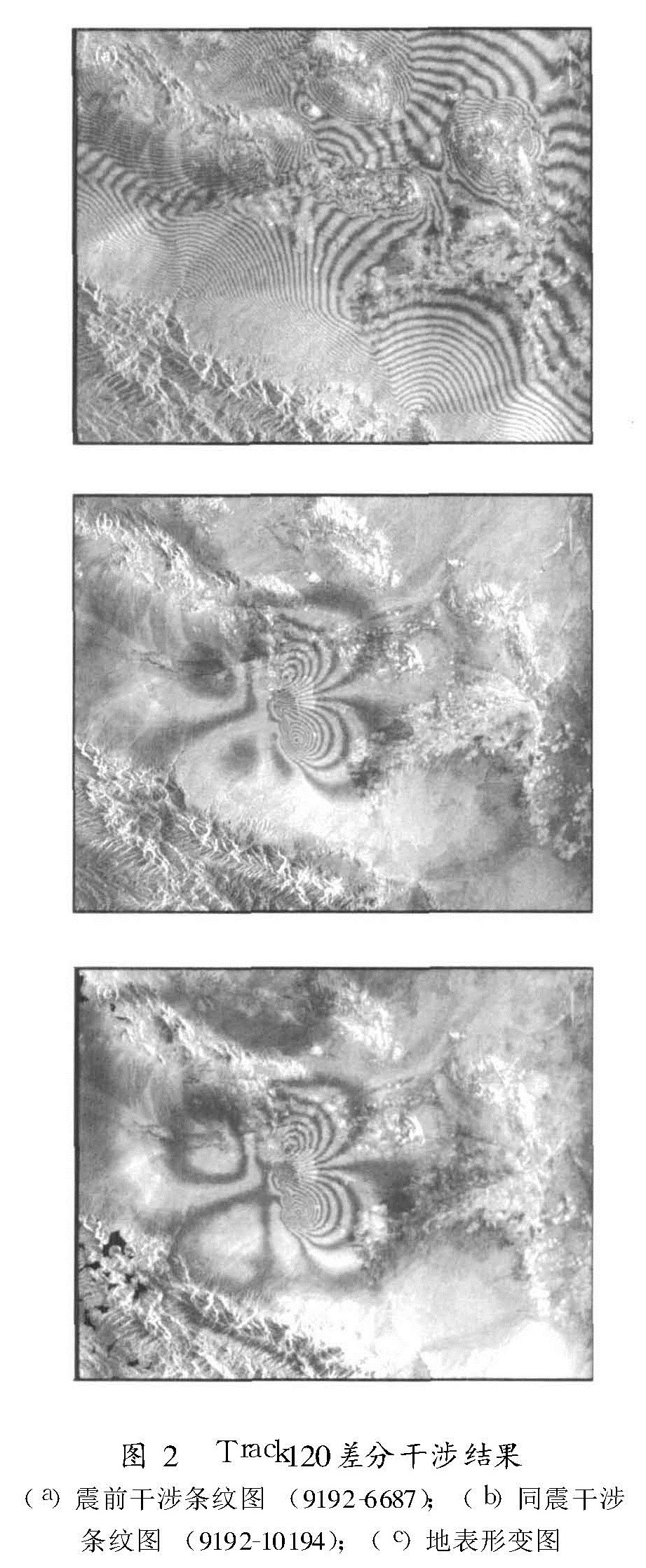
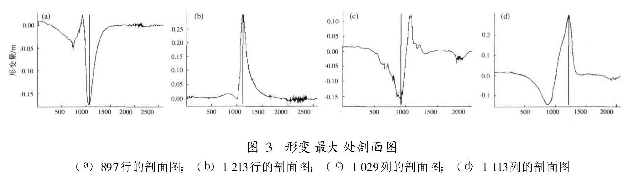
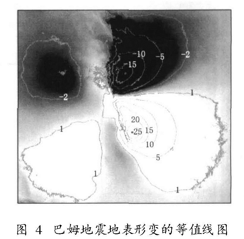
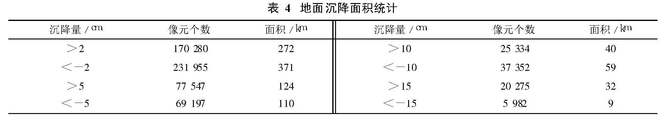
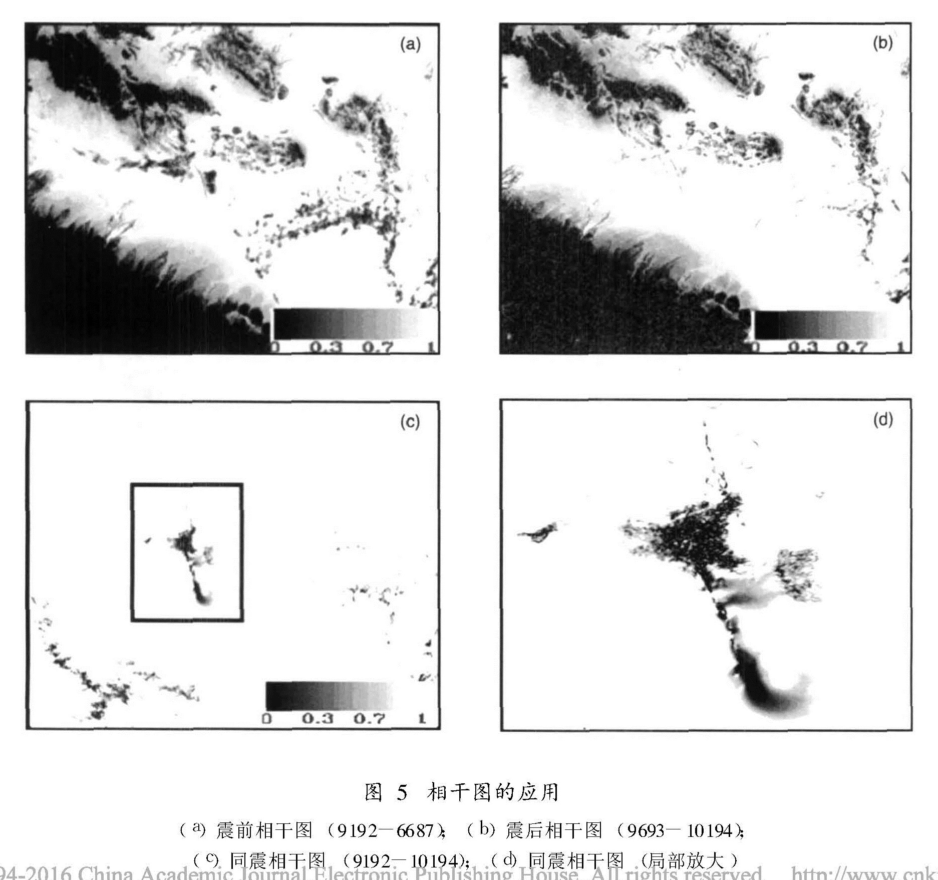
介绍了雷达差分干涉测量的原理,利用星载合成孔径雷达差分干涉测量技术和ENVISAT ASAR雷达数据,成功获取了2003年12月26日发生在伊朗巴姆的6.5级地震引起的同震形变场,通过生成地表形变的剖面图及等值线图,对形变场进行了深入的解译与分析,同时根据相干图确定了地震造成破坏最严重区域的位置、分布及面积。
The MW=6.5 Bam earthquake,taking place on 26th December 2003 in Iran,caused severe surface deformation.This paper described that it monitored the Bam co-seismic deformation fields using the differential interferometric SAR(D-InSAR)technique and ENVISAT ASAR data.Firstly,it introduced the principle of D-InSAR technique.It introduced the method to select proper D-InSAR data pairs.Then we used ENVISAT ASAR data to carry out 3-pass D-InSAR test in the Bam earthquake.It introduced the procedure of data processing of D-InSAR in detail.We successfully got the Bam co-seismic deformation field.We carried out interpretation and analysis for the deformation field.We generated the profiles and the isoline map according to the deformation map.We also determined the location,distribution and area of the serious destruction region caused by the Bam earthquake according to the coherence map.