收稿日期:2011-12-26
基金项目:国家自然科学基金(40974062,41174083)和地震行业重大专项(200908029)联合资助.
基金项目:国家自然科学基金(40974062,41174083)和地震行业重大专项(200908029)联合资助.
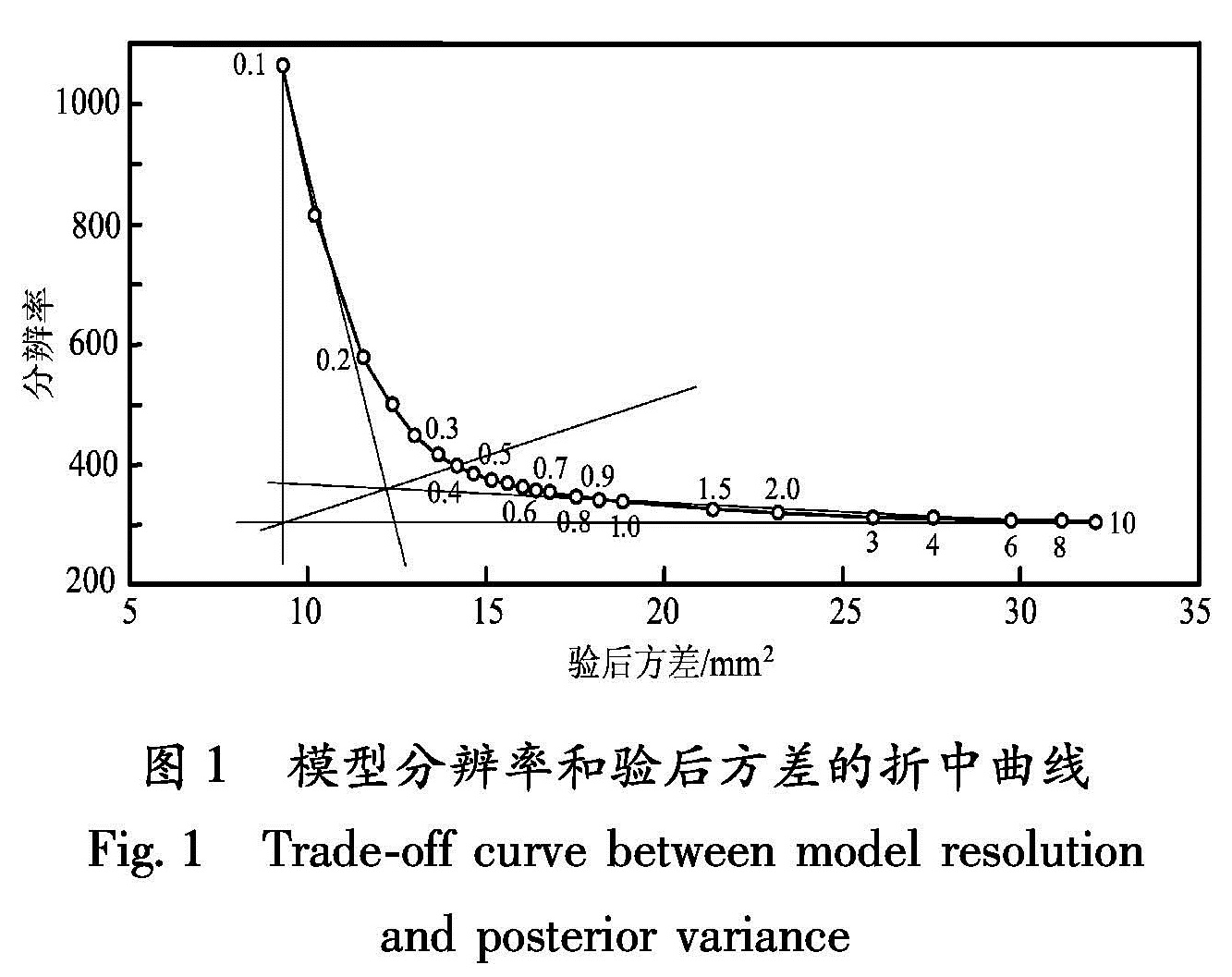
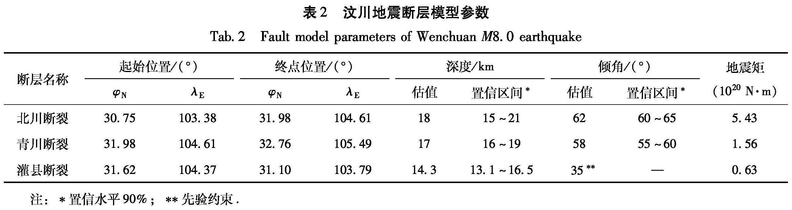
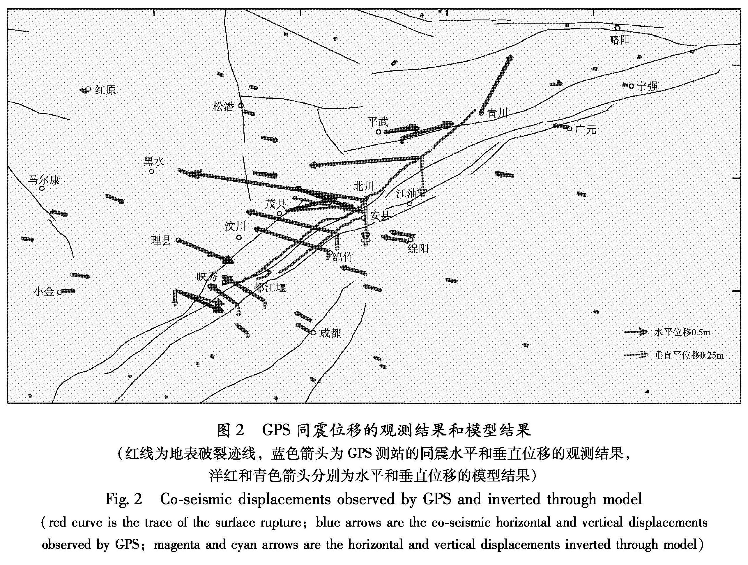
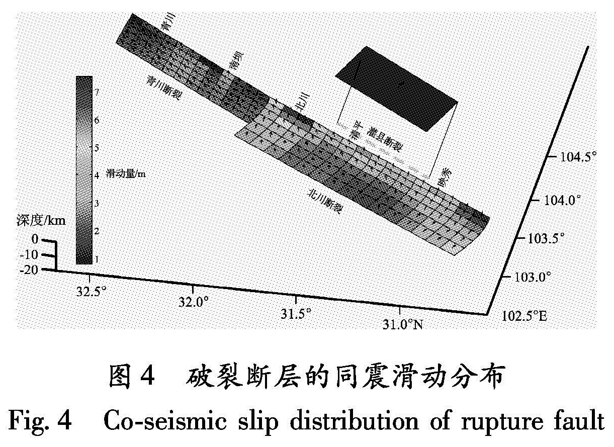
通过分析2008年汶川8.0级地震前后的GPS观测资料和1983~2010年的精密水准观测资料,得到地表同震位移场。结合野外地质调查,反演了汶川地震同震断层几何模型和断层面上滑动分布。反演结果表明:北川—映秀断裂是一个铲形断层,长度为180 km,地表倾角为62°,随指数函数形式逐渐变缓,深度18 km,断层面滑动以逆冲为主; 青川断裂长为120 km,倾角为58°,断层面上走滑分量由南向北逐渐增加; 灌县—江油断裂为纯逆冲断层,长度为80 km,倾角35°。整个断层模型中最大错动量达到7.6 m,对应破坏最严重的北川地区。本次地震释放的地震矩为7.62×10²⁰ N·m,相应矩震级为MW7.9。反演所得模型对于近场的水准观测资料和GPS观测资料拟合很好。
Basing on the GPS and precise leveling observation data before and after Wenchuan M8.0 earthquake in 2008,we got its co-seismic displacements fields.Combining the field geological investigation,we inversed the geometric model of co-seismic fault and slip distribution on the fault plane.The inversion results show that Beichuan-Yingxiu fault is a listric fault with a length of 180 km,the dip on the ground is 62° and decreases gradually in exponential function along with the depth increase.The depth of the fault is 18 km and the slip on the fault plane is mainly the thrust motion.The length and dip of Qingchuan fault is 120 km and 58° respectively,and the strike-slip component increases gradually along the strike from south to north.The Guanxian-Jiangyou fault is a thrust fault with the length of 80km and the dip of 35°.The maximum slip of the fault model is 7.6 m,which is corresponding to Beichuan area in most severe damage.The seismic moment releasing of Wenchuan M8.0 earthquake is estimated to be 7.62×10²⁰ N·m,and its corresponding moment magnitude is MW7.9.The geometric model of co-seismic fault is well fit for GPS and precise leveling observation data.