基金项目:地震行业专项“GNSS系列产品在监测预报中的应用”(201208006)资助.
备注
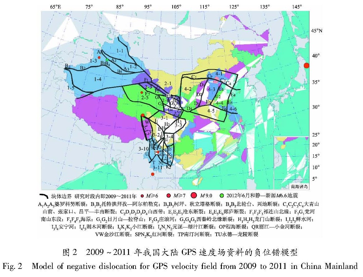
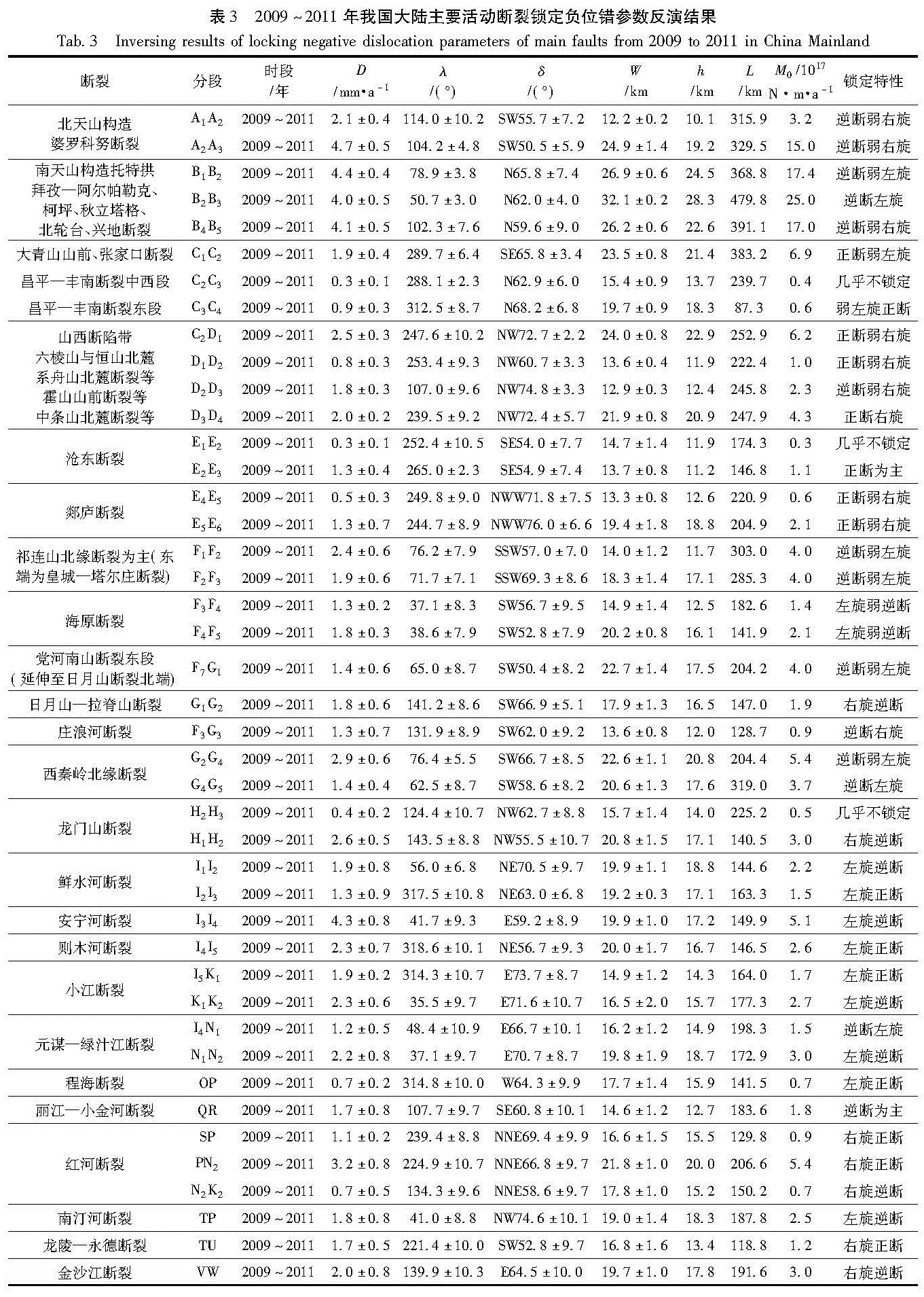
利用2009~2011年全国GPS水平运动速度场资料,借助负位错反演,寻找新疆、青藏块体东北缘、川滇、华北地区主要活动断裂能量积累闭锁段,研究其积累速率、闭锁深度、分区分段差异性,及与强震孕育—发生的可能关系。结果 表明:(1)新疆天山地区应变积累速率最强,平均闭锁深度也最深,约20.9 km。其次为川滇地区,平均深度约16.3 km。青藏块体东北缘存在一定程度应变积累,平均深度约15.7 km。华北地区应变积累最弱,平均深度约16.0 km;(2)南天山西段、川滇交界东部、红河断裂中段至滇西、祁连山断裂带西段、西秦岭北缘断裂甘青交界段、晋冀蒙交界区近期能量积累相对显著。
Firstly,using data of GPS horizontal velocity field in China Mainland from 2009 to 2011,aided by inversion of negative dislocation,we found locked segments with energy accumulation at main fractures in Xinjiang,the northeastern margin of Qinghai-Tibet Block,Sichuan-Yunnan and the North China. Secondly,we studied the accumulation rate and locked depth and difference at different regions or segments of main fractures and their possible relationship with preparation of strong earthquakes. The result indicated that:(1)Strain-accumulating rate was the highest in Xinjiang area,average locked depth was about 20.9 km; Strain-accumulating rate in Sichuan-Yunnan area was the second,average locked depth was about 16.3 km; There existed strain accumulation to some degree in northeastern margin of Qinghai-Xizang Block,average locked depth was about 15.7 km,and the strain accumulation rate in North China was the lowest,average locked depth was 16.0 km.(2)At present,there exited relatively higher energy accumulation in west of Southern Tianshan,the eastern of the boundary between Sichuan and Yunnan,from the middle segment of Honghe Fault to the western Yunnan,the western segment of Qilianshan Fault,the segment of the northern margin fault of West Qinling Mountain near boundary between Gansu and Qinghai,the boundary among Shanxi,Hebei and Inner Mongolia Autonomous.


