收稿日期:2013-04-08
基金项目:国家自然科学基金(41374030)、地震科技星火计划项目(XH1030)、地震科学联合基金(A08056)和新疆维吾尔自治区自然科学基金(2012211B56)联合资助.
基金项目:国家自然科学基金(41374030)、地震科技星火计划项目(XH1030)、地震科学联合基金(A08056)和新疆维吾尔自治区自然科学基金(2012211B56)联合资助.
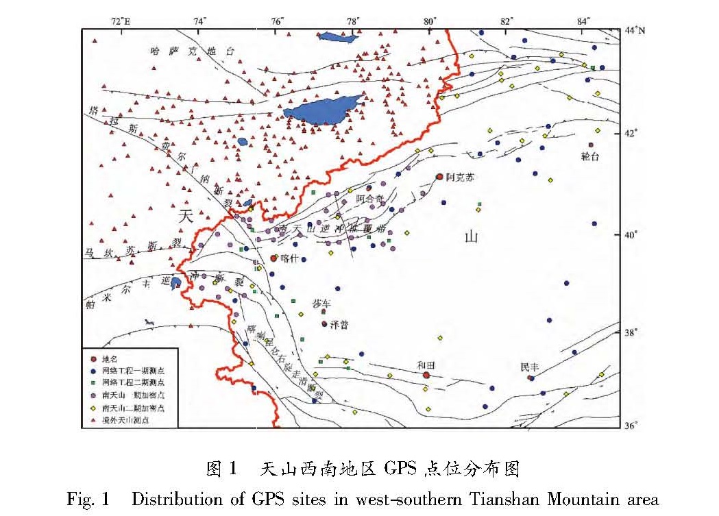
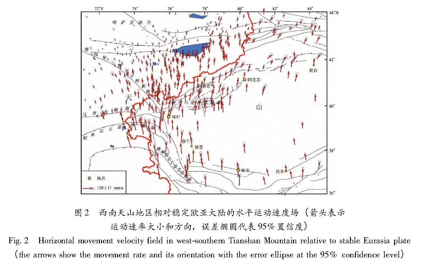
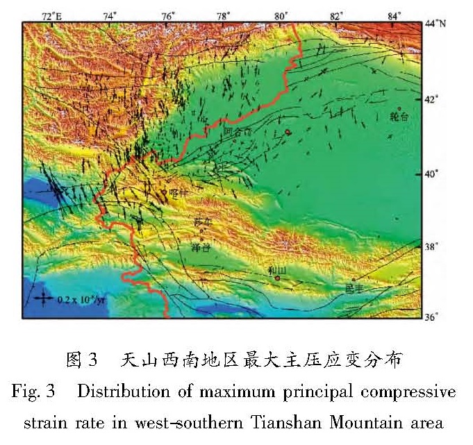
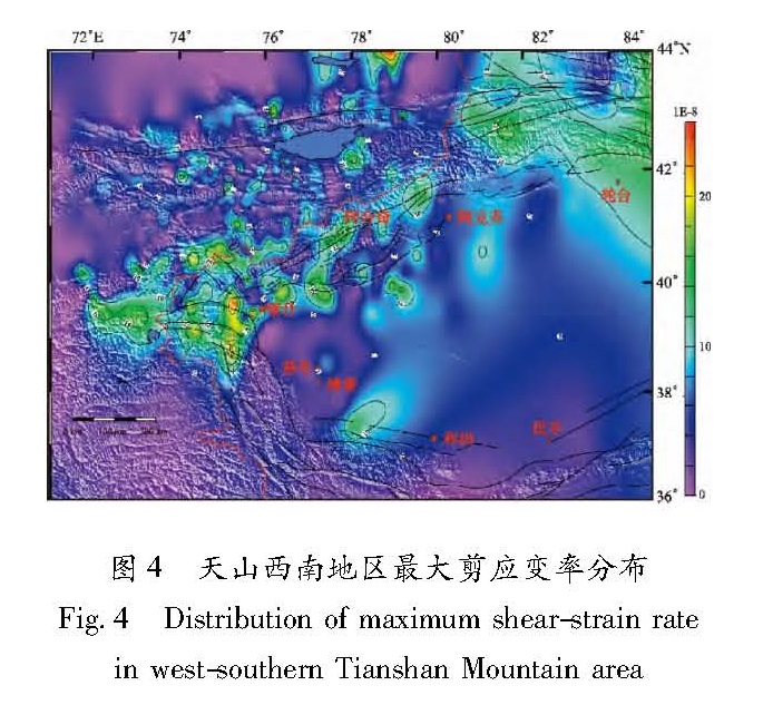
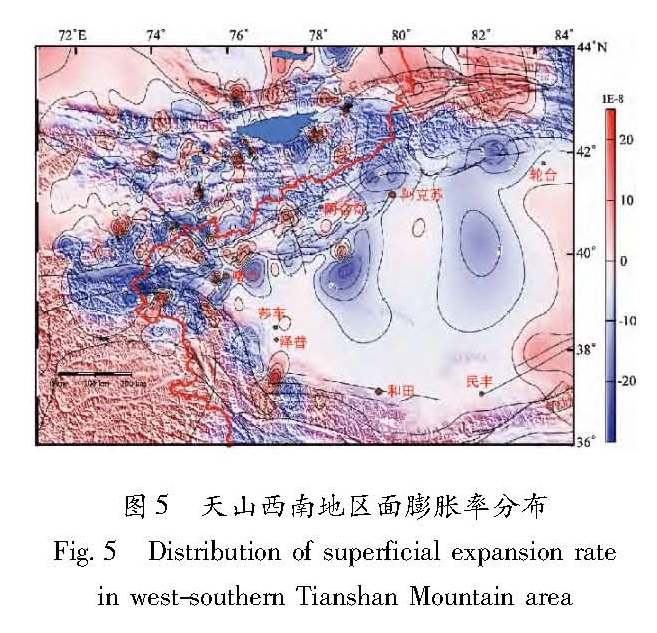
利用1992~2012年多期境内外天山西南地区GPS观测数据,计算得出天山西南及帕米尔地区现今构造变形运动速度场,并计算给出了研究区内最大主应变、剪应变率和面膨胀的分布情况。结果 表明:在西天山地区受印度板块西构造结挤压作用下,帕米尔高原快速向北俯冲,造成天山沿这一经度带发生了强烈的地壳缩短; 盆—山结合带的变形大于山体内部变形,形变幅度最大的地方往往就是历史上多次发生7~8级大震的地方; 天山主压应变方向随经度增加逐渐由北北西向转向南北及北北东向,基本上与天山山脉走向垂直; 主压应变较大的地区集中在西天山南北褶皱带上,最大剪应变率位于西天山南缘与帕米尔高原及西昆仑结合部,高值区是强地震的主要分布区。
Based on GPS observational data from 1992 to 2012 in the west-southern Tianshan area,the present-day crustal tectonic deformation movement velocity field in west-southern Tianshan and Pamir area is obtained,and the distribution of maximum strain,shear strain rate and surface dilation are calculated. The results indicated that under the extrusion of the India plate Western syntaxis on Western Tianshan area,the Pamirs plateau subducted to the north rapidly,which caused the strong crustal shortening in Tianshan area along this longitude belt. The deformation in the basin-range junction zone was greater than that in mountain interior,and the area with large range of the deformation always occurred M7~8 earthquakes in history. The direction of principal compressive strain is gradually from NNW to SN and NNE with the increasing of longitude,which is basically perpendicular to the trend of Tianshan Moutian. The area with larger principal compressive strain concentrated in the north-south fold belt of West Tianshan. The maximum shear strain rate located in the southern margin of Western Tianshan and the joint part between Pamirs and the South West Kunlun,where is the main distribution area of strong earthquake.