收稿日期:2014-08-30
备注
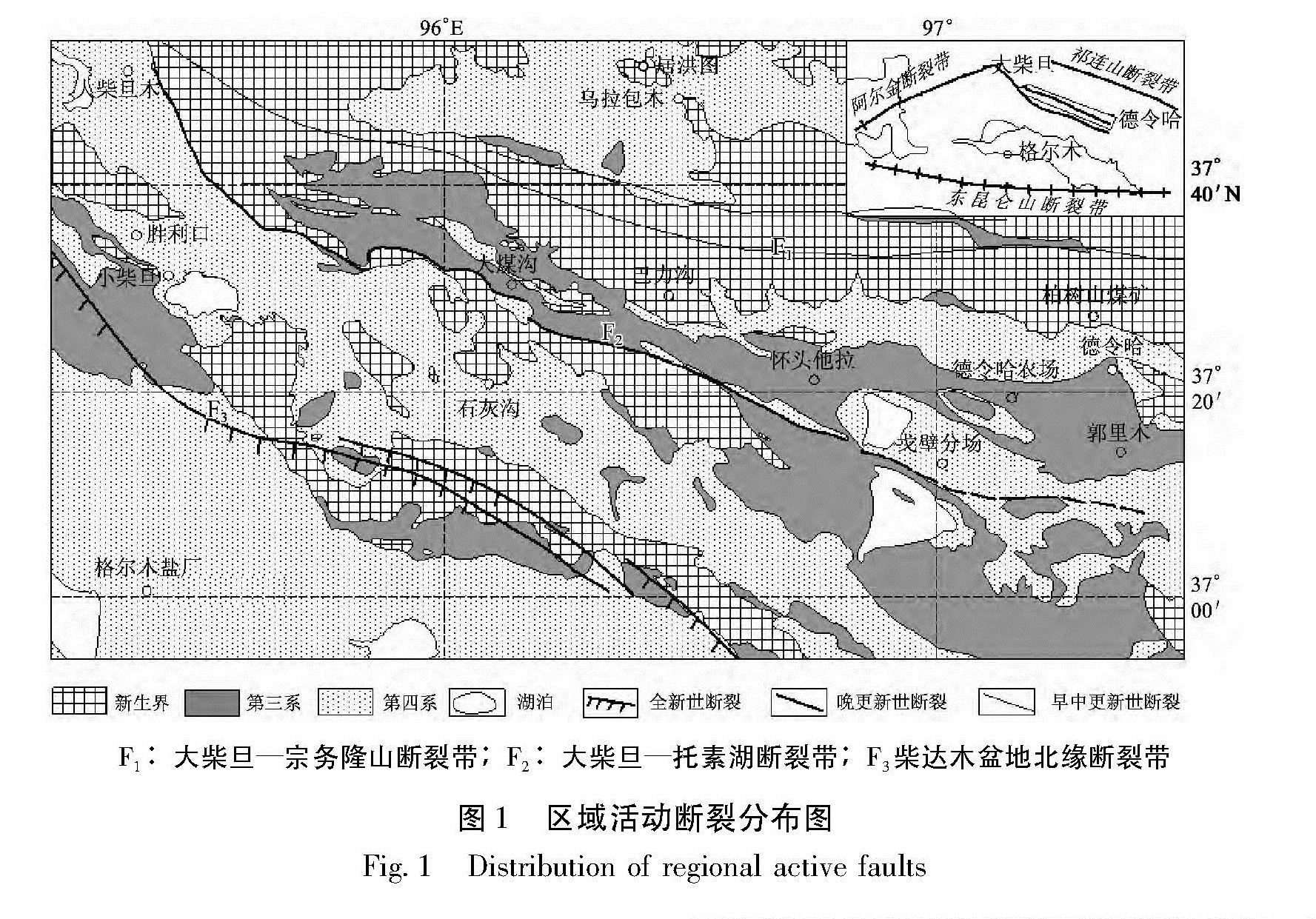
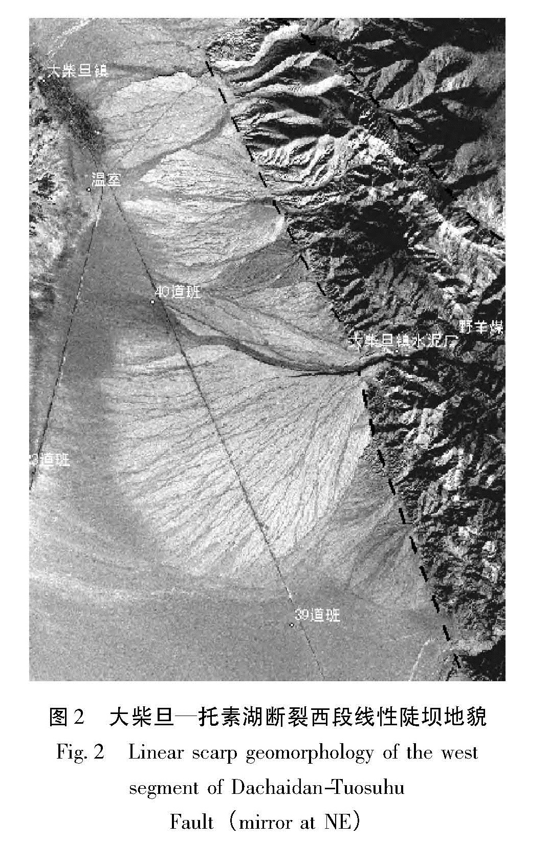
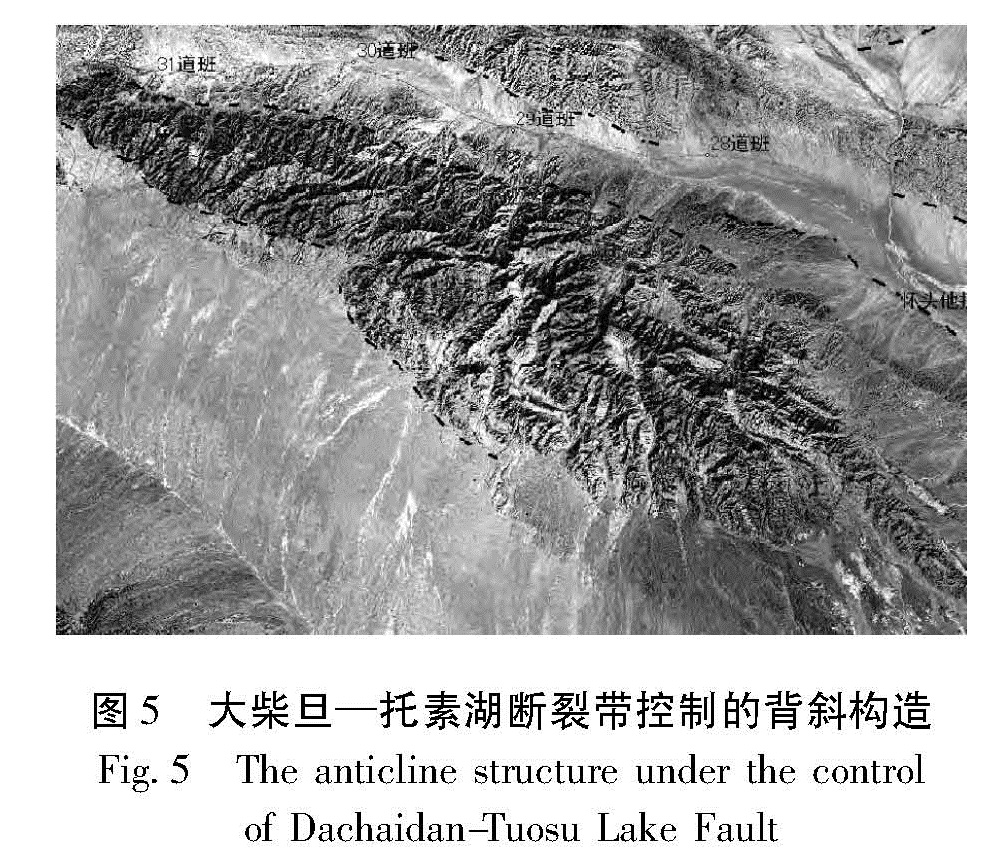
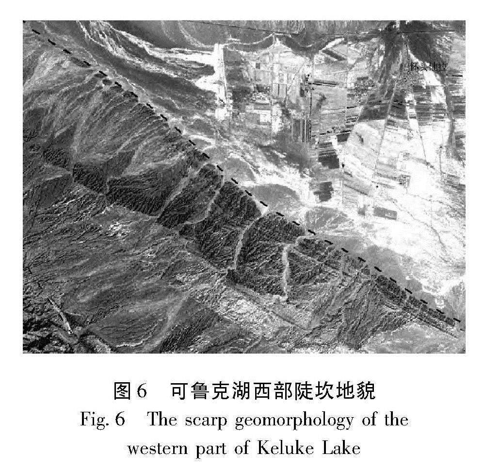
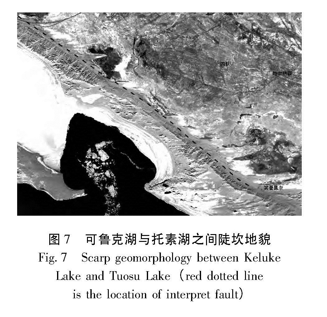
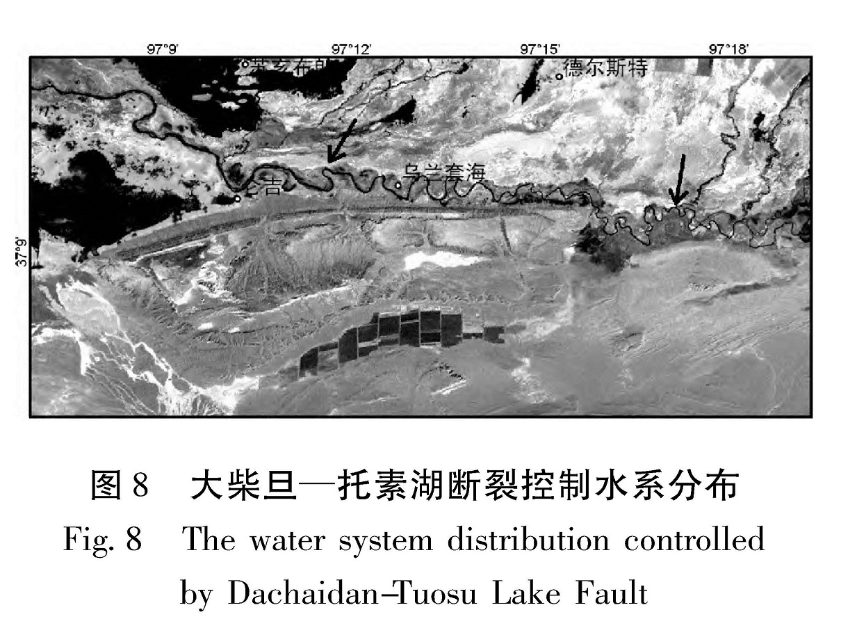
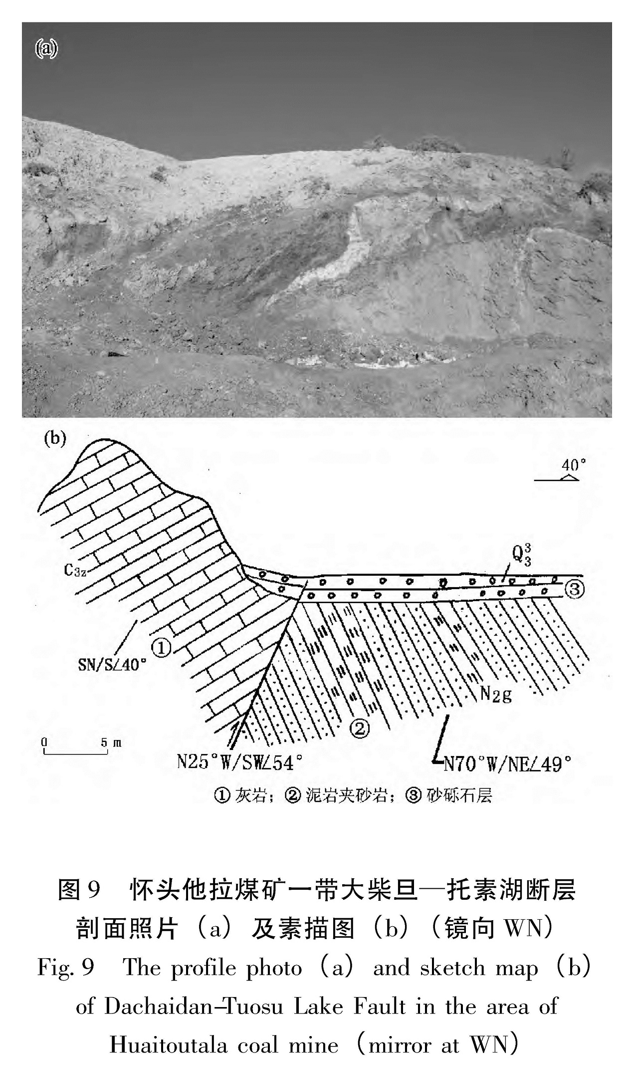
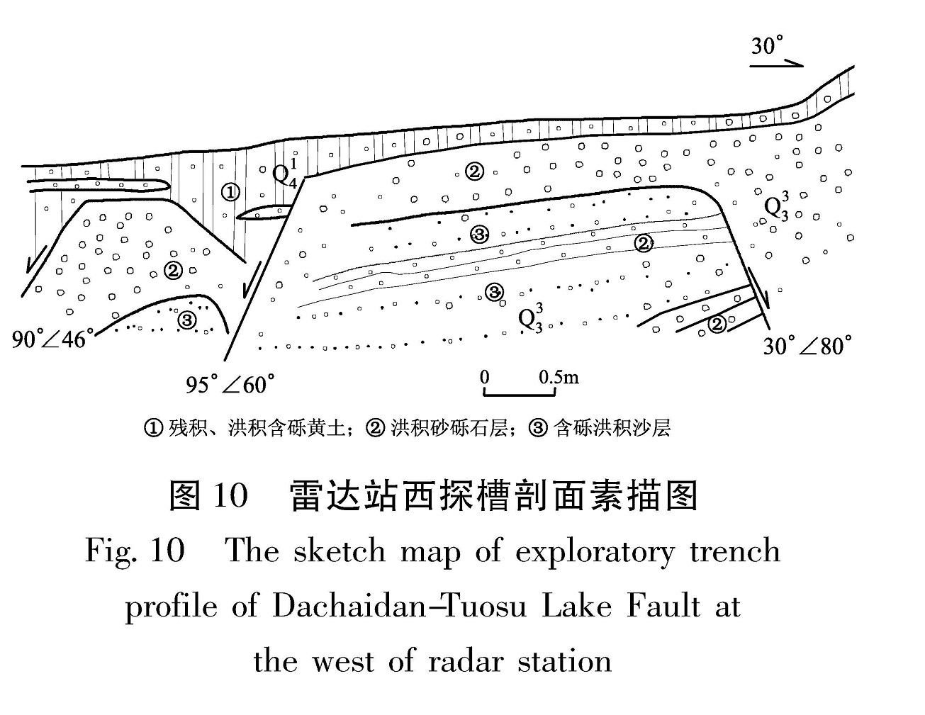
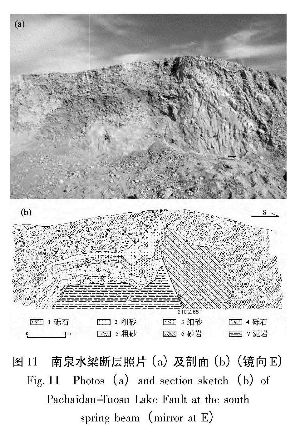
通过对大柴旦—托素湖断裂进行遥感解译、野外地质调查,认为该断裂遥感迹象清晰、断层三角面发育、线性陡坎明显,分为东、中、西三段。断裂在东、西两段晚更新世以来活动强烈,中段晚更新世以来活动较弱。根据构造类别法认为该断裂具有发生中强地震的发震构造,很可能是德令哈至大柴旦多次中强地震的发震构造。
According to the remote sensing interpretation and field geological investigation etc. of Dachaidan-Tuosu Lake Fault belt,we find that the remote sensing sign of the fault is clear,the fault facet is develop,and the linear scarp is obvious. The fault belt could be divided into three segments of east,central and west. The activity of east and west segment of Dachaidan-Tuosu Lake Fault was very strong,however the central part of it was weak since late Pleistocene. It shows that the fault has the seismogenic structure of mid-strong earthquake by the structural category method,which could be the seismogenic structure of several strong earthquakes in Delingha-Dachaidan region.