基金项目:2018年度地震监测、预测、科研三结合课题(CEA-JC/3JH-173706)和2016年度震情跟踪定向工作任务(2016010207)联合资助.
备注
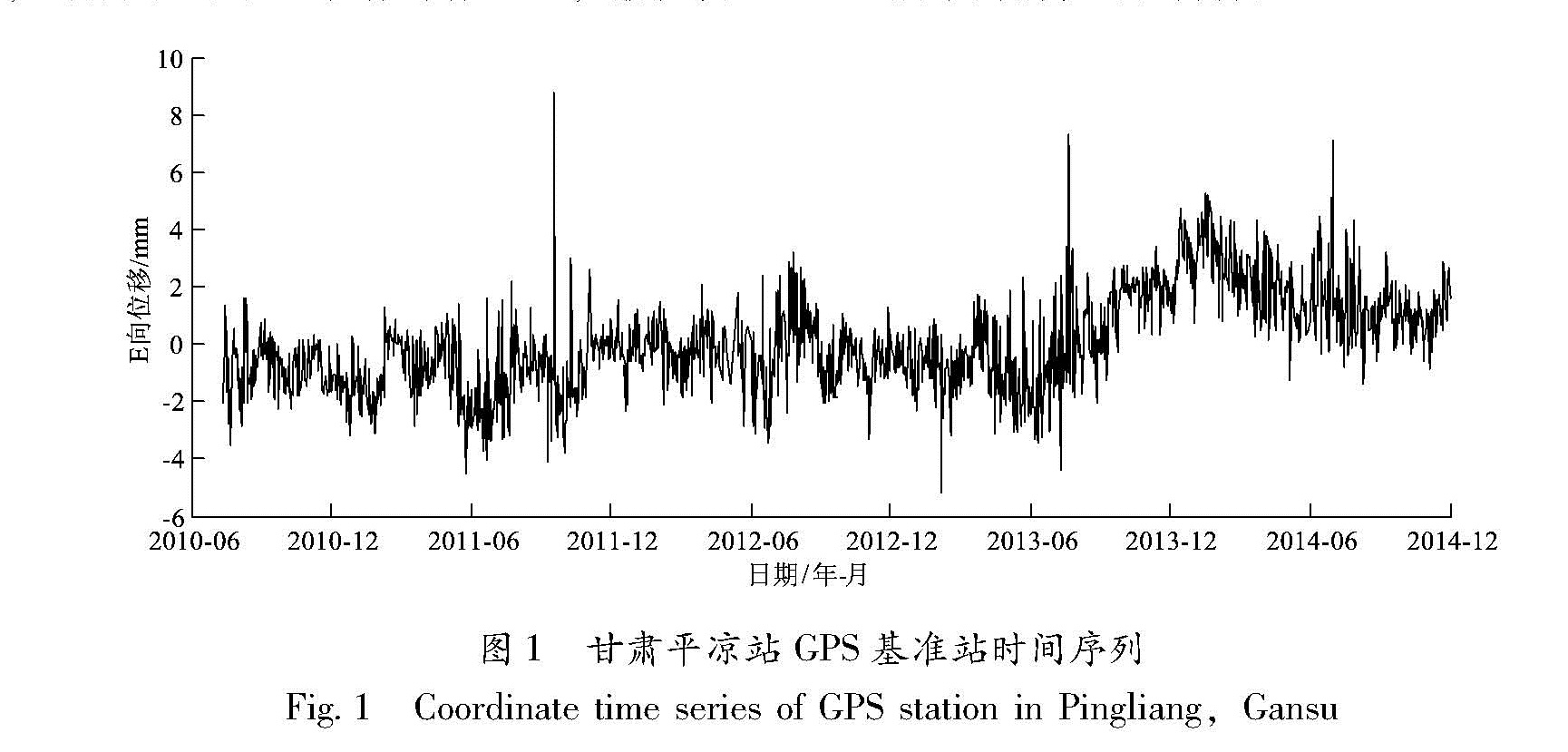
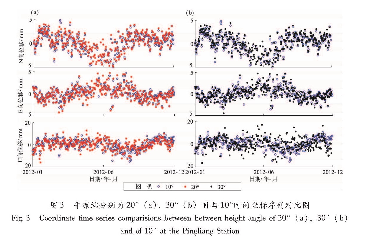
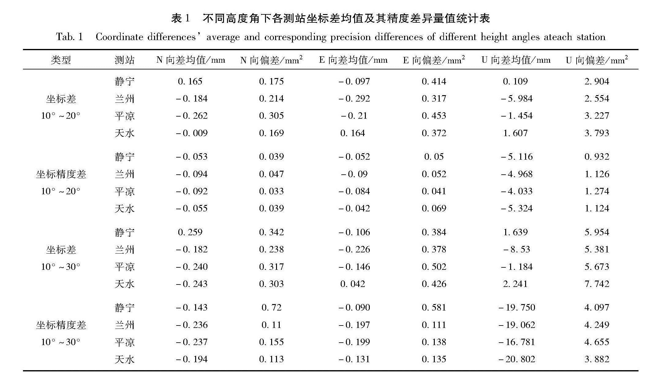
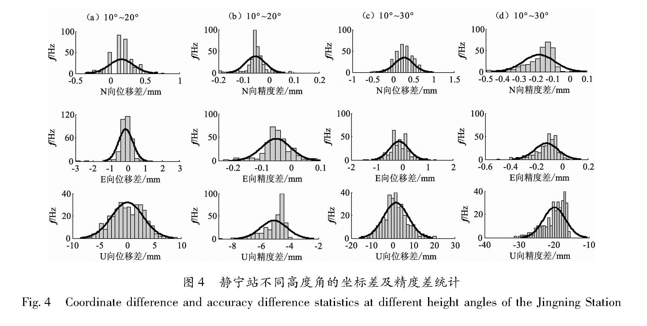
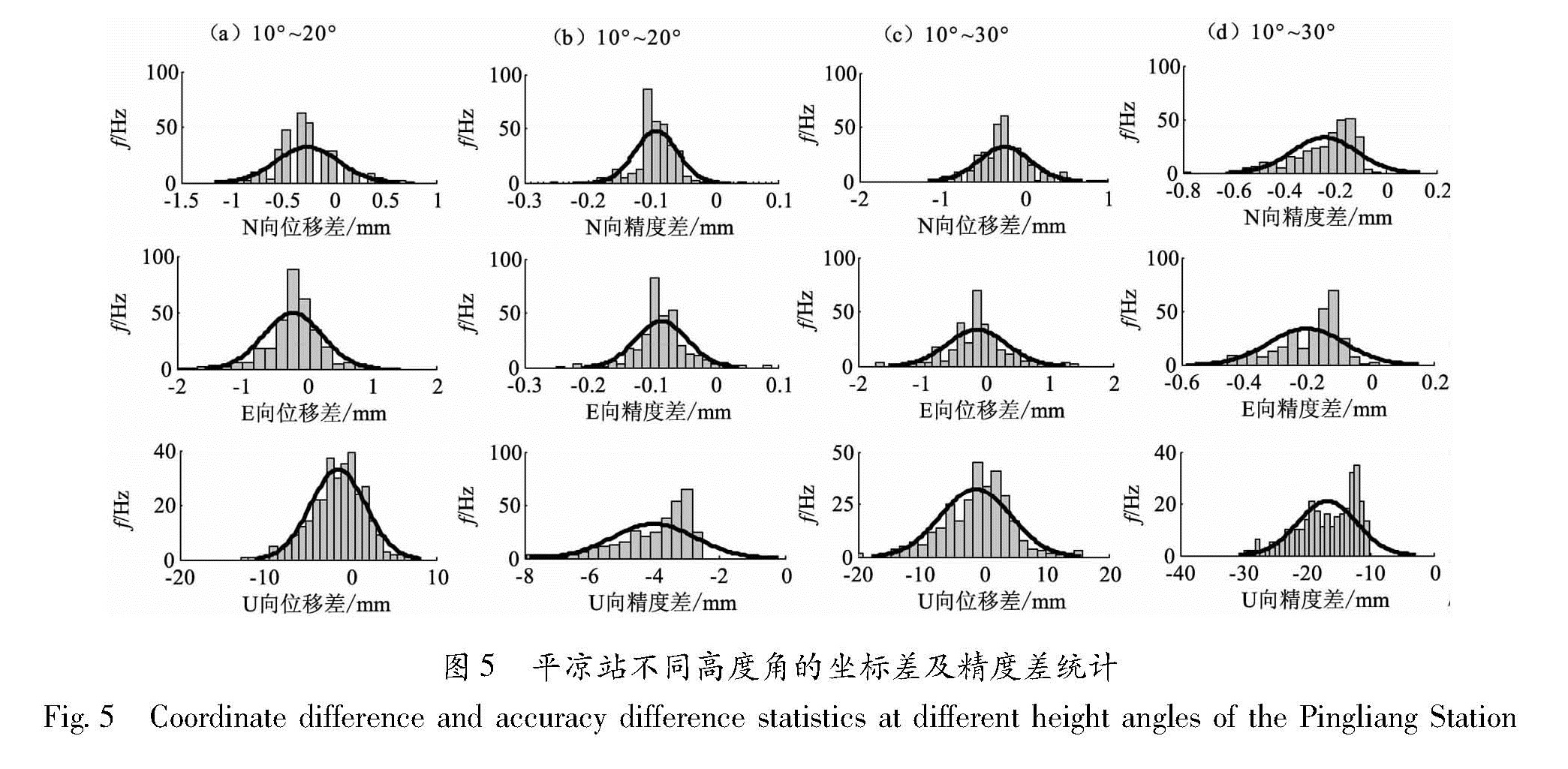
采用统一的参考框架和数据处理方案,对中国大陆构造环境监测网络GPS连续观测站自2010年6月正式运行以来所有观测数据进行解算,得到可靠的连续站坐标时间序列结果。在此基础上,对GPS连续观测时间序列出现的非线性、非周期性异常变化,开展现场调研核实与分析,梳理异常GPS观测站的环境变化情况并确定可能影响因素,针对树木等遮挡物对观测结果的影响,选取部分测站的已有数据通过人为设定环视角、屏蔽部分卫星信号等方式进行数据筛选实验,结果表明环视角提高对垂向的影响大于水平方向,当环视角提高到20°时可以有效地改善多路径效应引起的影响,对净化原始数据很有利,环视角增大到30°时坐标的精度下降比较明显; 屏蔽部分卫星信号在一定程度上能够提高坐标的精度,但比较繁琐,不适合处理大规模的数据,对个别流动站不超过4天的数据进行检查和改正具有一定可行性。
In this paper,we calculated reliable coordinate time series of continues GPS stations of Crust Movement Observation Network Of China(CMONOC)by unified reference frame and data processing scheme since June 2010.And then non-linear and non-periodic abnormal changes from those coordinate time series have been carried out in-depth and detailed field verification and analysis to determine environmental changes and their influences.For the effect on the observation results from trees and other obstructions,we set data screening experiments by artificially set ring angle,shielding part of the satellite signal and other means based on part of existing coordinate time series.The results show that the effect on coordinate time series is that when the ring angle increases,the the precision for vertical direction is worse in contrast to horizontal direction.When the ring angle is increased to 20 degrees,the multi-path effect can be effectively improved which is very favorable for the purification of raw data.When the ring angle is increased to 30 degrees,the accuracy degree of coordinate time series significantly decreased.Shielding part of the satellite signal can improve the accuracy of coordinates to a certain extent,but not suitable when processing large-scale data.However,it is feasible,to a certain extent,to check and correct the data of individual mobile stations within 4 days.
