收稿日期:2019-01-28
基金项目:云南省地震局青年基金项目(2017ZL08)资助.
基金项目:云南省地震局青年基金项目(2017ZL08)资助.
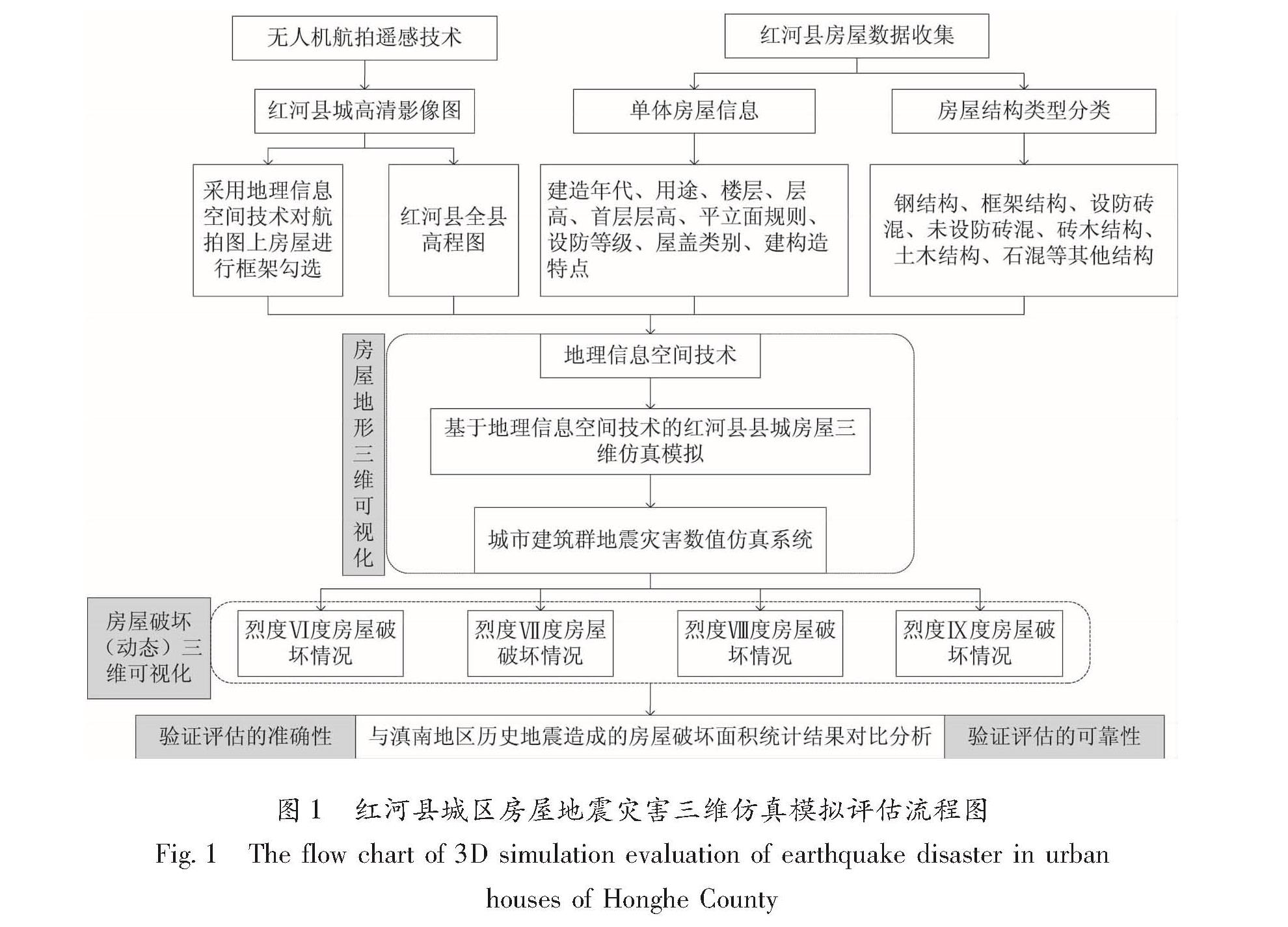
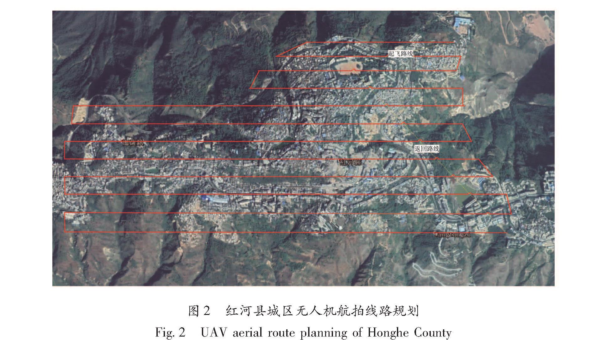
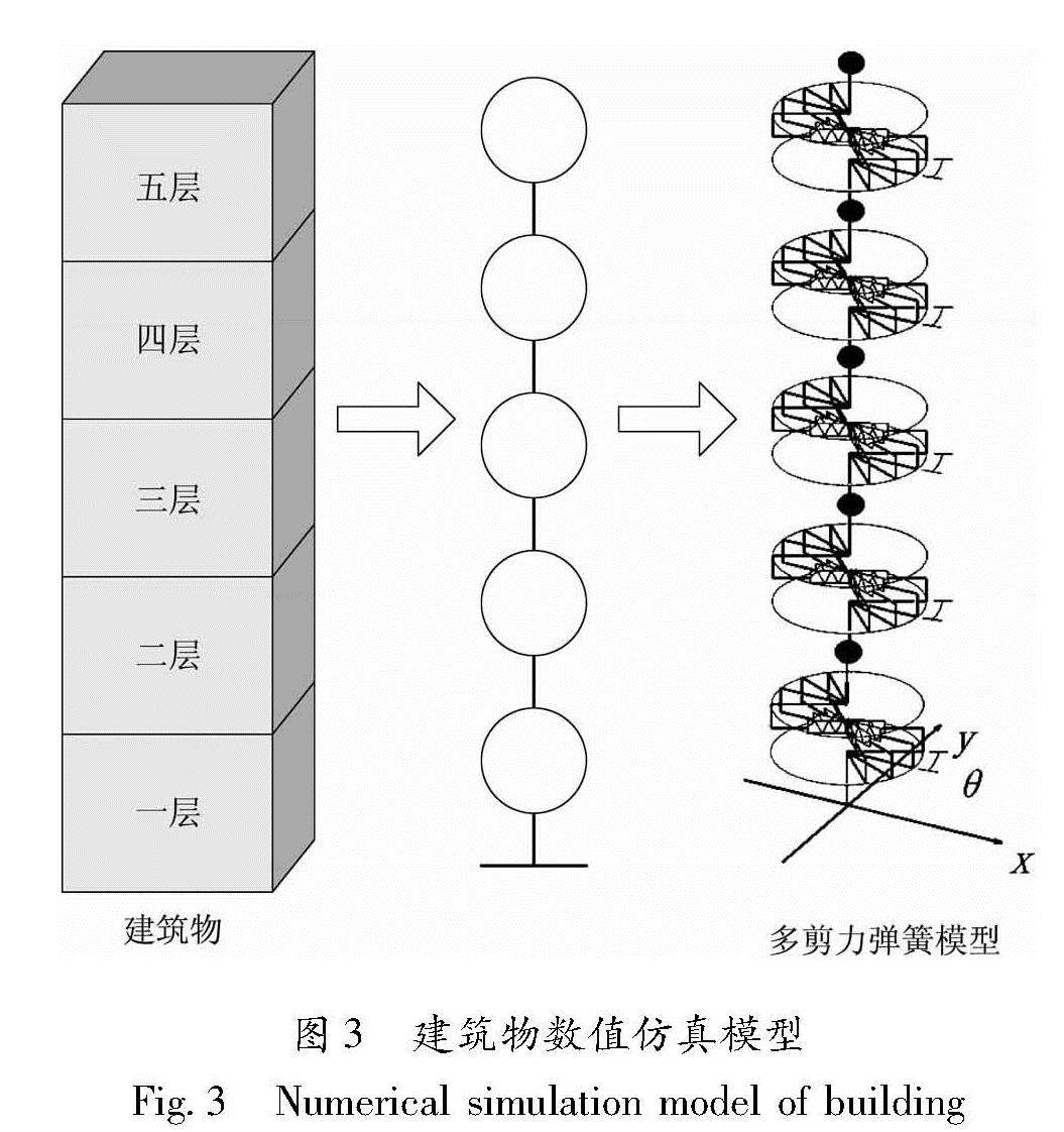
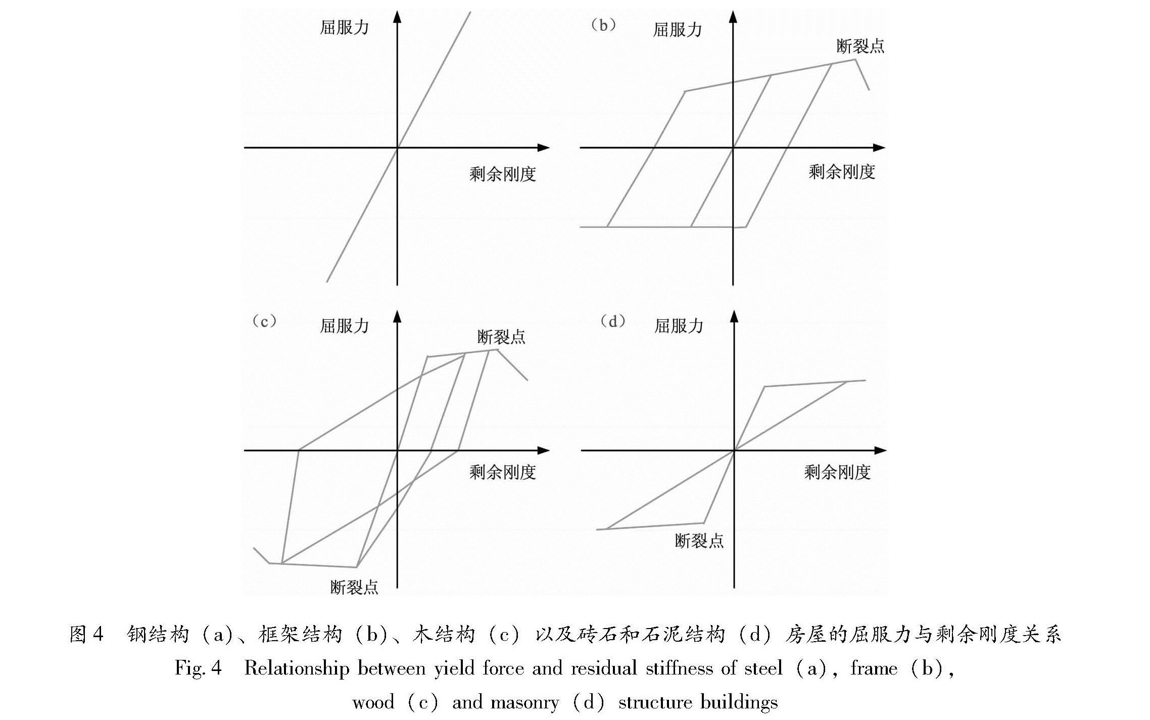
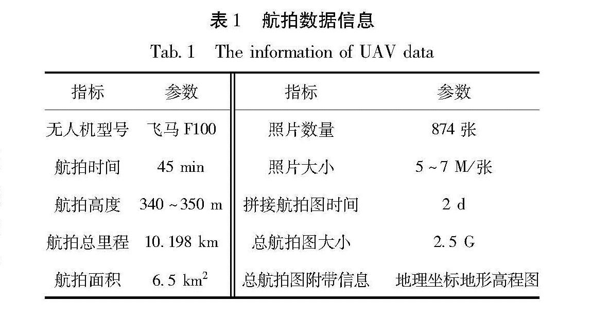
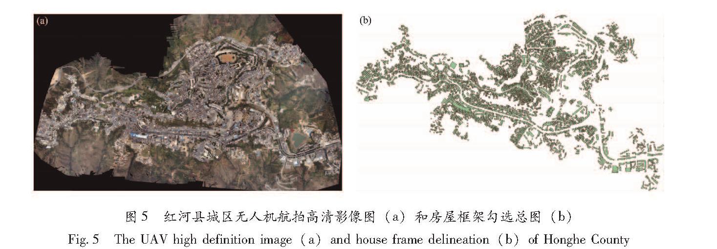
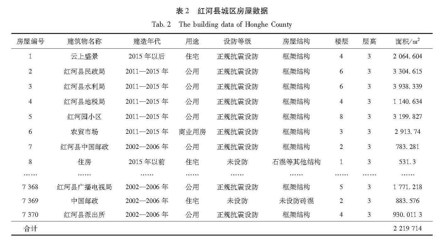
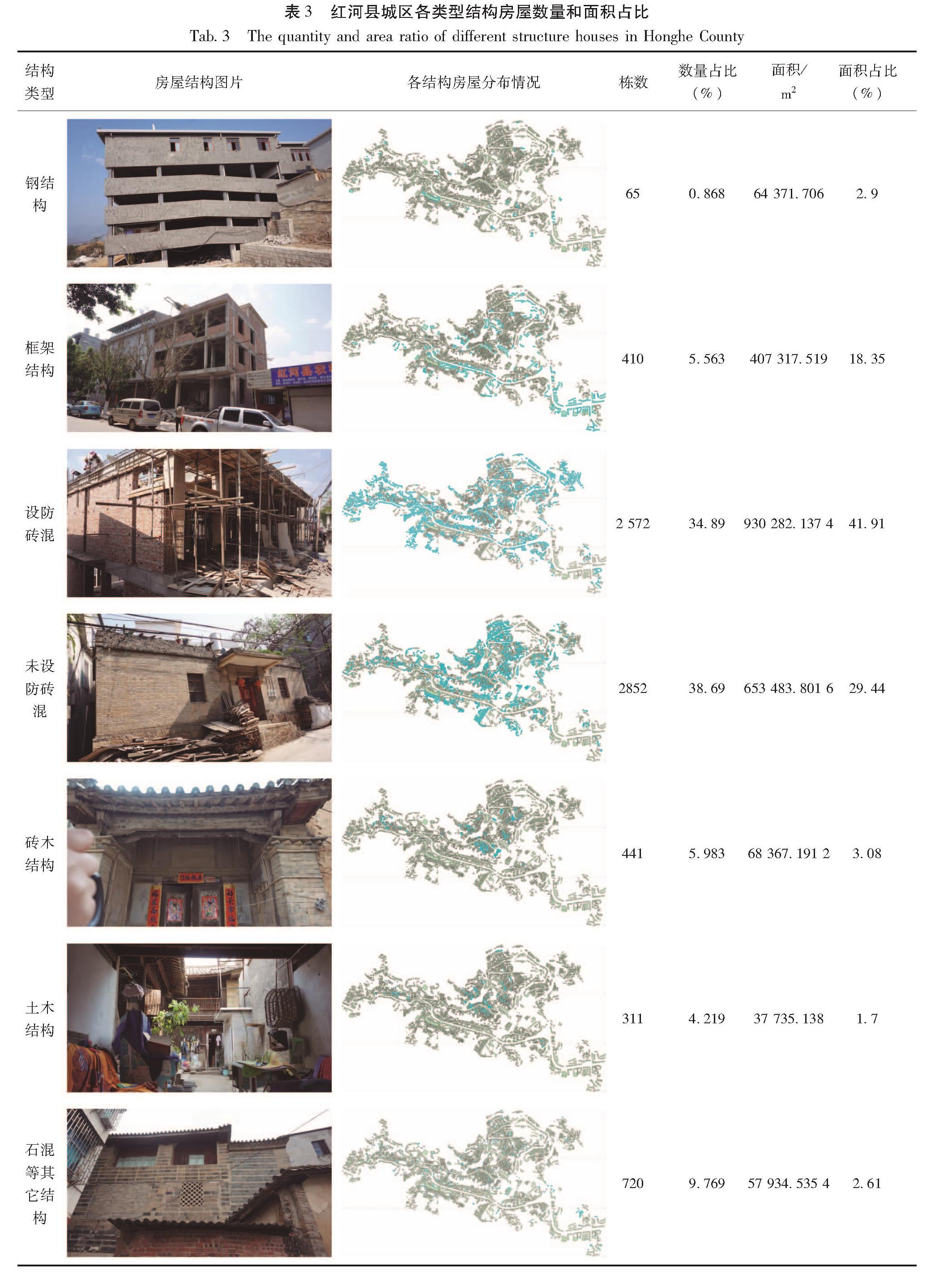
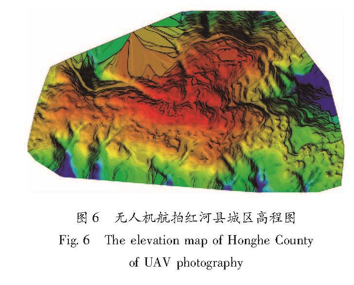
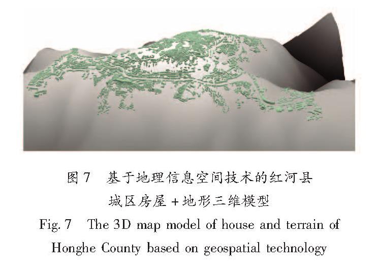
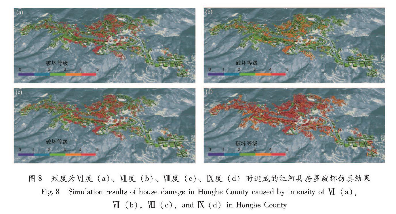
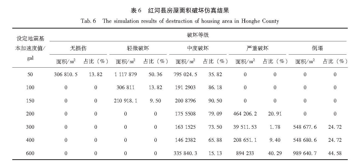
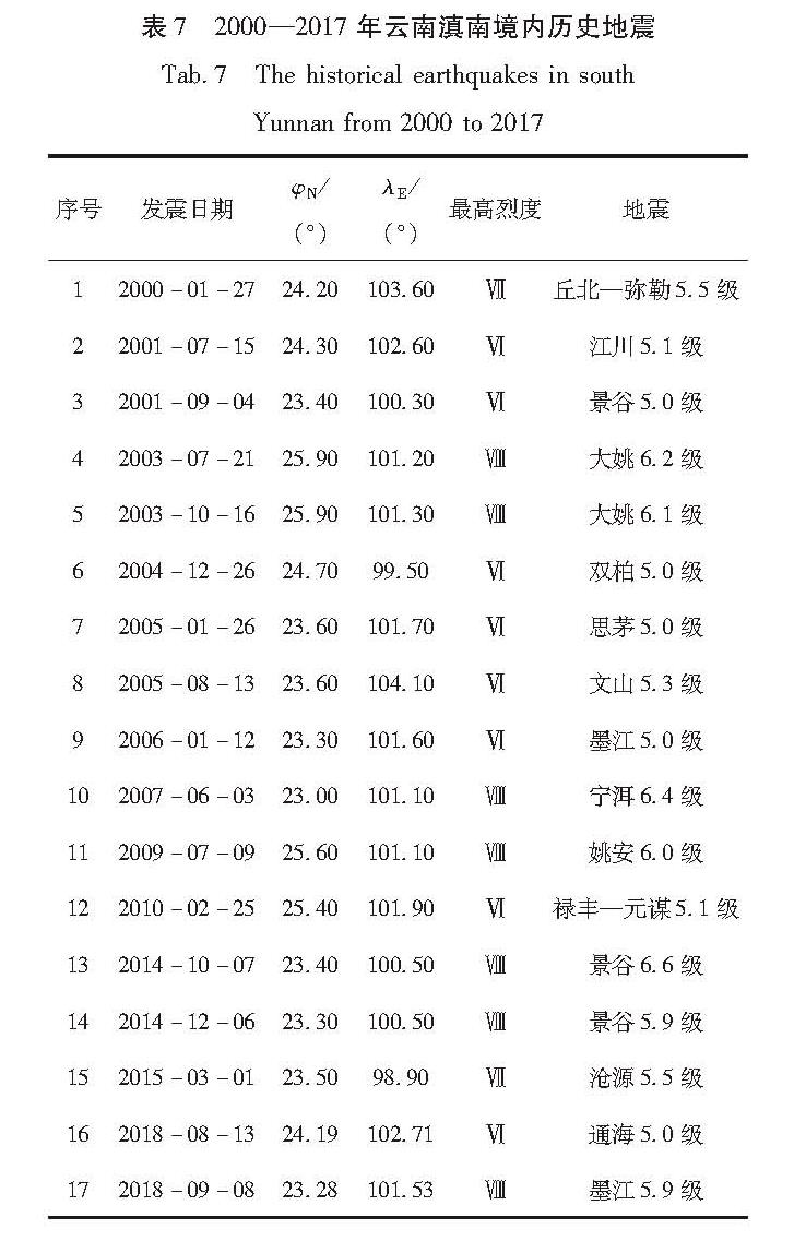
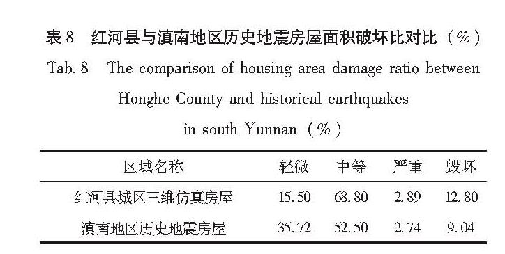
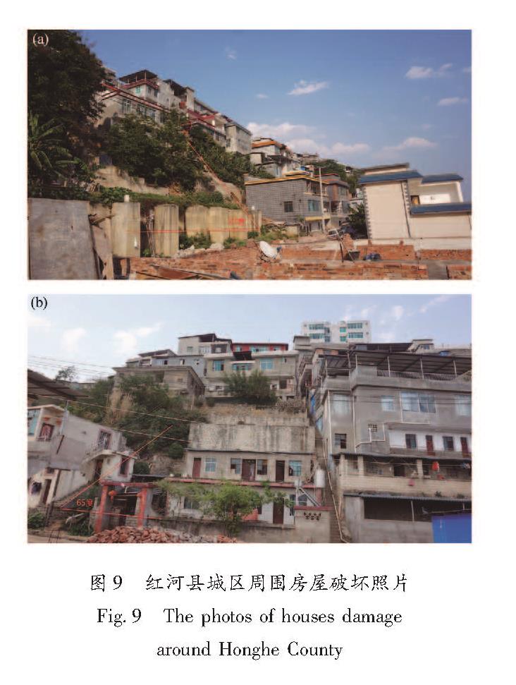
对云南省红河县城区房屋建造年代、结构类型、设防等级、楼层、层高、面积、外观形状及所处地形等进行调查,并采用无人机航拍遥感技术、地理空间信息技术和三维仿真建模技术,对红河县城区进行地震灾害三维仿真模拟评估,得出不同烈度下城区房屋的破坏程度及分布情况。最后将评估结果与滇南地区历史地震造成的房屋破坏情况进行对比。结果 表明:红河县城区三维仿真与滇南地区历史地震房屋面积破坏比相近,地震灾害三维仿真系统在房屋破坏动态可视化方面优势明显,因此使用该方法模拟评估地震灾害对房屋造成的影响是可行的。
Through detailed investigation to the topography,the housing construction age,the use,the defense level,the structure,the number of floors,the floor height,the area and the appearance shape in Honghe County,Yunnan,we carried out the 3D simulation evaluation of earthquake disaster of Honghe County by using the remote sensing of UAV,geospatial information and 3D simulation modeling technologies,and obtained the degree and distribution of houses damage under different seismic intensity. Finally,the evaluation results are compared with the damage of buildings caused by historical earthquakes in southern Yunnan. The results show that the damage ratio of the 3D simulation of Honghe County is similar to that of historical earthquake buildings in southern Yunnan. The 3D simulation system of earthquake disasters has obvious advantages in visualizing the dynamic damage of buildings. Therefore,this method is feasible to simulate and evaluate the impact of earthquake disasters on houses.