收稿日期:2019-01-22
基金项目:“十三五”国家重点研发计划项目(2017YFB0504104)与国家自然科学基金国际合作项目(41661144037)联合资助.
基金项目:“十三五”国家重点研发计划项目(2017YFB0504104)与国家自然科学基金国际合作项目(41661144037)联合资助.
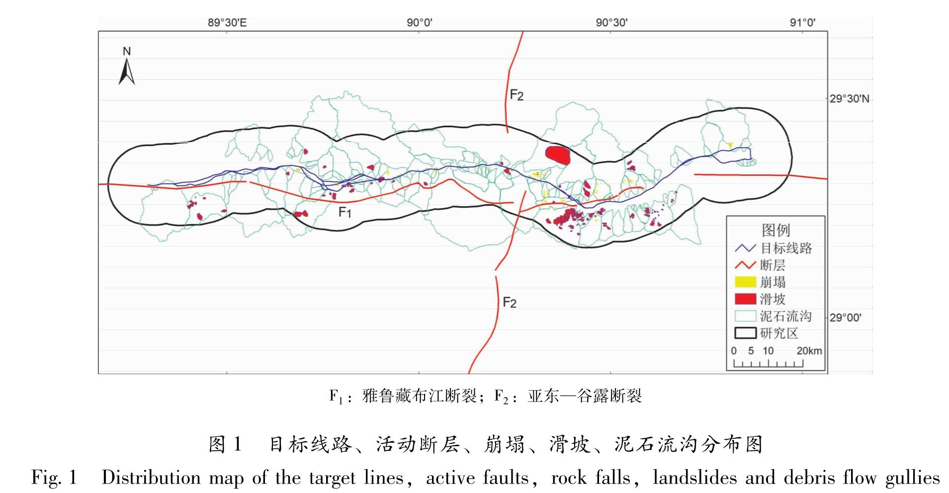
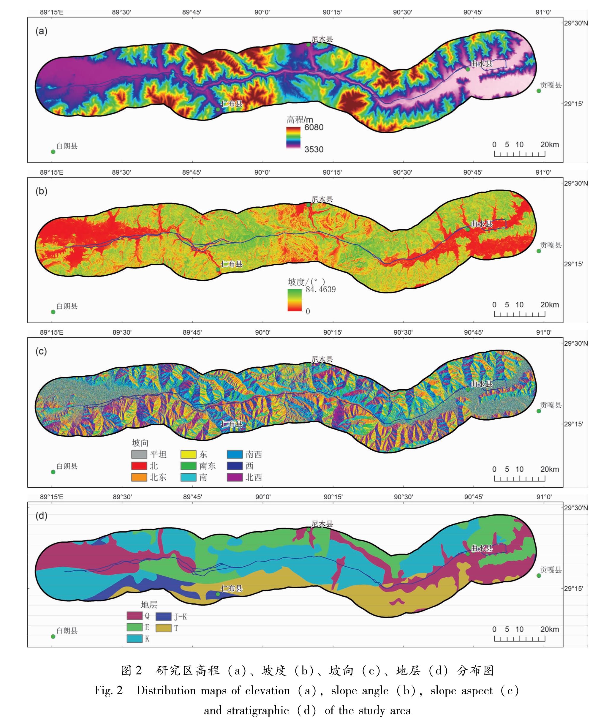
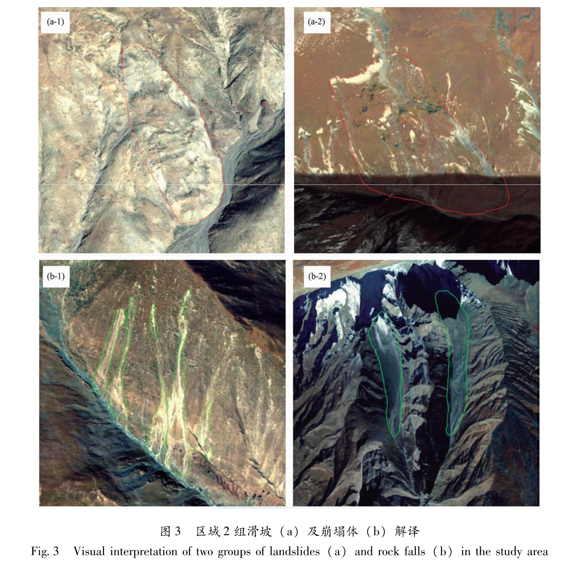
利用高分辨率遥感影像目视解译技术,结合野外调查,对318国道拉萨—日喀则段沿线两侧10 km范围内的崩塌、滑坡与泥石流地质灾害开展解译与调查,并分析其特点与发育规律。结合研究区高程、坡度、坡向与地层分布,统计了崩塌与滑坡的空间分布规律。结果 表明:研究区内发育有79处崩塌、117处滑坡与133条泥石流沟。面积为0.01~0.1 km2的崩塌有45处,崩塌高度主要在300 m以内,300~700 m崩塌体数量随高度增加而减少; 面积为0.1~0.01 km2滑坡有74处,包括一处面积大于10 km2的巨型滑坡体,滑坡的高度主要集中在100~300 m,包括54处滑坡体; 面积在1~10 km2和10~100 km2的泥石流沟分别为70条和39条。崩塌多发生在4.0~4.5 km高程、20°~30°坡度、南坡向、白垩纪(K)地层中,滑坡多发生在4.0~4.5 km高程、20°~30°坡度、NE坡向、三叠纪(T)地层中。
Combine high-resolution remote sensing image visual interpretation technology with field investigation,we carried out detailed interpretation and investigation of collapse,landslide and debris flow within 10 km on both sides along G318 Lhasa-Shigatse and analyzed their characteristics and developmental regularities. Then we calculated the spatial distribution regularities of collapse and landslide according to the elevation,slope,aspect and stratum distribution of the study area. The result showed that there are 329 places of disasters categories,among which there are 79 collapses,117 landslides,and 133 debris flows. There are 45 collapses with area in the range of 0.1~0.01 km2,and the height of collapses is mainly within 300 m,while the collapses in the height of 300~700 m tends to decrease with height; 74 landslides with area in the range of 0.1~0.01 km2 developed,including a giant landslide with an area larger than 10 km2,and there are 54 landslides in the height within 100~300 m.There are 70 and 39 debris flows with area in the range of 1~10 km2 and 10~100 km2,respectively. Collapses mostly occur in the strata with the elevation of 4.0~4.5 km,the slope of 20°~30°,south slope direction and Cretaceous(K). Landslides mostly occur in the strata with the elevation of 4.0~4.5 km,the slope of 20°~30°,NE slope direction and Triassic(T).