基金项目:国家重点研发计划项目(2018YFC1504500)和中国地震局地震应急青年重点任务CEA_EDEM-202018)联合资助.
备注
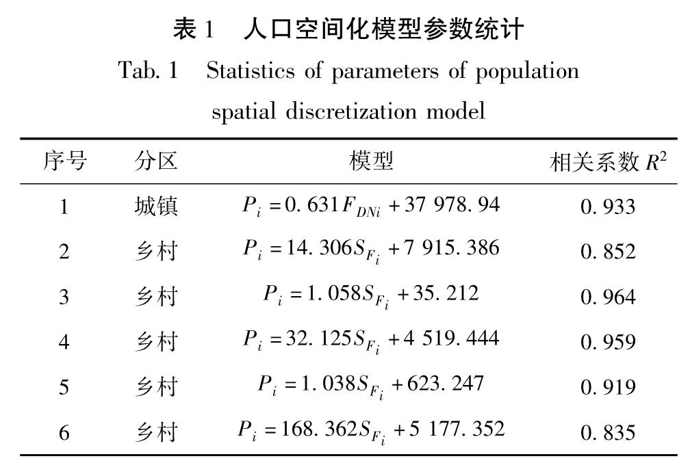
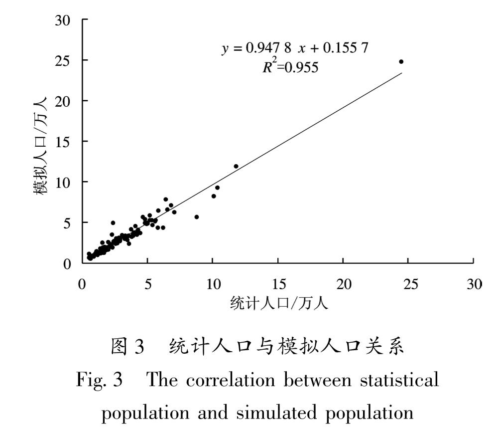
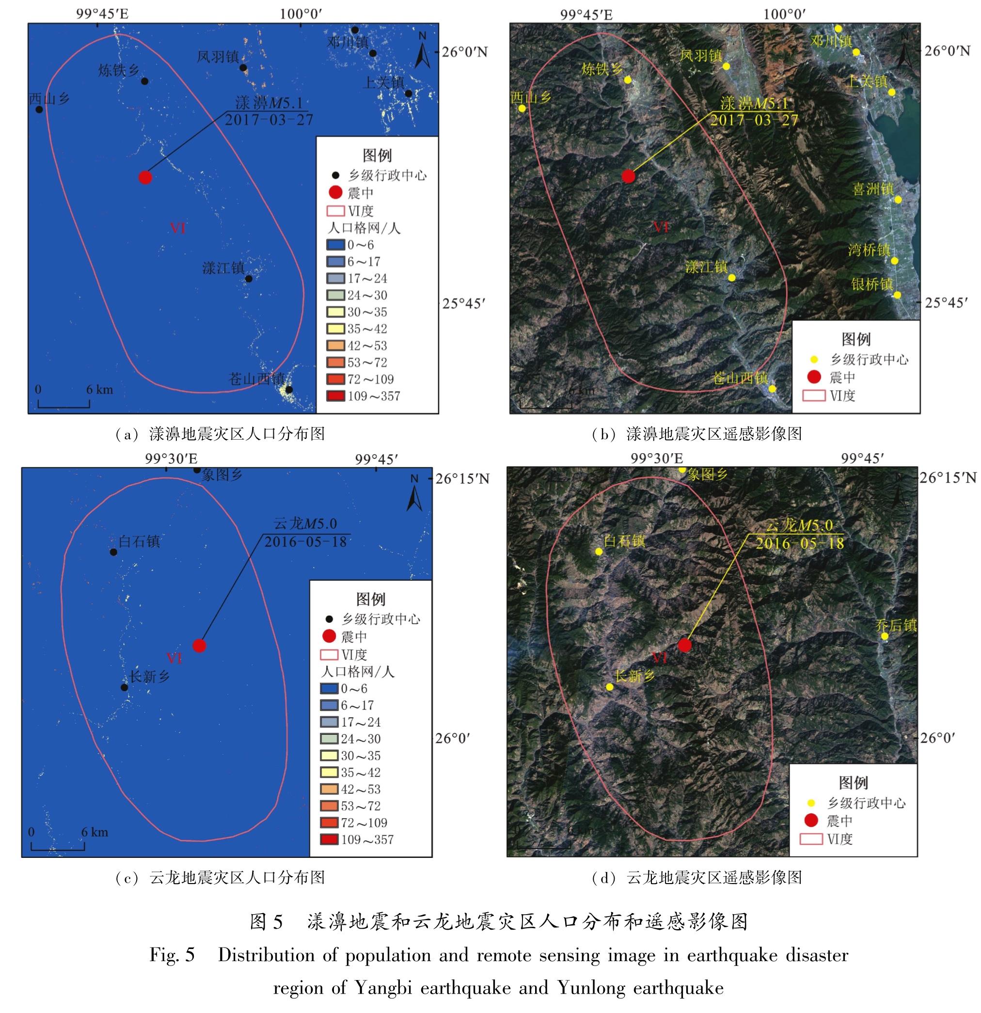
为提高震后受灾人口估算精度和灾区人口空间分布可视化表达效果,以云南省大理州为研究区,结合FROM-GLC10地表覆盖数据和NPP/VIIRS夜间灯光数据,基于乡镇人口统计数据,展开人口空间化方法研究,制作了大理州50 m×50 m人口格网数据。使用相关系数、相对误差和平均相对误差对人口模拟结果进行了检验,以漾濞5.1级地震和云龙5.0级地震为例对模拟结果进行了应用分析。结果 表明:①结合FROM-GLC10地表覆盖数据和NPP/VIIRS夜间灯光数据的人口空间化可以有效提取人口空间分布范围,并区分人口空间分布的差异性; ②乡镇模拟人口与实际统计人口的相关系数R2为0.955,平均相对误差为14.306%,82%的乡镇相对误差在±20%以内,人口模拟数据精度较高; ③2次地震的灾区人口模拟数据与实际统计数据的相对误差分别为-1.67%和-2.27%,人口空间分布模拟结果可以直观反映灾区人口分布情况,研究成果可为震后辅助决策提供数据支持。
In order to improve the accuracy of population estimation and the visual effects of population spatial distribution in earthquake disaster region,the method of population spatialization of Dali prefecture is studied based on the FROM-GLC10 land cover data and the NPP/VIIRS night-time light data and the demographic data of towns.And the grid data of population of 50 m×50 m in Dali prefecture is made.The correlation coefficient,relative error and average relative error are used to test the simulated results.And the application analysis of the simulated results are made by Yangbi MS5.1 earthquake and Yunlong MS5.0 earthquake.The results show that the spatial distribution of population can be effectively extracted and the differences of spatial distribution of population can be distinguished by the land cover data and night-time light data.The correlation coefficient R2 between simulated population and actual population is 0.955,and the average relative error between simulated population and actual population is 14.306%,and the relative error of 82% villages is within±20%.It shows that the data of simulated population has high precision.The relative errors between the data of simulated population and the data of actual population of the two earthquakes are -1.67% and -2.27%,respectively,and the simulation results of population spatial distribution can directly reflect the population distribution of the disaster area.The research results can provide data support for earthquake emergency.


