基金项目:国家重点研发计划(2018YFC1503605)资助.
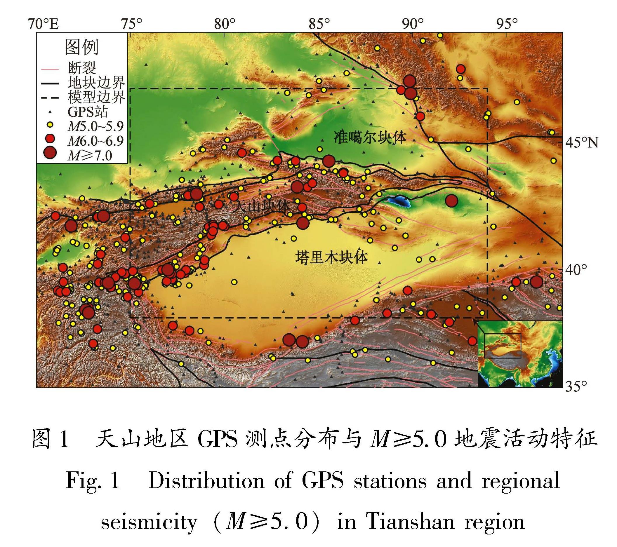
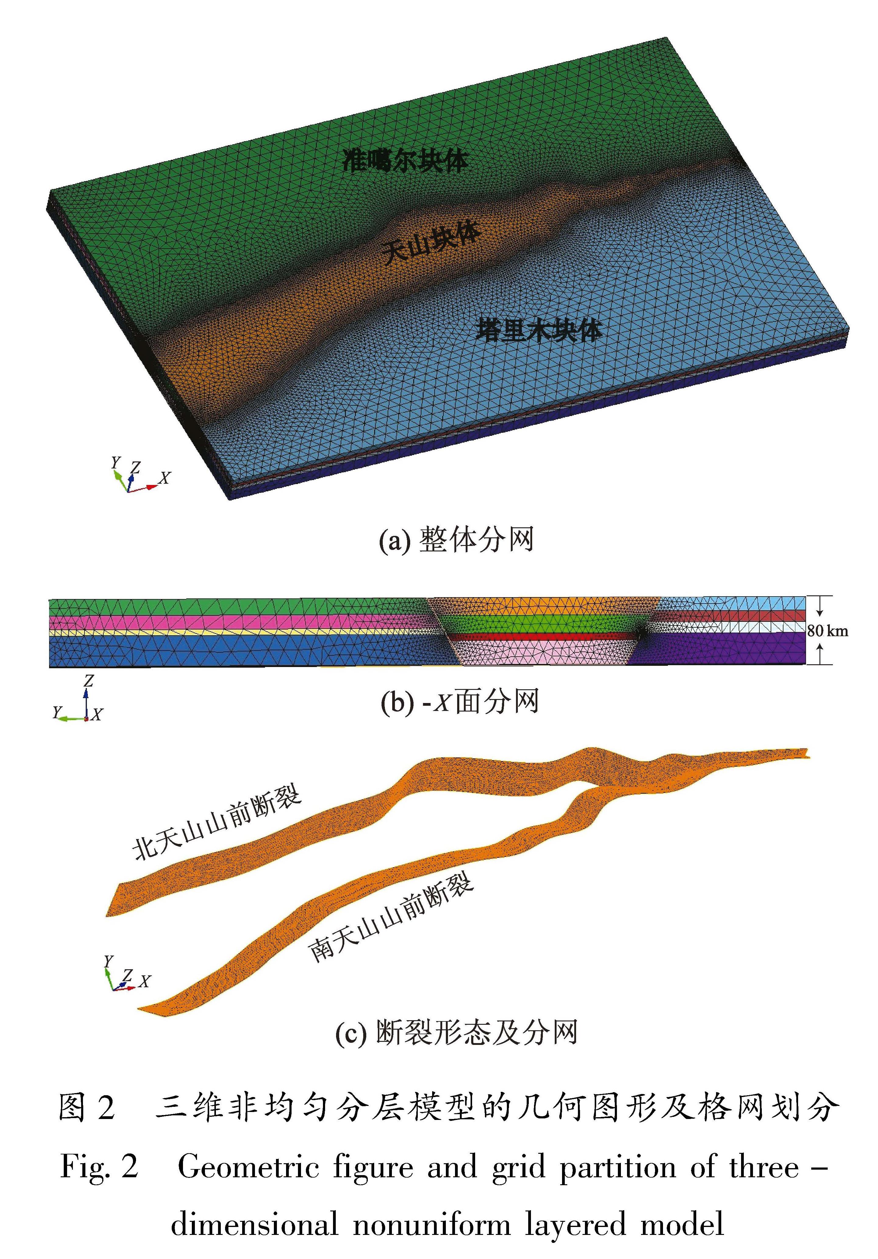
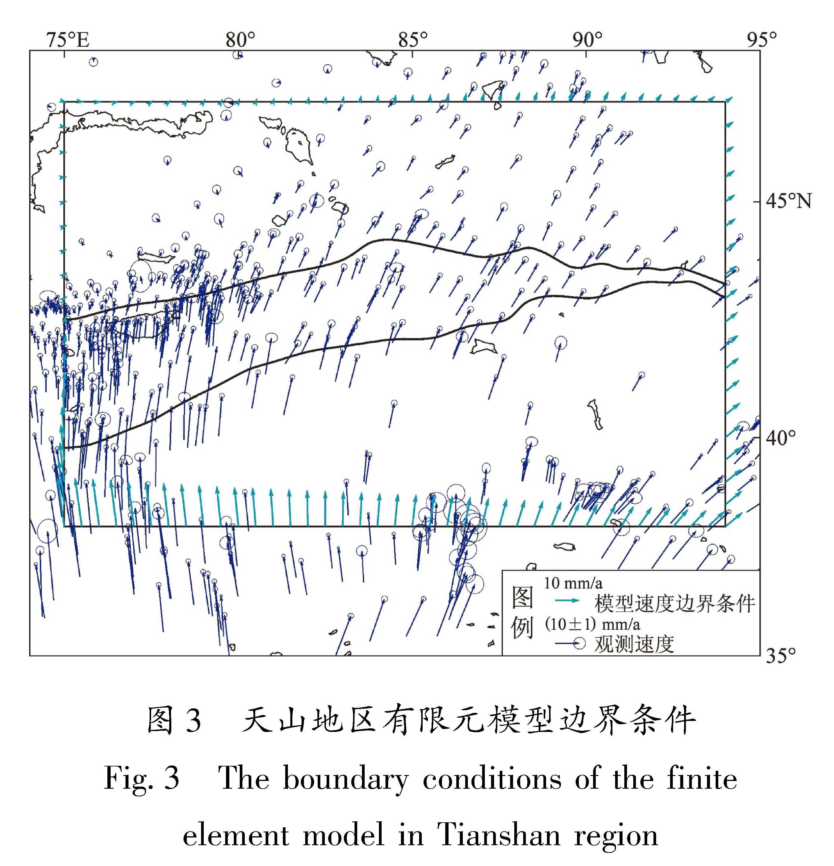
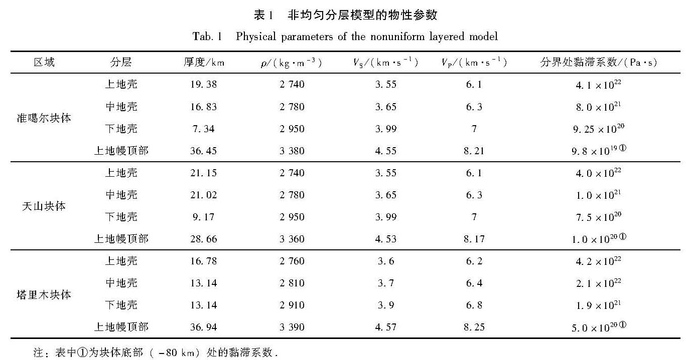
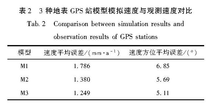
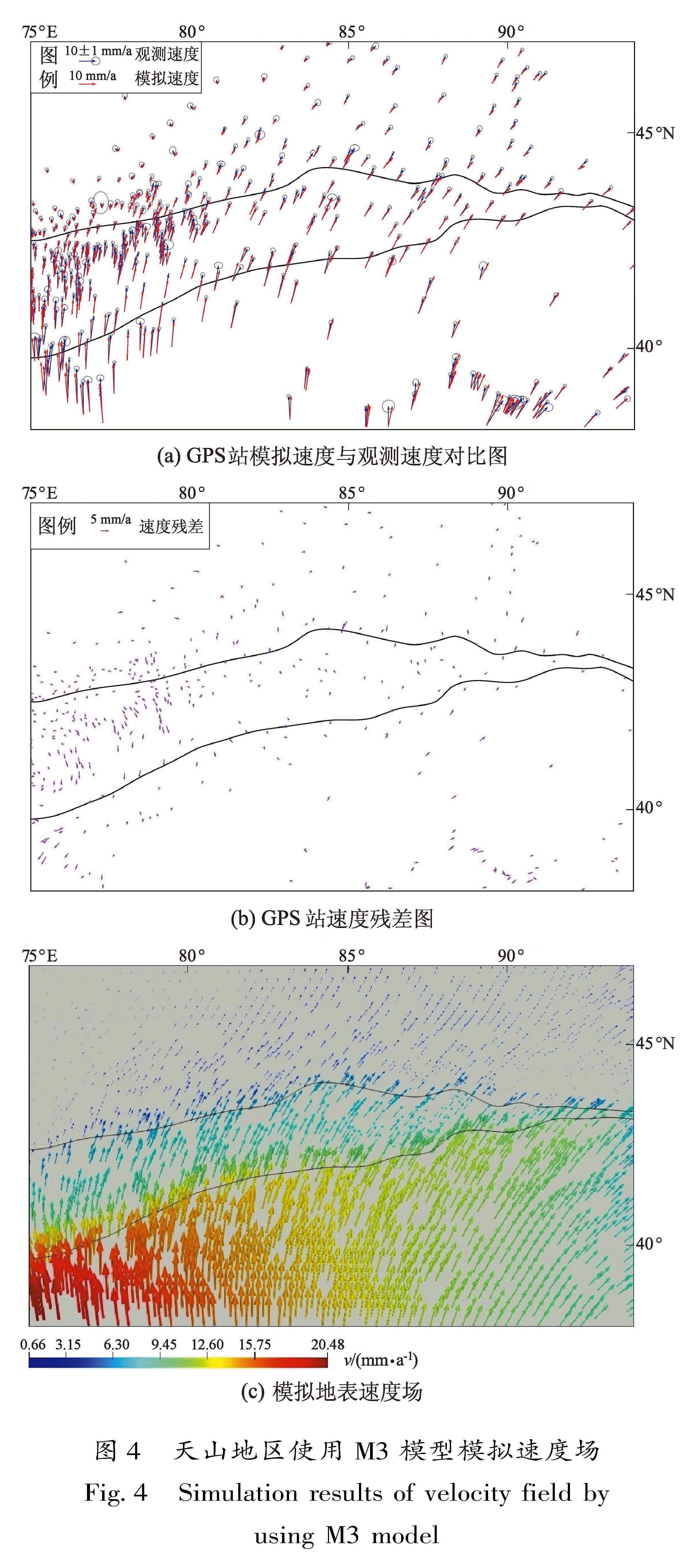
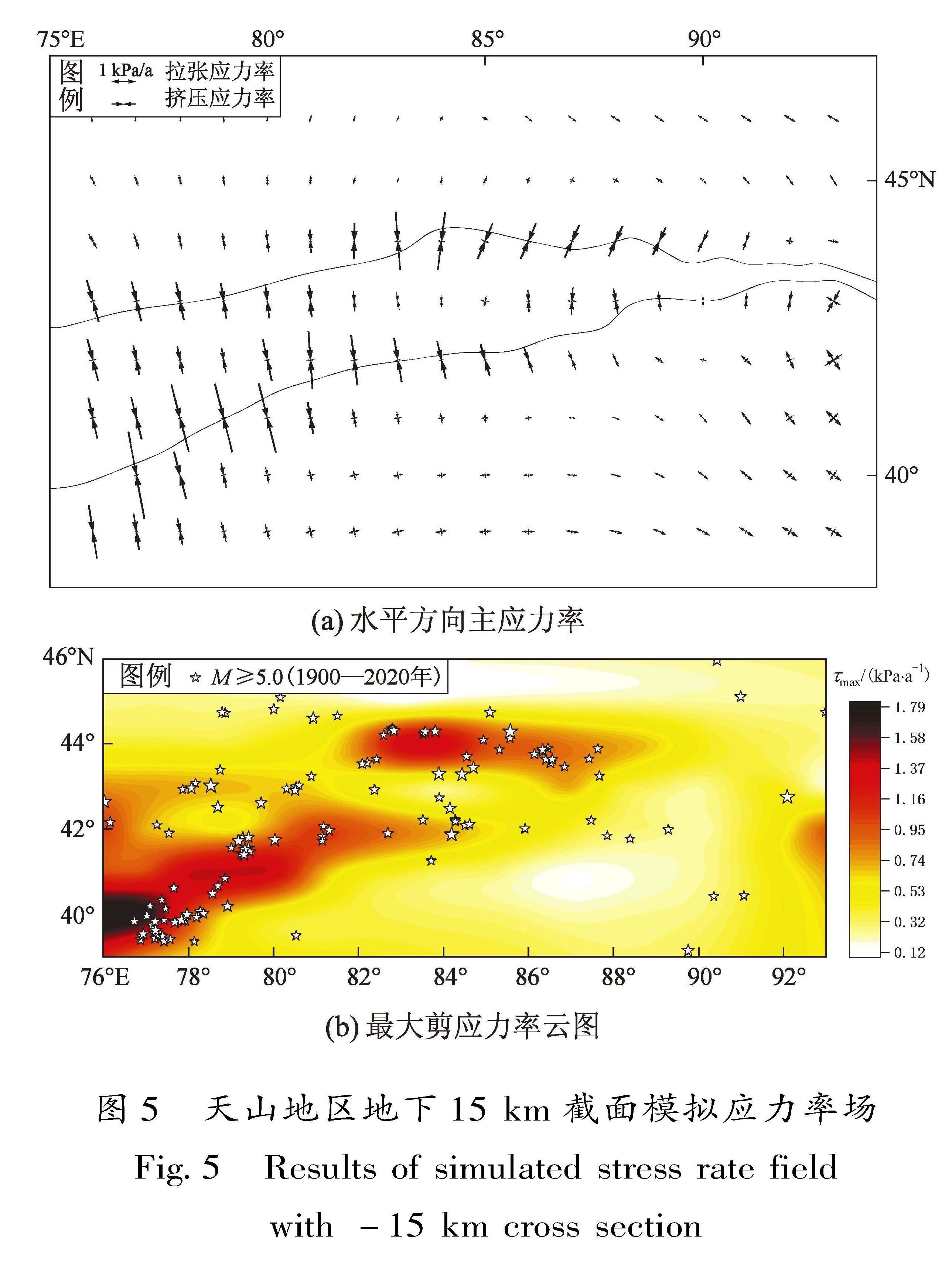
根据天山地区活动断裂带分布和区域流变结构等资料,建立该地区弹性均匀分层、黏弹性均匀分层、黏弹性非均匀分层三维有限元块体运动断层位错模型。利用GPS观测结果作为边界约束,附加断裂闭锁深度和滑移速率约束,模拟计算天山地区的地壳形变场及构造应力场,定量分析其大小、分布形态及特征,探讨天山地区地壳运动变形的运动学机制。结果表明:运用这3种模型模拟得到的地表速度场均与实测GPS结果吻合较好,并且最符合实际情况的黏弹性非均匀分层模型得到了最优的模拟结果。与改变模型纵向介质分层厚度相比,黏弹性效应对模拟地表速度场结果的影响更为显著,黏弹性模型提高了对震间地表形变的拟合程度。计算结果表明,天山地区从西向东、从南到北汇聚速率呈递减态势。同时,研究区上地壳模拟应力场以近N-S向水平挤压应力为特征,与天山地区地壳整体以水平缩短和垂向隆升的实际情况相一致。
In the Tianshan region,the tectonic environment is complex,active fault zones are widely distributed,and earthquakes occur frequently.Based on the data of active fault zones distribution and regional rheological structures in the Tianshan region,three three-dimensional finite element models of elastic uniform delamination,viscoelastic uniform delamination and viscoelastic non-uniform delamination are established.Using GPS observations as boundary constraints and additional fault locking depth and slip rate constraints,the crustal deformation field and the tectonic stress field in the Tianshan region are simulated and calculated.The two fields' size,distribution and characteristics are quantitatively analyzed,and the kinematic mechanism of crustal movement and deformation in the Tianshan region is discussed.The results show that the surface velocity fields simulated by the three models are in good agreement with the measured GPS results,and the optimal simulation results are obtained by the viscoelastic inhomogeneous stratified model which is most consistent with the actual situation.Changing the longitudinal medium delamination thickness of the model can influence the simulated surface velocity field,but the viscoelastic effect influences more significantly on the simulated surface velocity field,and the viscoelastic model improves the fitting degree of interseismic surface deformation.In addition,the calculation shows that the convergence rate in the Tianshan region decreases from west to east and from south to north.At the same time,the simulated stress field of the upper crust in the study area is characterized by horizontal compressional stress near N-S direction,which is consistent with the actual situation of horizontal shortening and vertical uplift of the crust as a whole in the Tianshan region.
