应急避难场所是地震发生后受灾居民紧急疏散的重要场所,也是自然灾害应急响应的重要组成部分。科学合理地利用有限避难空间,可以有效提高震后避难疏散效率和应急响应能力,最大限度减轻人员伤亡,具有较强的实际意义和研究价值。
国内外众多学者针对震后避难空间评价开展了很多研究,大致可分为传统的评价方法、基于GIS空间分析技术和基于机器学习的3种评价方法。传统的评价方法是通过问卷调查、实地调研等方式对应急避难场所进行评价,实现了从宏观和主观层面对应急避难场所的评价,但对于应急避难场所的空间化以及可视化分析不足。Mesrop(2020)开发的半自动化设计算法被用来制作避难所研究模型,该研究解决了庇护所高度和面积的设计标准; Geng等(2020)提出一种多标准约束选址模型来优化灾前避难所选址配置问题; 吕伟等(2022)提出从适宜性和服务范围双重角度探究避难场所空间分布的合理性。
将GIS空间分析技术融入到应急避难场所评价方法中,有效提高了应急避难场所评价的精确度和可视化程度,但现有的基于GIS空间分析技术的评价方法不但需要人工处理大量的数据,而且采用的卫星影像分辨率不足,不足以满足对避难场所快速、精确评价的需求,如Yao等(2021)采用多准则TOPSIS评价模型,对开放空间的安全性、可达性和可用性进行了综合定量评价; Huang等(2019)建立了城市应急避难所适宜性评价指标体系; 魏本勇等(2019)基于GIS空间分析技术和实际调查数据,构建了避难场所综合服务效能指数。
随着计算机科学、遥感技术、人工智能、地理空间分析技术的发展,使得有效解决城市化区域复杂的空间优化问题成为可能,基于机器学习算法的评价方法能在短时间内处理大量的数据,避免了人工数据搜集、处理带来的主观性差异,因此越来越多地被应用到评价模型中,但该方法也存在不足,主要来自于卫星影像时效性差、分辨率低的问题,导致数据提取与处理精度不高,如Su等(2021)考虑应急避难所服务能力和人口分布的差异,提出了一种可变服务半径和疏散半径的两步浮动集水区方法; 卢永华和李爽(2019)分别从供给点竞争、需求点定位、路网距离优化等3方面对G2SFCA进行改进; 魏本勇等(2022)针对地震灾害应急疏散策略,构建了一种基于避难场所容量限制的灾民应急疏散分配与路径选择算法模型。
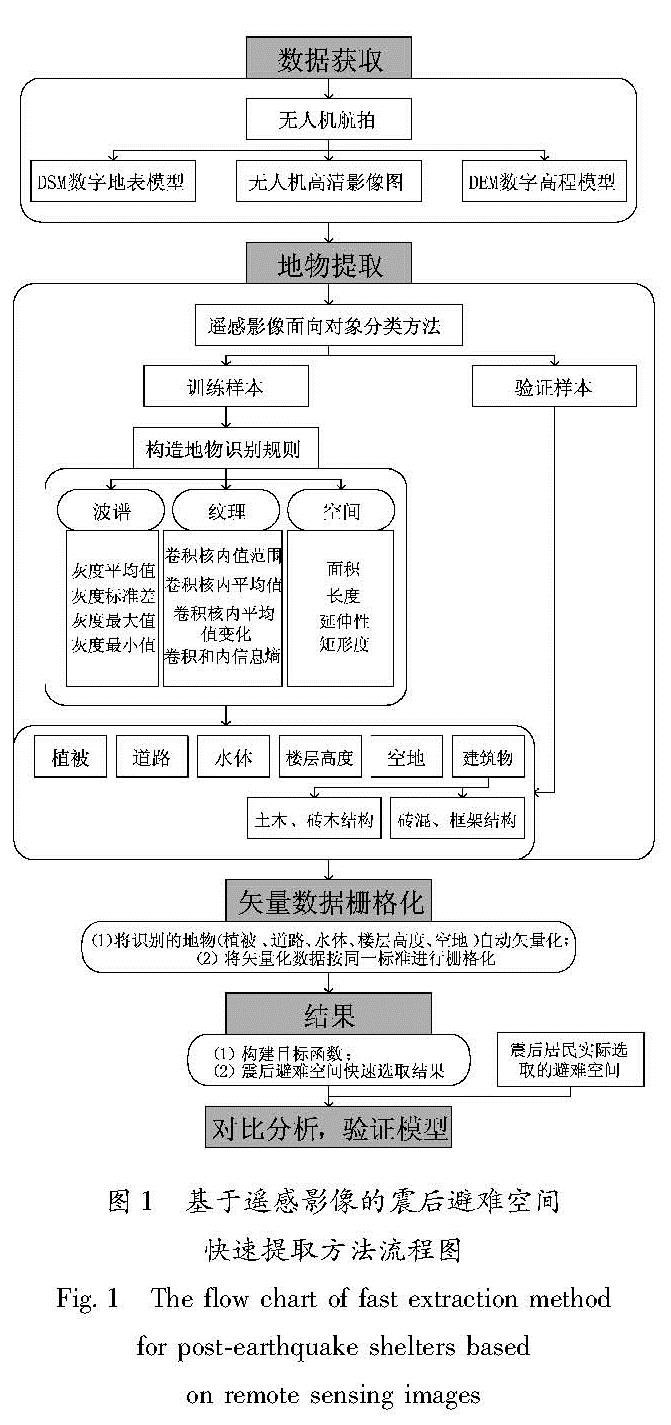
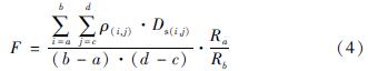
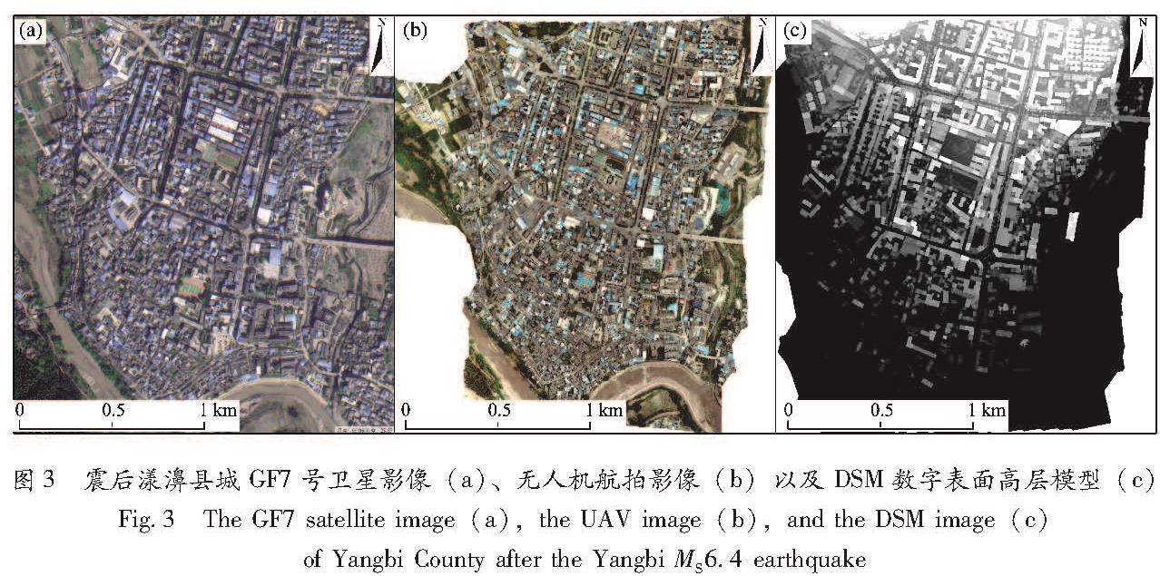
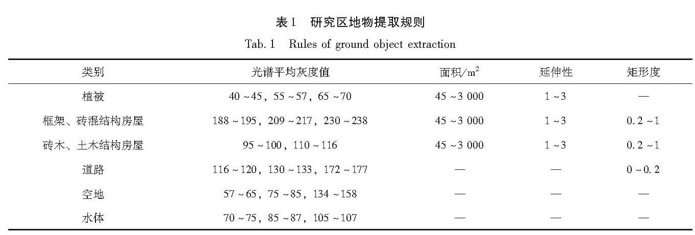
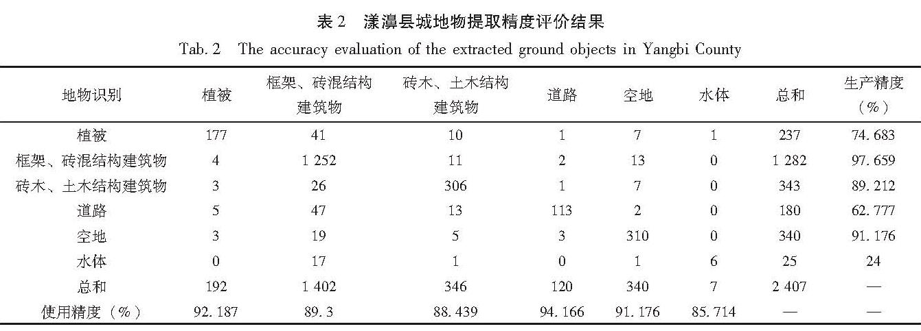
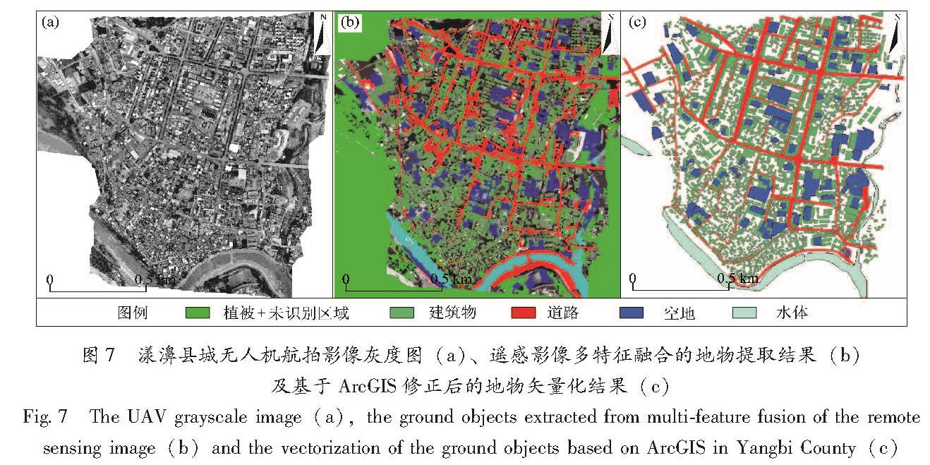
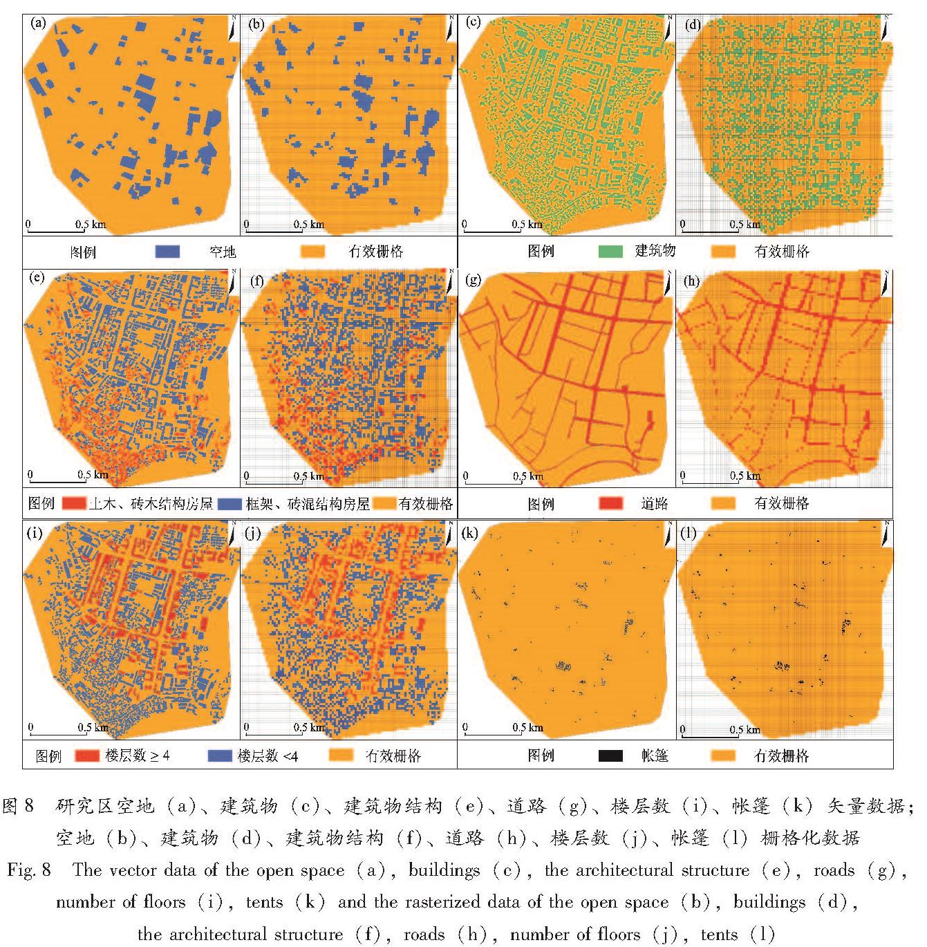
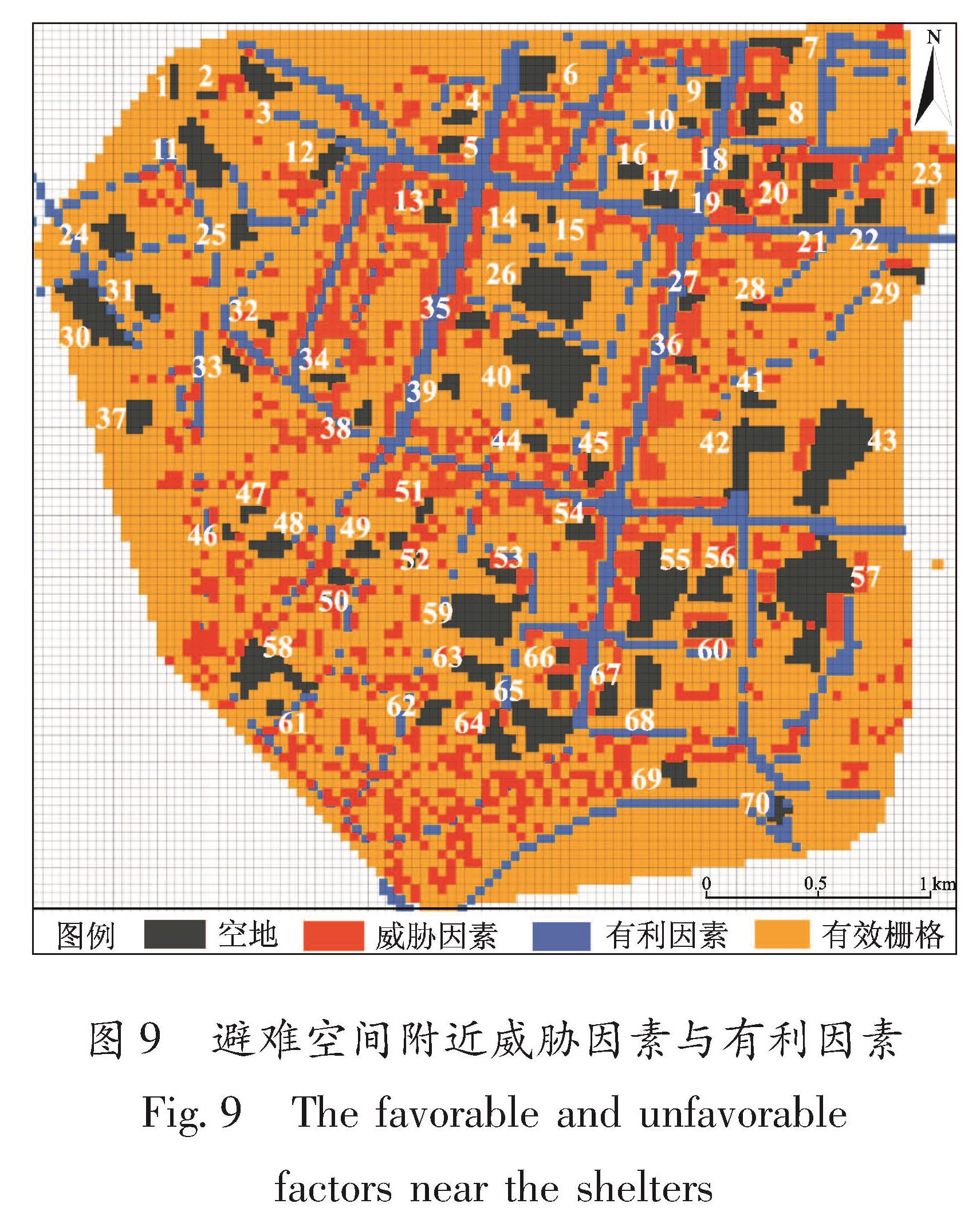
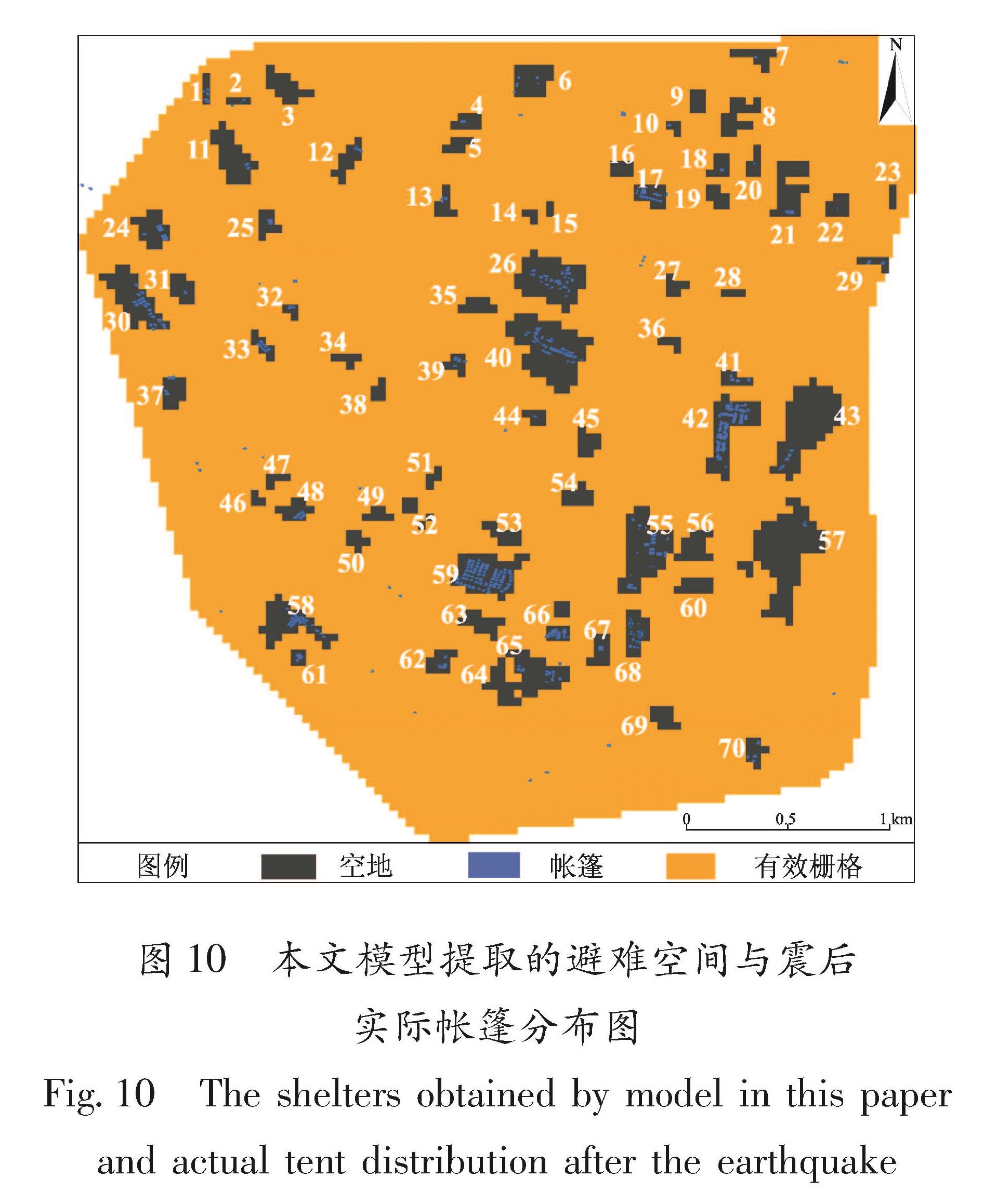
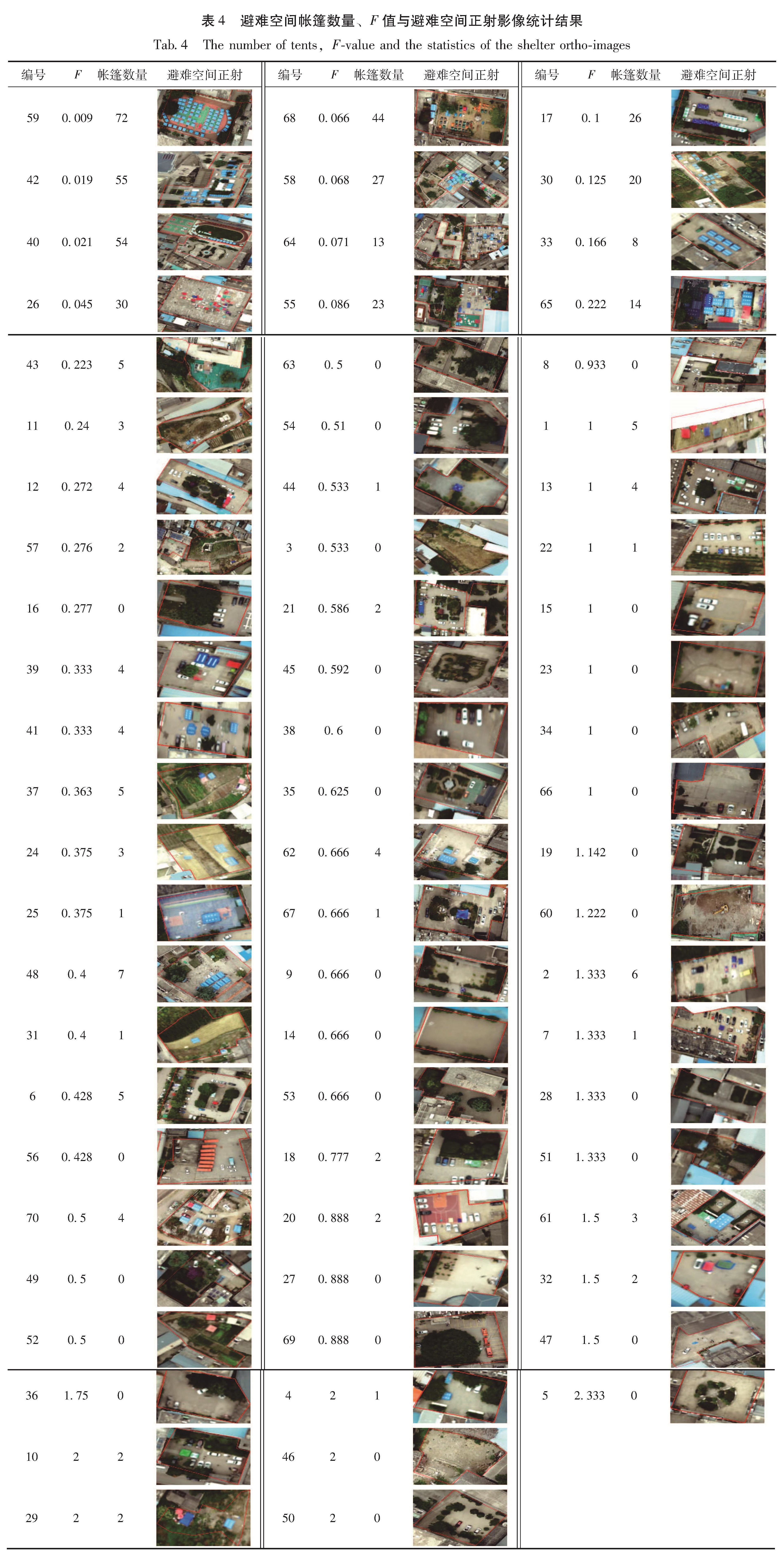
笔者综合分析3种方法的优点,以无人机高分辨率遥感影像为基础,采用像元方法与面向对象方法把关注点聚焦于单一或少量邻近像元上建立基于遥感影像的震后避难空间快速提取模型,以2021年云南漾濞MS6.4地震为例,提取震后避难空间,并与实际避难空间进行对比。