1.1 质量负荷理论
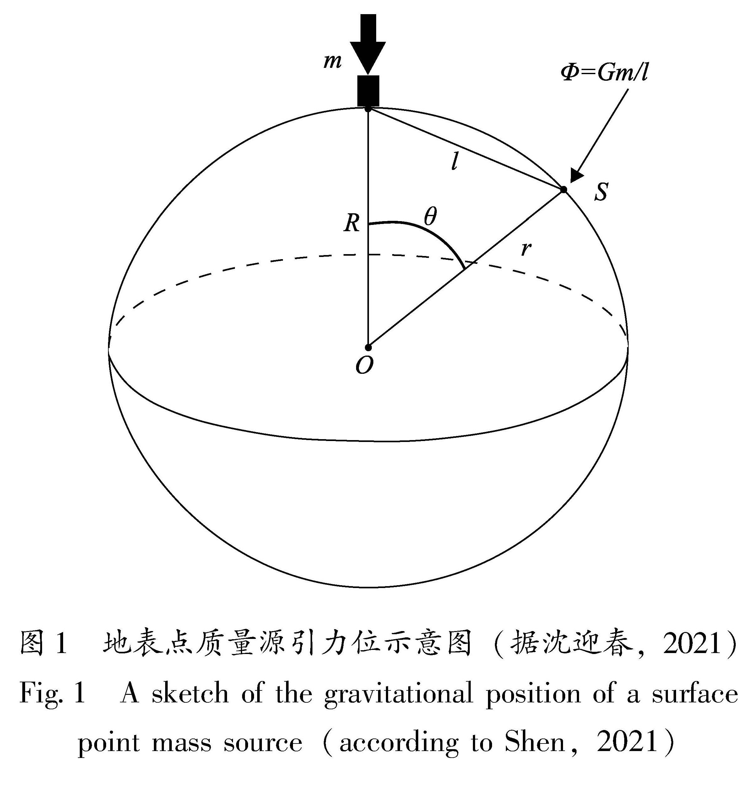
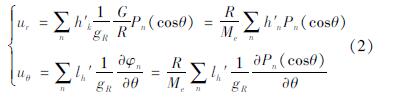
地表点质量源引力位如图1所示。如果将地球视为近似规则的球体,根据万有引力定律,地球上某一点引力位Φ的计算公式为:
式中:G表示引力常量; m表示点源的质量; R表示地球平均半径; r表示点位与地球中心的距离; θ表示点位间的角距离。
图1 地表点质量源引力位示意图(据沈迎春,2021)
Fig.1 A sketch of the gravitational position of a surface point mass source(according to Shen,2021)
基于Farrell(1972)所提出的地壳负荷形变理论,结合引力位函数相,通过地壳负荷形变量求得单位质量的点负荷所产生的垂直和水平方向的形变量,表示为:
地表负荷造成的垂直形变会随着离负荷距离的增大而迅速减小,如图2所示:以圆盘半径7 km、等效水深4 m、约0.62 Gt负荷为例,距离圆盘中心10 km处的垂向形变小于距离圆盘中心5 km垂直形变的一半,距离圆盘中心20 km处的垂向形变小于距离圆盘中心10 km垂直形变的一半。
图2 圆盘半径7 km、等效水深4 m 时的地面负荷造成的地表垂直运动示意图
Fig.2 A sketch of the vertical surface movement due to ground loading for a disk radius of 7 kilometers and an equivalent water depth of 4 meters
目前计算负荷与地壳位移之间联系的方法主要有格林函数积分法、球谐函数法及Slepian基函数法。这3种方法都是基于地球初始参考模型(Preliminary reference earth model,PREM)质量负荷引起垂直位移的计算方法。负荷格林函数为单一点负荷的垂向基函数,主要用于解决单位质量的点负荷问题(Guo,2004)。球谐函数主要用于描述质量源在地球外部产生引力位的作用,对于地球表面流体质量变化可以将其看成连续球面函数并进行球谐函数展开(Hofmann-Welenhof,Moritz,2005)。Slepian基函数是一种常用的球面径向基函数,相较前两种方法,它可以有效减少信号泄露,提高结果的信噪比(Albertella et al,1999)。
1.2 质量负荷反演理论
首先,设U表示观测到的垂直位移,m表示区域网格质量模型,G表示通过负荷格林函数建立的系数矩阵。在完全理想的情况下,观测数n与模型t相等(n=t),且系数矩阵G存在逆矩阵,则可以求得:
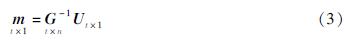
获得质量模型m是基本的反演过程,可以通过直接求G的逆系数阵来实现这一线性观测函数。然而实际的地球物理反演比较复杂,通常表现为欠定问题,需要添加约束条件建立约束矩阵,在求解法方程后得到约束解析式。
在计算中通常进行Tikhonov正则化(Tikhonov,Arseninn,1977),加入正则化因子λ2,其求解结果如下:
m=(GTG+λ2I)-1GTU(4)
Argus等(2014,2017,2022)在反演过程中
引入正则化参数和拉普拉斯算子,其目标函数为:
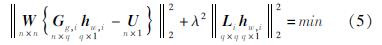
式中:W为GNSS垂向位移权重; hw,i为第i个格网内的等效水高; Gg,i表示负荷格林函数的系数矩阵; L为拉普拉斯算子; λ2为正则化参数; n为垂向位移数值; q为研究区内的格网数量。
由于反演过程中的负荷格林函数卷积是对全球范围进行计算,而一般情况下反演只是针对某一个小区域进行计算,因此研究区外的负荷形变会被当成噪声从而影响反演结果。为了减小这个影响,可以对质量模型参数及其约束矩阵扩充,以降低外部区域对研究区内质量反演造成的影响。式(5)可以变化为(沈迎春,2021):
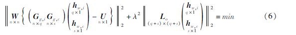
式中:hw,i和hw,c分别为研究区内和扩展边界外的质量负荷模型; Gg,i和Gg,c分别为格林函数得到的系数矩阵和约束矩阵; n、q和s分别为向量U、hw,i和hw,c的维度信息。通过此方法可以对区域质量的圆盘反演起约束作用。
Wang等(2022)在反演过程中,加入了GNSS水平位移,使用格林函数G(ψ)的卷积积分计算由多个质量负荷源q(θ',φ')引起的点位移b(θ,φ),式(7)为曲面变形对质量负荷的反演:
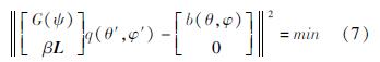
式中:q表示最小二乘的反演质量,并且假设水平分量和垂直分量是等权的; β是平滑因子,用于调整质量的最小二乘拟合和平滑度之间的相对权重; L是拉普拉斯算子,有3种表现形式,分别对应与网格位置位于角落(2个相邻斑块)、边缘(3个相邻斑块)、其他地方(4个相邻斑块)。
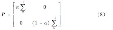
Carlson等(2022)使用GNSS和GRACE数据联合反演,反演公式类似于式(5),联合反演的权重矩阵为:
式中: 和
和 分别为GNSS和GRACE观测值的对角方差-协方差矩阵; α为0~1之间的数值,表示GRACE和GNSS的相对权重。