收稿日期:2008-03-24
基金项目:国家自然科学基金“羌塘国家自然保护区空间信息共享环境应用研究(40761018)”资助.
基金项目:国家自然科学基金“羌塘国家自然保护区空间信息共享环境应用研究(40761018)”资助.
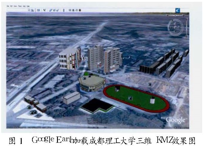
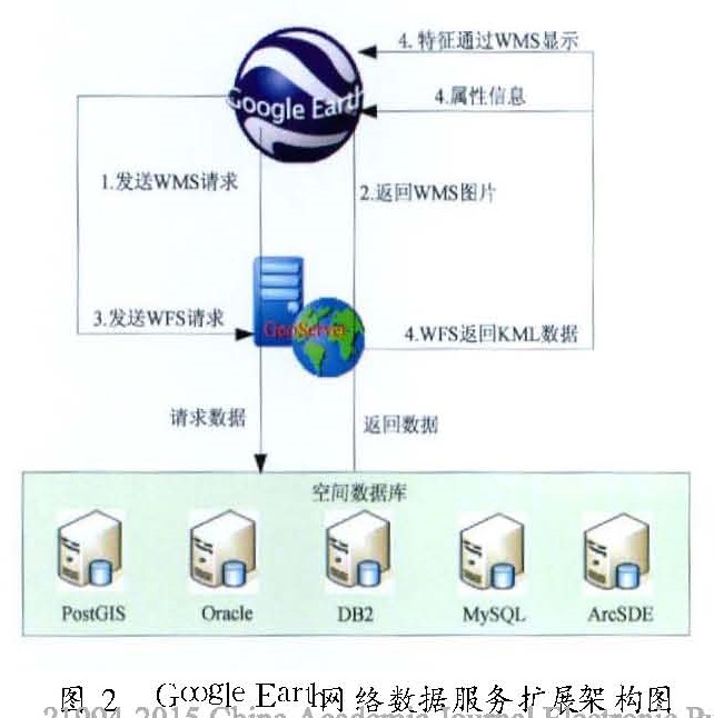
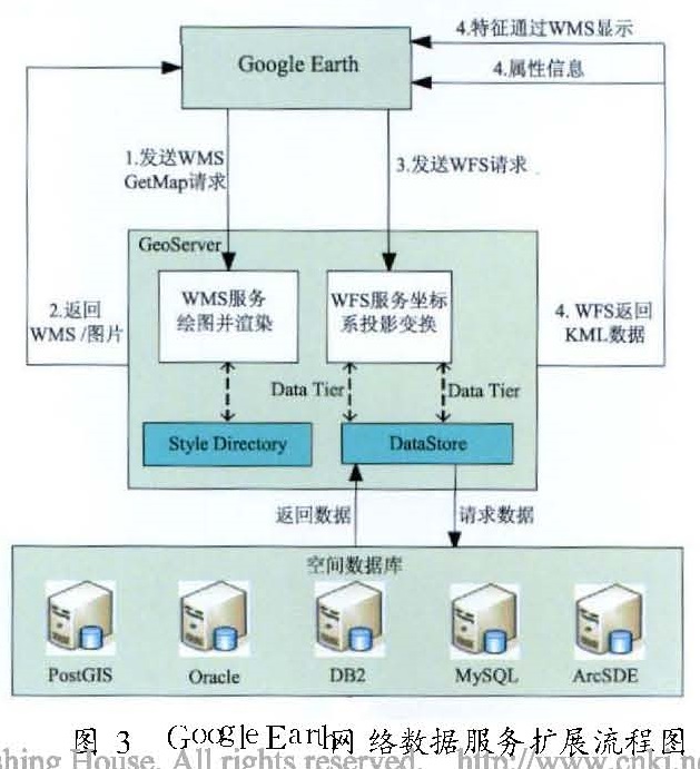
在Google Earth平台基础上,通过基于XML的KML进行文件传递,实现本地专题平面数据加载,用KMZ格式实现三维数据的加载,然后利用Google Earth在防震减灾工作中实现本地数据应用扩展。为更好利用Google Earth平台和数据,采用PostGIS空间数据库和Geoserver地图服务器的一个体系,来实现对网络数据服务的扩展,并且对网络数据服务应用的架构及运行流程进行了描述,使之成为防震减灾决策的数据支撑。
As the most popular digital terrestrial platform at present,Google Earth,has been overwhelming majority of the industry's concern.In order to realize the application of Google Earth in the decision making of earthquake disaster prevention and reduction,we first analyze the information sources of earthquake.Then on Google Earth platform,through XML-based KML file transfer,we realize the local thematic data loading on the model and 3D data loading using KMZ format,thus realizing local data application expansion based on Google Earth.For better use of Google Earth platform and data,we use PostGIS as spatial database and Geoserver as a map server system,also achieving the expansion of the network data services,and make it into the decision-making data support in earthquake disaster prevention and reduction system.