基金项目:陕西省地震局起航与创新基金(201309)资助.
备注
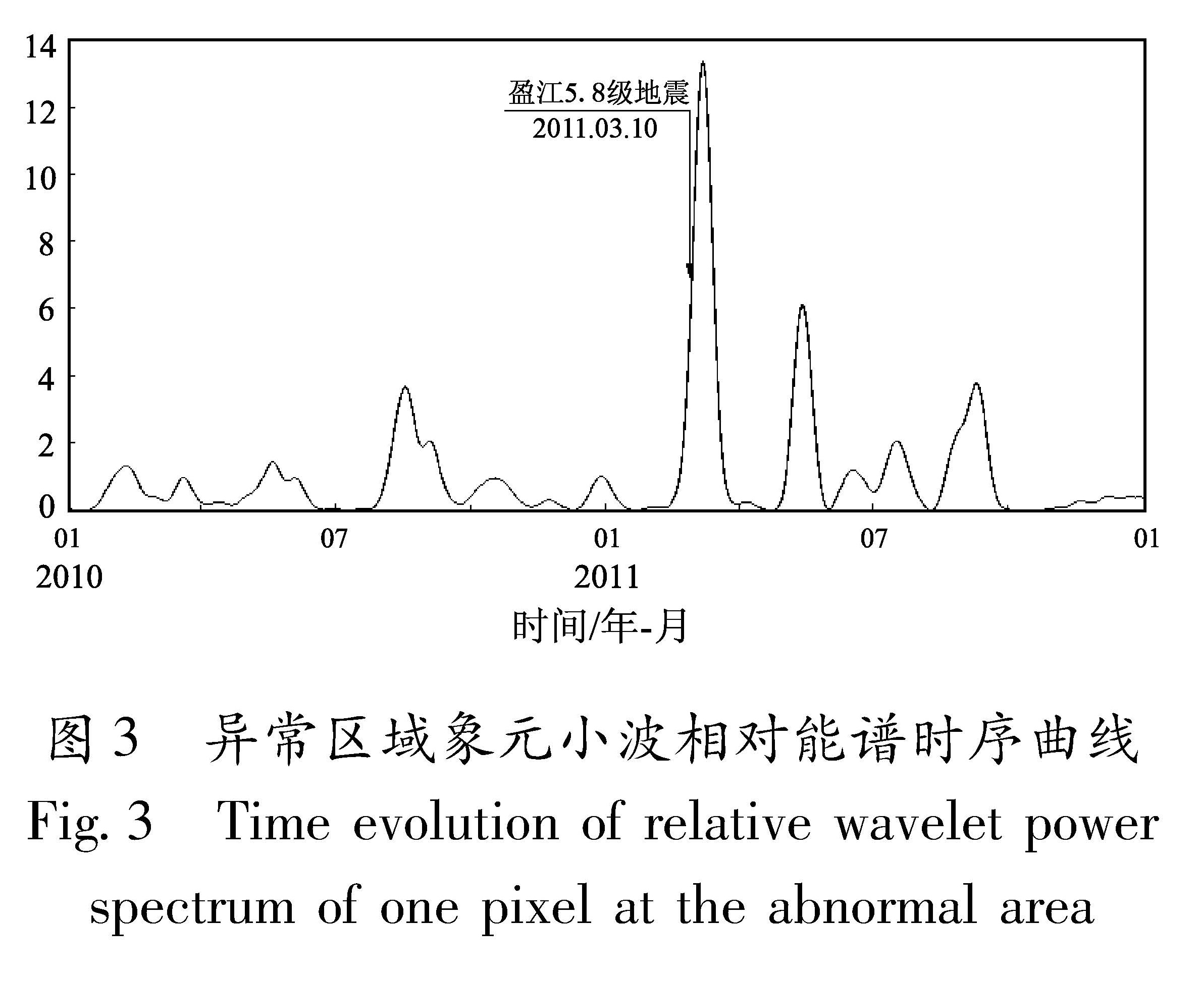
使用从2010年1月12日至2012年1月11日,在(20°~30°N,93°~103°E)范围内由中国静止气象卫星FY-2E观测的热红外遥感亮温资料,对2011年3月10日盈江5.8级地震周边地区的热红外亮温异常特征进行了研究。结果 表明:从2011年3月初开始在盈江5.8级地震震中周围开始出现相对能谱异常,之后异常区域逐渐扩大并向震中区域集中,并于3月中下旬在震中偏西地区形成片状异常区域,相对能谱最大异常幅度达13倍,随后异常区域和幅度逐渐减小,地震发生后数天异常消失。
Using the thermal infrared remote-sensing data of brightness temperature from Jan. 12,2010 to Jan. 11 2012 which is observed by Chinese geostationary meteorological satellite FY-2E in the spatial region of(20°N~30°N,93°E~103°E),we analyze the thermal-infrared anomalous variation in the epicenter and its surrounding areas of Yingjiang MS5.8 earthquake on Mar.,10 in 2011. The results show that the relative wavelet power spectrum(RWPS)anomalies appeared since early Mar.,2013 around the epicenter of Yingjiang MS5.8 earthquake,and the abnormal areas gradually extended and concentrated towards the epicenter. In middle to late of Mar.,2013,a schistose abnormal area was formed along with the seismogenic fault in the westward direction,and the maximum anomalies amplitude of RWPS reached 13 times of the mean value. The abnormal area and amplitude of RWPS dwindled afterward and the anomalies disappeared in several days after Yingjiang MS5.8 earthquake.


