收稿日期:2014-07-25
基金项目:国家自然科学基金项目(51178351)资助.
基金项目:国家自然科学基金项目(51178351)资助.
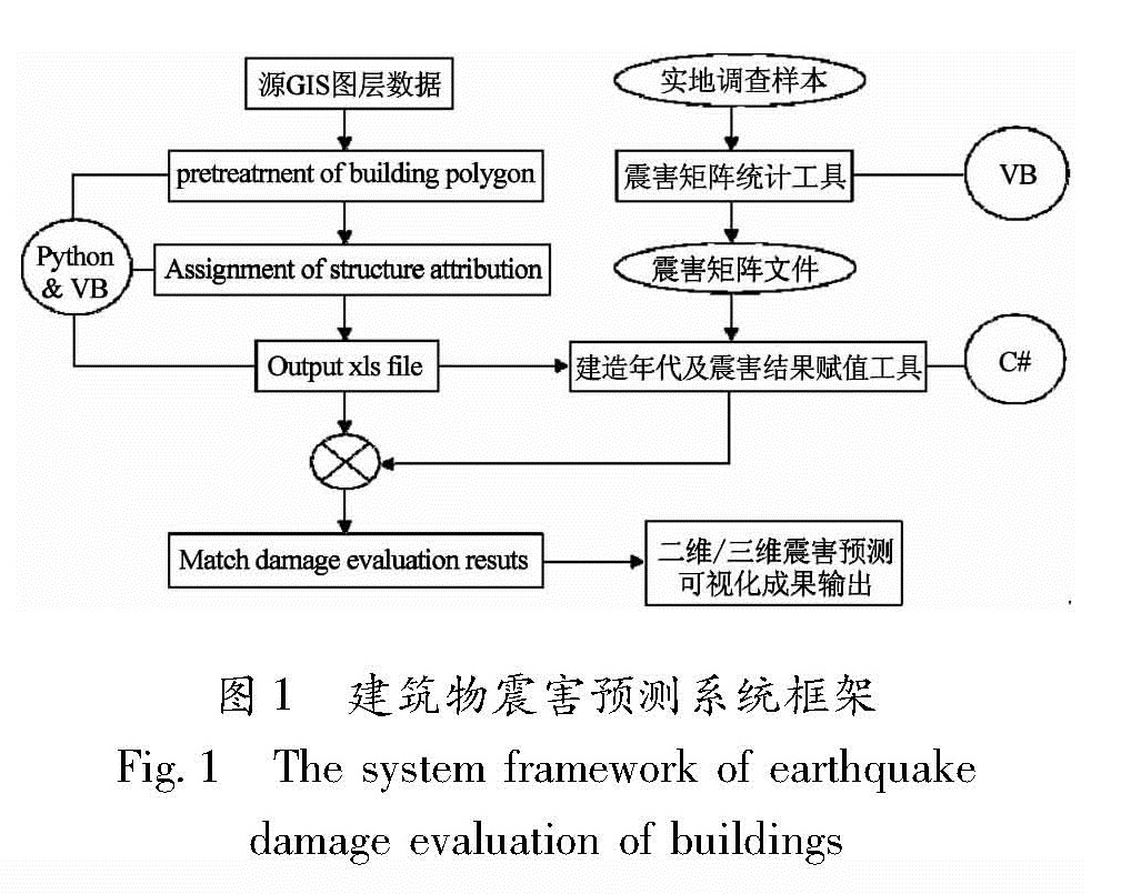
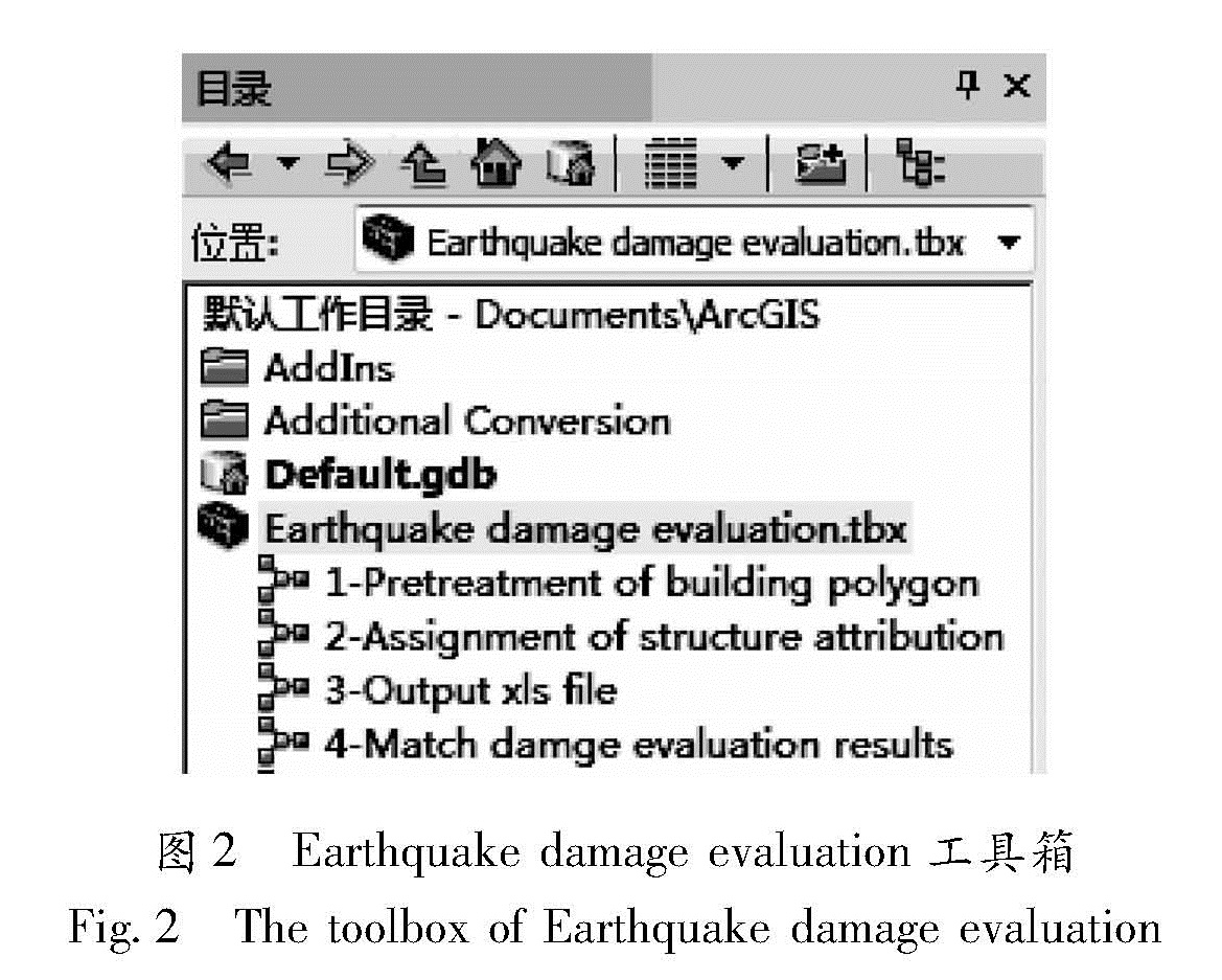
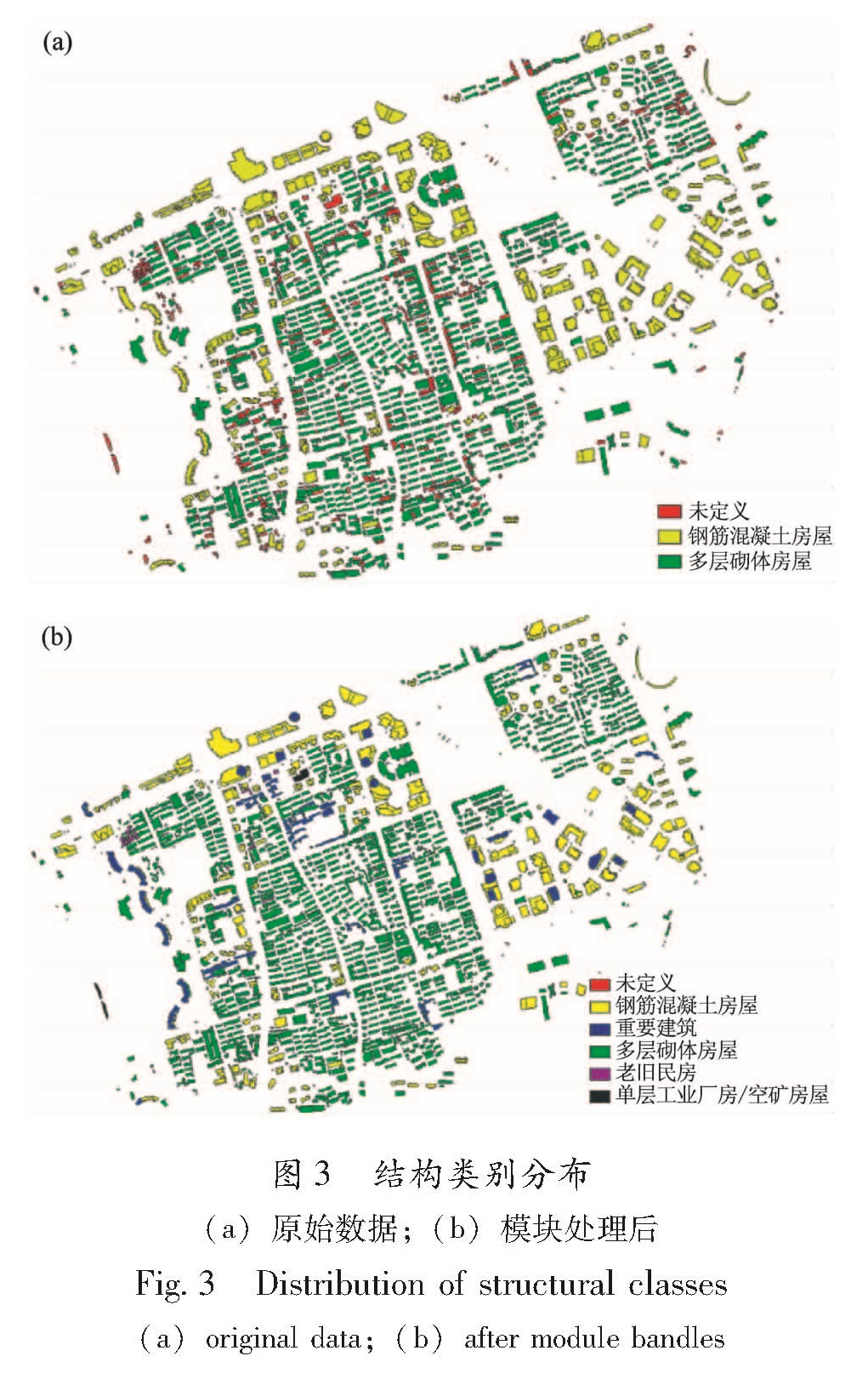
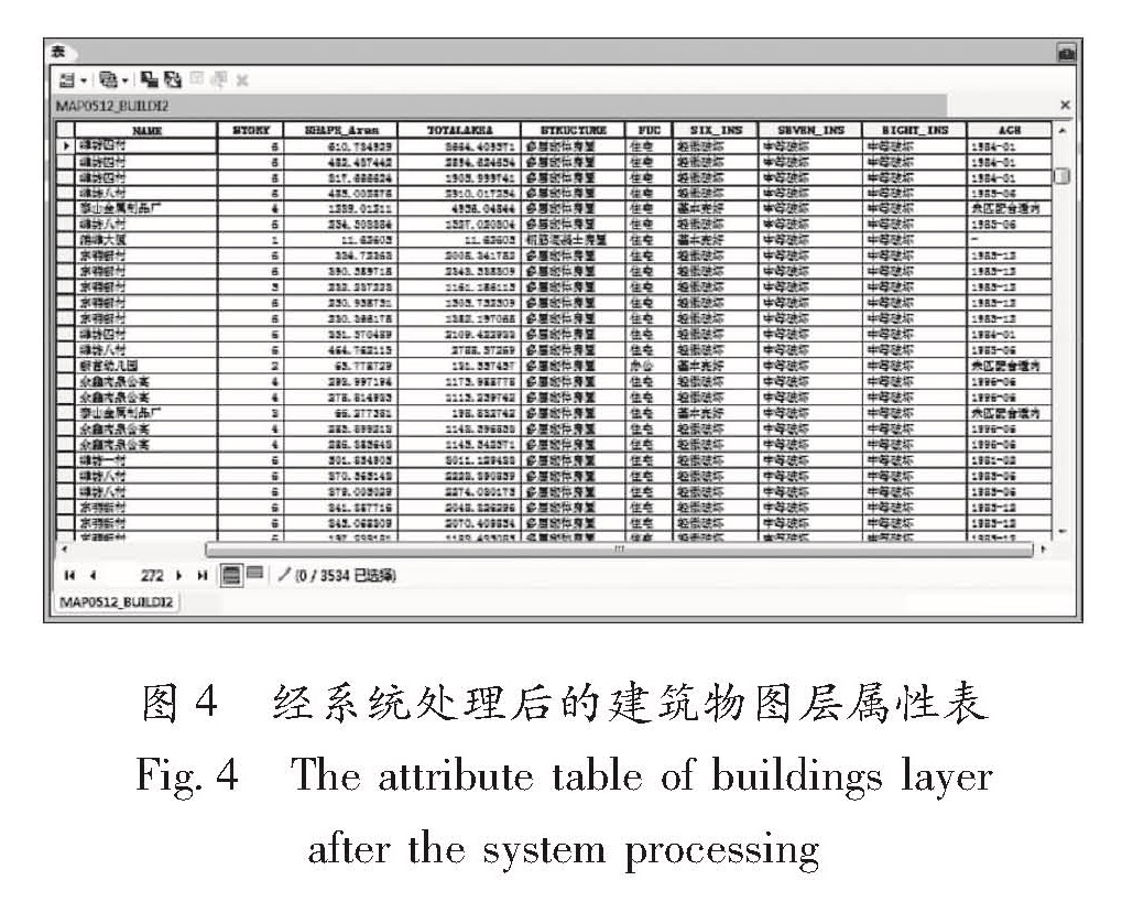
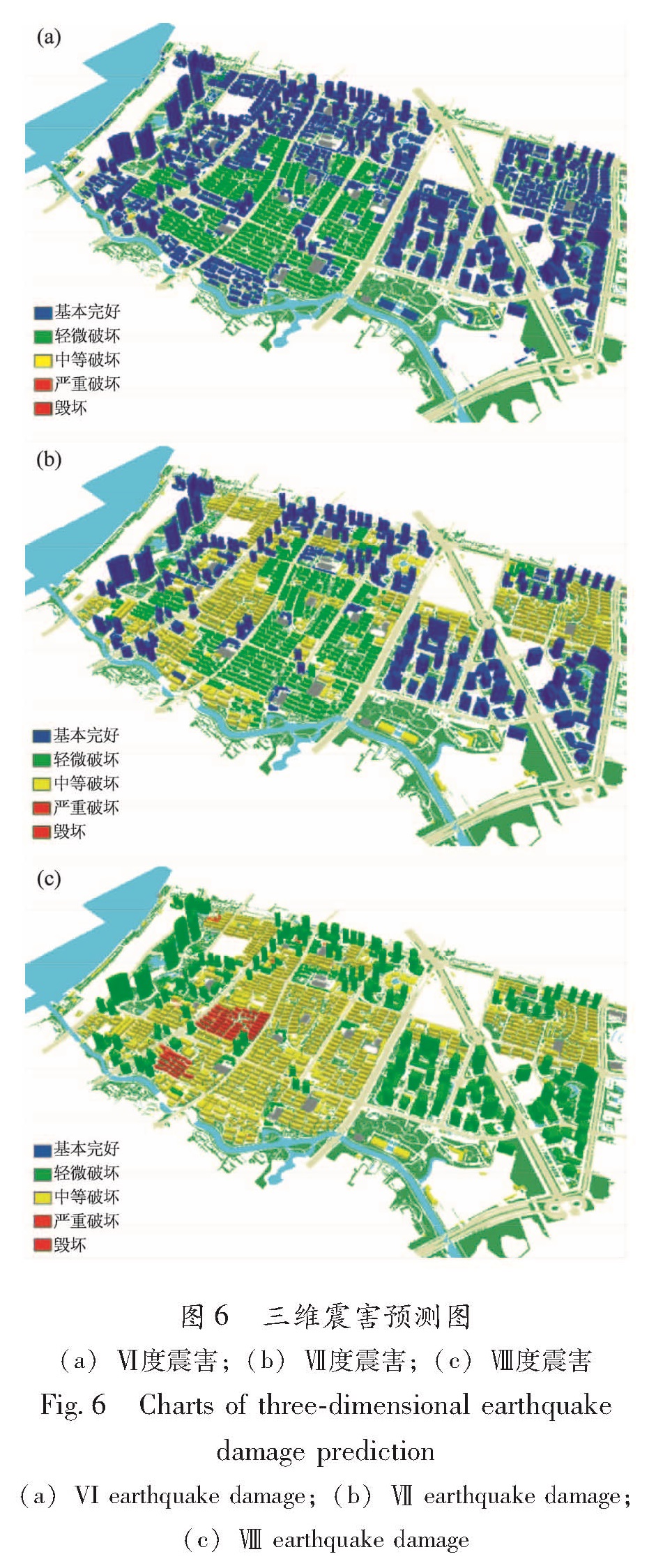
以上海市浦东新区潍坊街道为实验区,基于ArcGIS软件平台,开发了建筑物震害预测系统。该系统分为3个组件:震害矩阵统计工具、震害预测工具箱、建造年代及震害结果赋值工具,将建筑物的属性数据、建筑物易损性模型和震害预测结果嵌入GIS平台,实现了震害预测的批量化和自动化,以及预测结果的交互可视化。另外还将开发的建筑物震害预测系统应用于实验区,所得结论与以前项目研究成果对比一致,验证了该系统的可靠性,得出的震害预测结果,可以辅助城市抗震防灾规划的决策。
Taking the Weifang Street of Shanghai Pudong New Area as the experimentation area, based on the ArcGIS software platform, we developed an Earthquake Damage Prediction System of Buildings. The system consists of three components: the statistical tool of damage matrix, the toolbox of damage prediction, the assignment tool of construction years and seismic damage results, and embeds the attribute data of the buildings, the building vulnerability models and earthquake damage prediction results in GIS platform to realize automation and visualization of the prediction result. In addition, the developed Earthquake Damage Prediction System of Buildings was applied in experimentation area. The conclusion is consisted with the previous research project, which demonstrates the reliability of the system. The damage prediction results contribute to assist the decisions of urban earthquake disaster planning.