收稿日期:2015-07-03
基金项目:地震科技星火计划项目——跨断裂综合剖面GPS-水准垂直形变对比研究(XH14070Y)和地震行业科研专项——中国综合地球物理场观测—大华北地区(201508009)联合资助.
基金项目:地震科技星火计划项目——跨断裂综合剖面GPS-水准垂直形变对比研究(XH14070Y)和地震行业科研专项——中国综合地球物理场观测—大华北地区(201508009)联合资助.
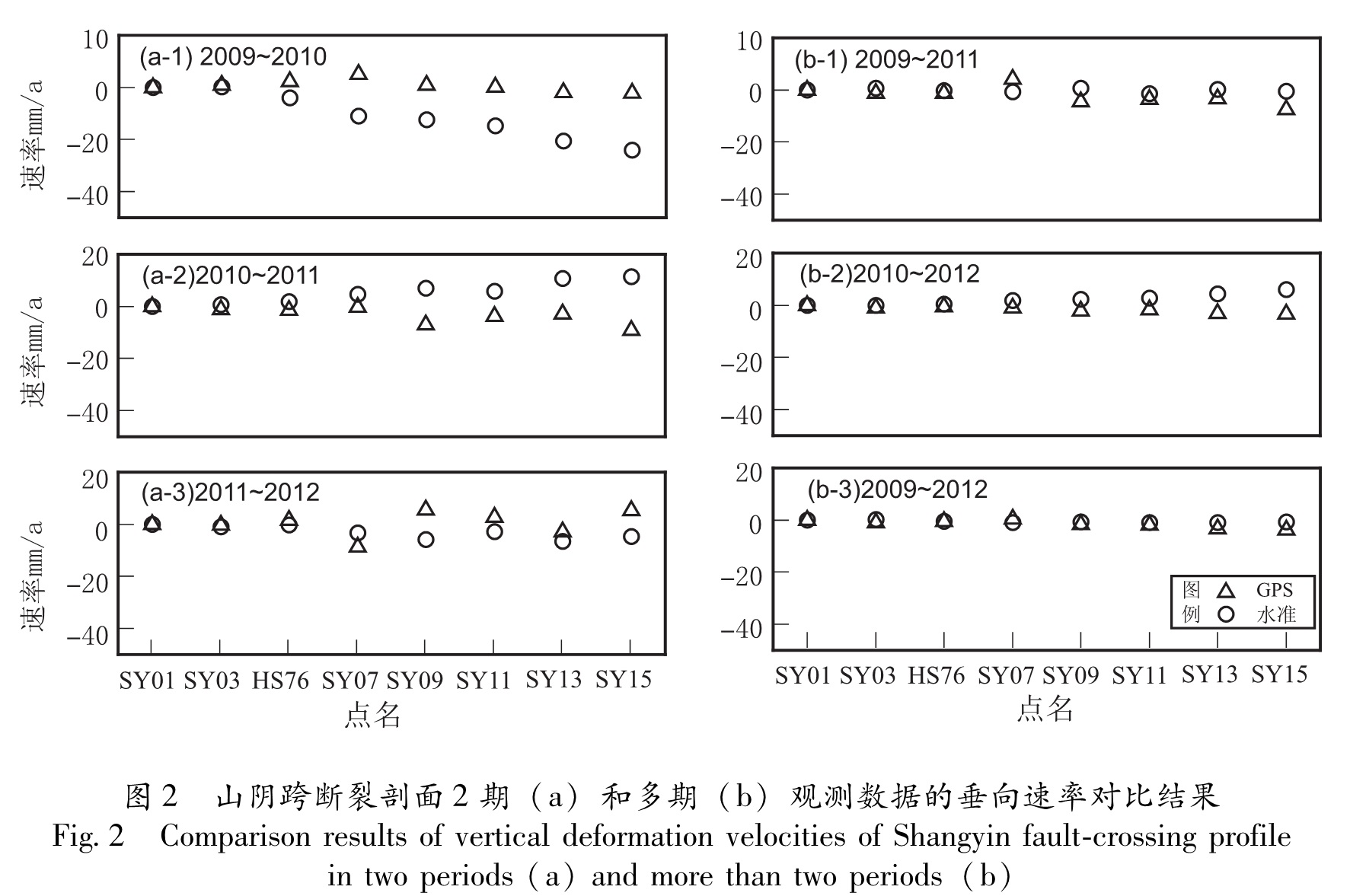
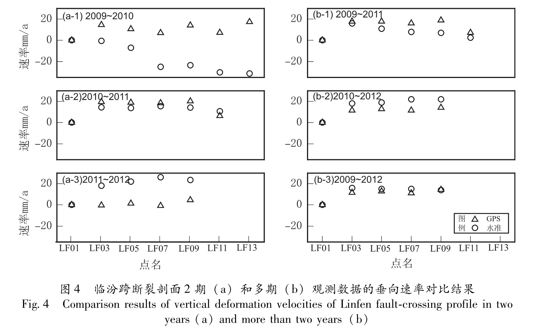
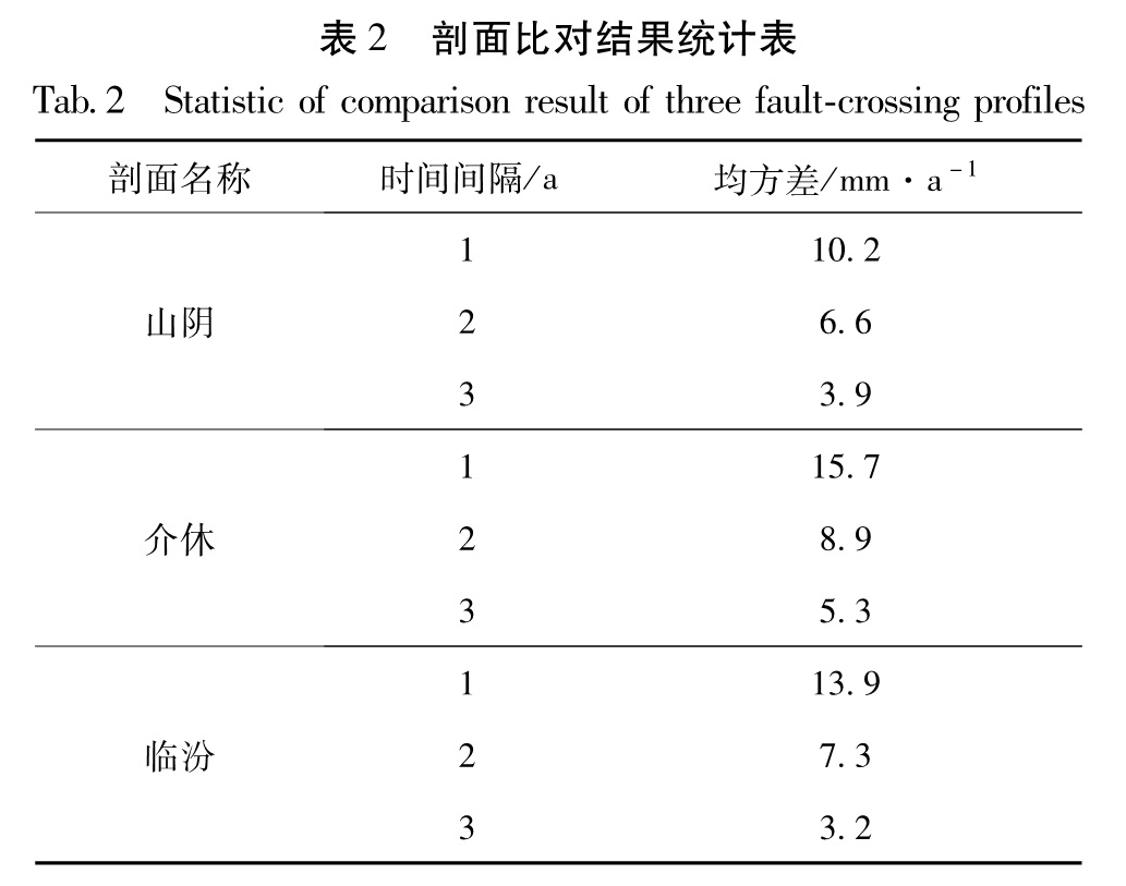
利用2009~2012年山西3个跨断裂综合剖面的GPS和水准资料,分别获取了这3个剖面的垂向形变速率。结果 表明:在时间间隔较短(数月至1 年左右)、观测时间不同步的情况下,GPS 观测与水准观测获得的垂直形变速率偏差较大; 在观测时间间隔较长(3 年及以上)时,二者之间有较好的一致性,同时也验证了在较长时间尺度上利用GPS技术获取跨断裂综合剖面垂直形变的可行性。
After processing and computing the GPS data and precise leveling observation data of three comprehensive fault-crossing profiles from 2009 to 2012,we compared the obtained vertical deformation rate of these three profiles.The results showed that when the observation time interval is shorter(from a few months to one year)and the observation time is not synchronized,the difference of vertical deformation rate between GPS and precise leveling observations are larger.When the observation time interval is longer(for three years or more than three years),the vertical deformation rate between them have good consistency,which verified the feasibility of application of GPS technology to the vertical deformation of fault-crossing comprehensive profiles in the longer time scale.