收稿日期:2016-05-16
基金项目:中国地震局震灾应急救援司专项课题“地震应急公共服务平台研究”、地震应急青年重点任务(CEA-EDEM-201507)和地震社会服务工程无人机灾情获取子系统建设项目共同资助.
基金项目:中国地震局震灾应急救援司专项课题“地震应急公共服务平台研究”、地震应急青年重点任务(CEA-EDEM-201507)和地震社会服务工程无人机灾情获取子系统建设项目共同资助.
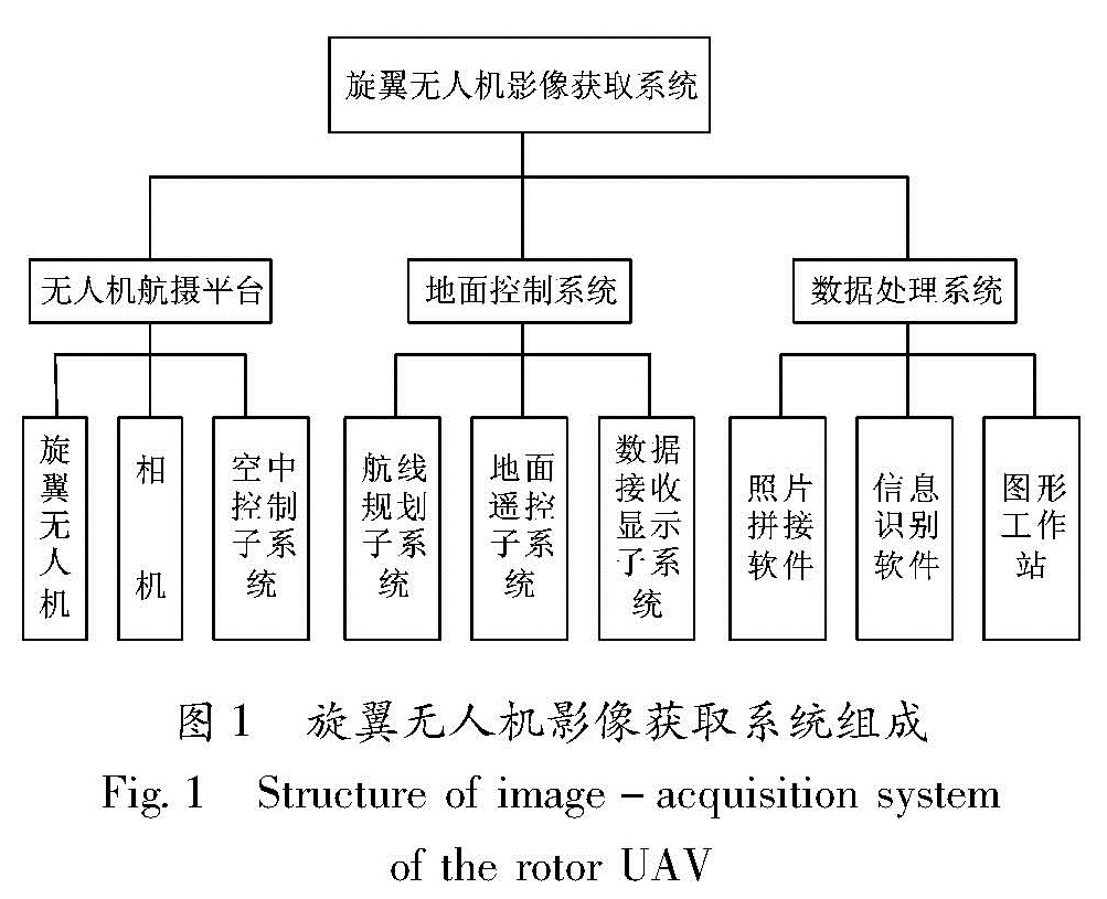
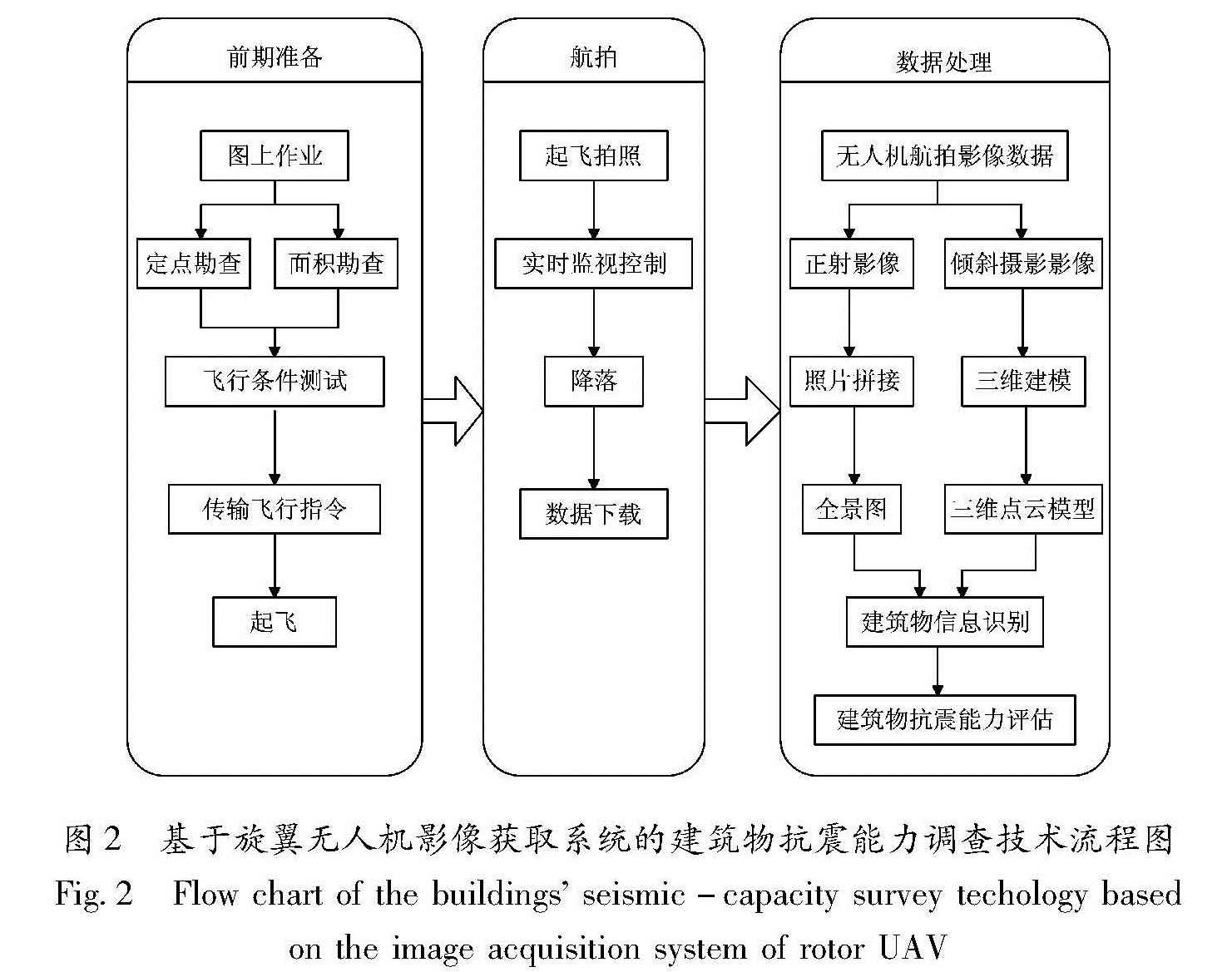
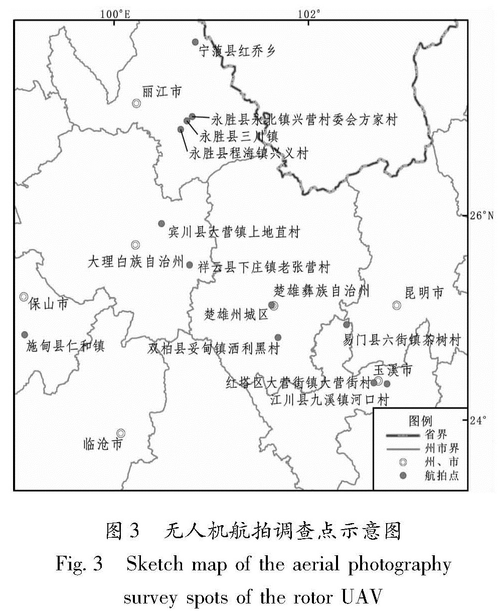
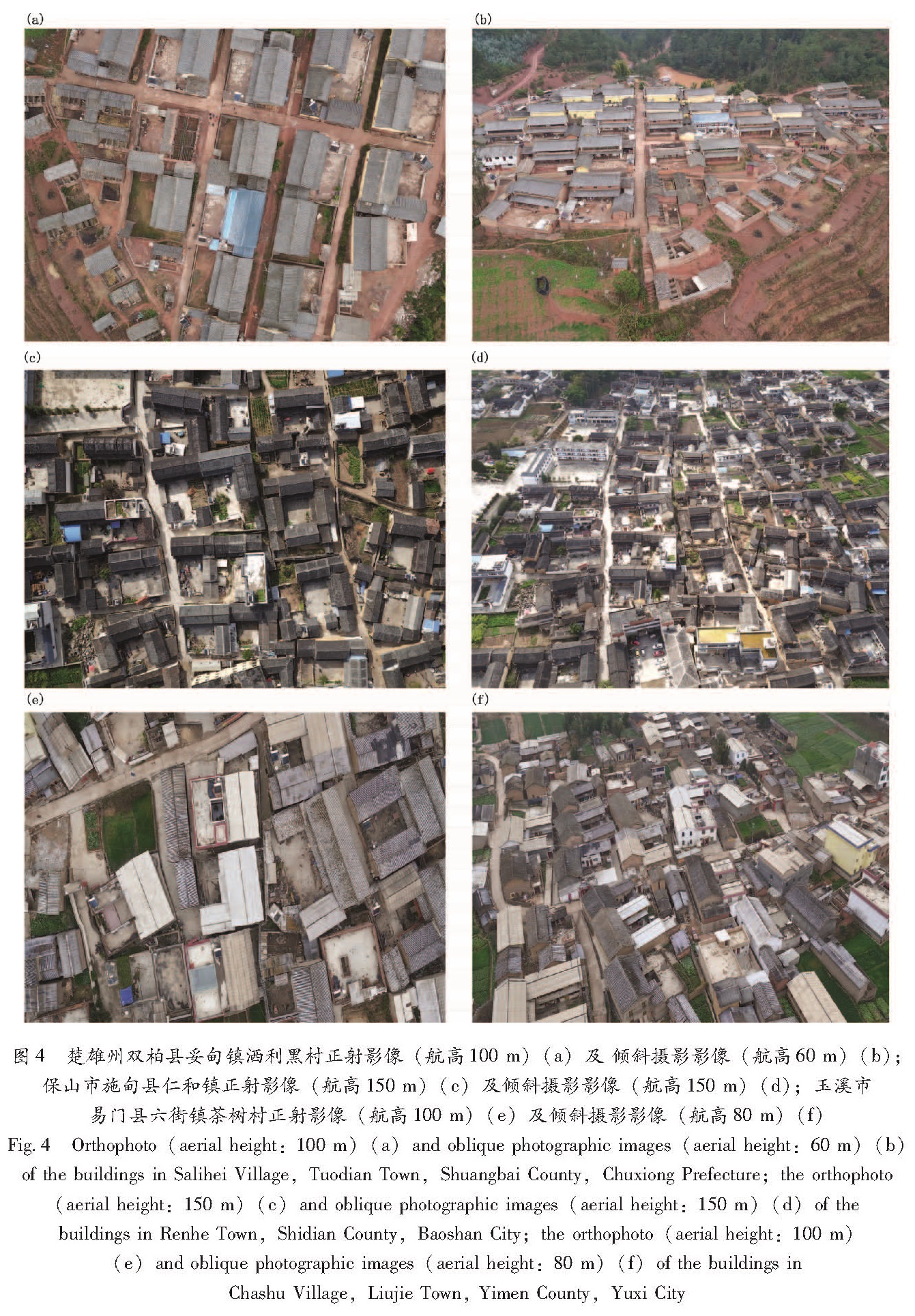
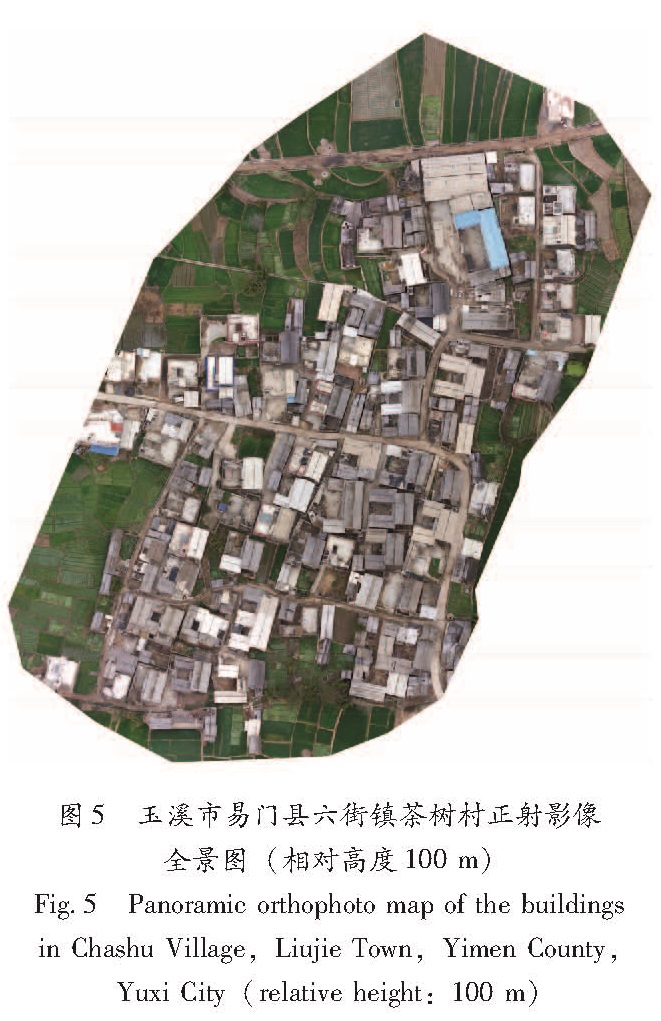
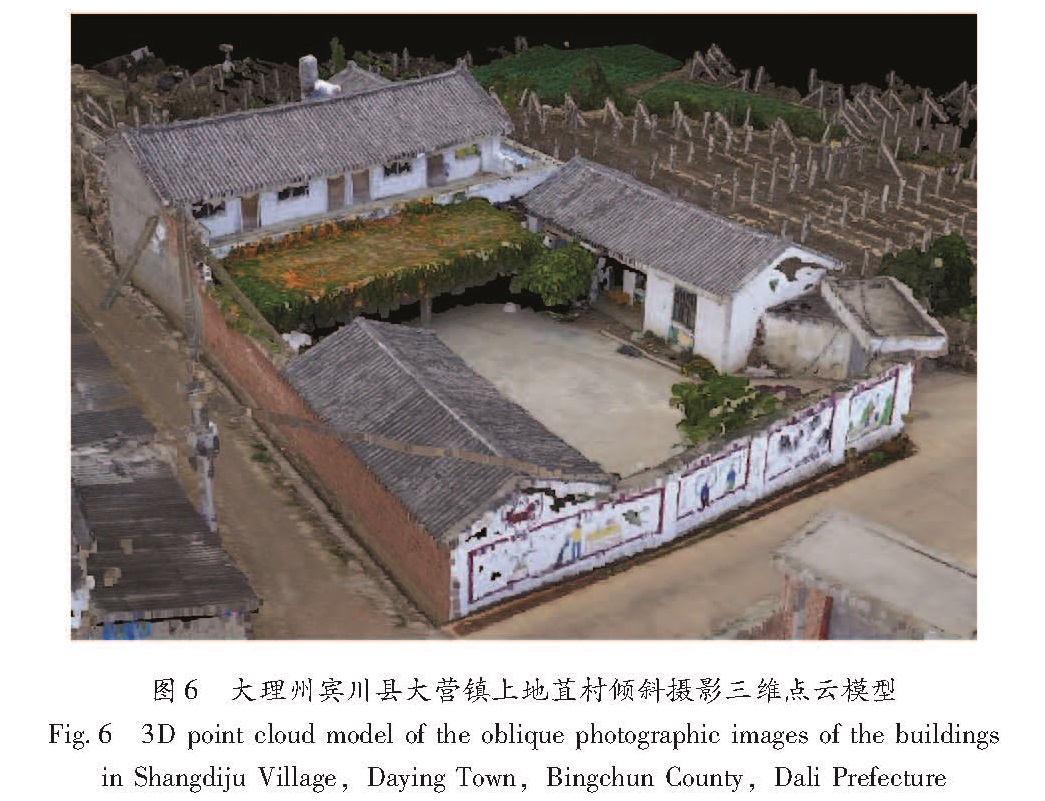
介绍旋翼无人机的工作原理和技术流程,以无人机在2016年云南重点监视防御区建筑物抗震能力调查中的应用为例,对其获取的12个调查点的房屋影像数据进行质量评价和照片拼接处理,并对产出的正射影像全景图和三维点云模型进行了对比分析。结果 表明,旋翼无人机在云南山区具有明显优势,可作为一种快速获取影像数据的技术手段,为区域建筑物抗震能力评估提供有效的基础信息。
Firstly,the working principle and technical process of the rotor UAV was introduced.Secondly,taking the application of the rotor UAV in the seismic-capacity survey of the buildings in the key monitoring and preparedness areas in Yunnan Province in 2016 as an example,we did the data quality evaluation and stitching the building images at 12 survey spots captured by rotor UAV,and analyzed the panoramic orthophoto maps and 3D point cloud model.The result showed that the application of the rotor UAV in maintain area in Yunnan has obvious advantage.As the technology method for quickly getting the image data,the rotor UAV could provide the useful primary data for estimating the seismic capacity of building.