收稿日期:2018-04-23
基金项目:中国地震局地震科技星火计划——基于InSAR的东昆仑断裂玛沁玛曲段地震危险性分析(XH17059)资助.
基金项目:中国地震局地震科技星火计划——基于InSAR的东昆仑断裂玛沁玛曲段地震危险性分析(XH17059)资助.
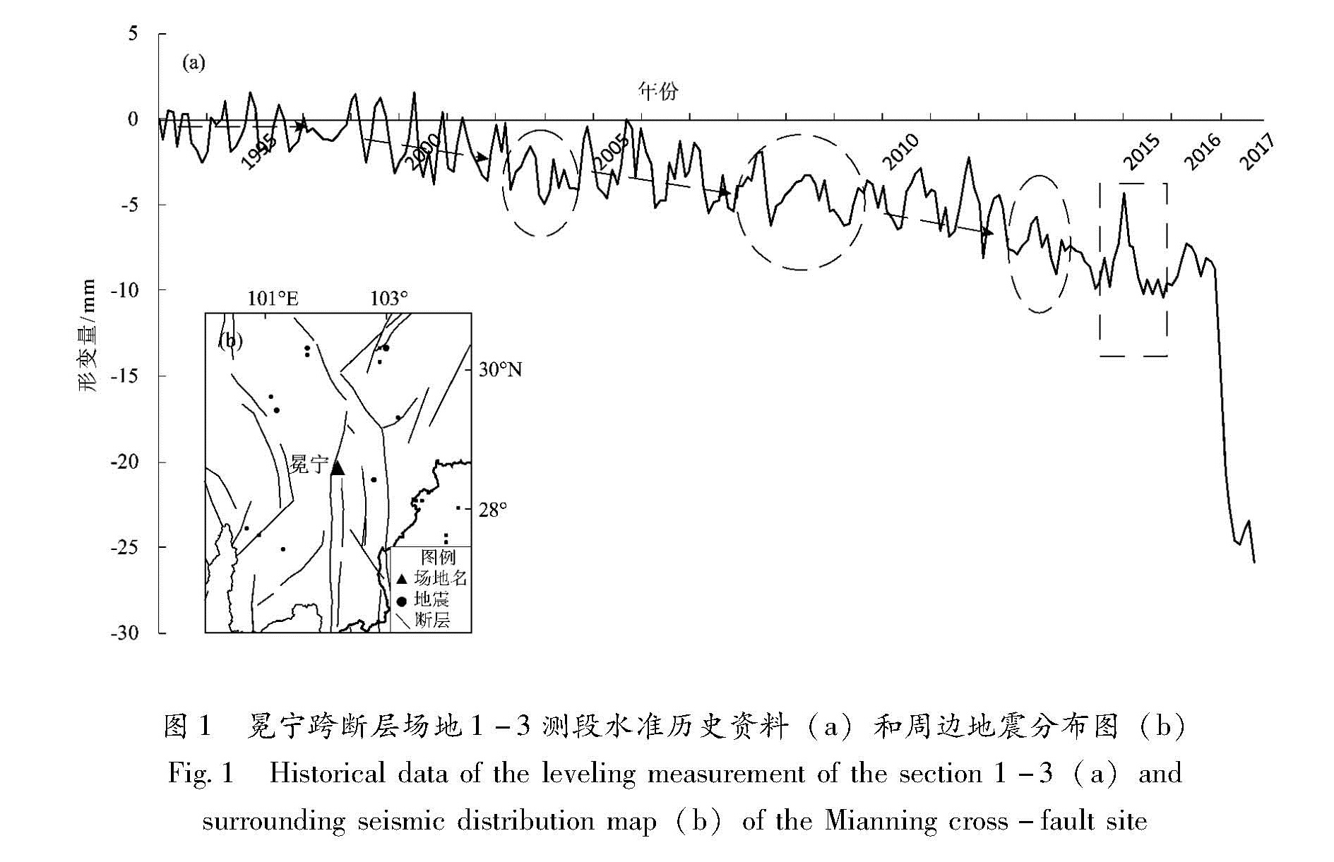
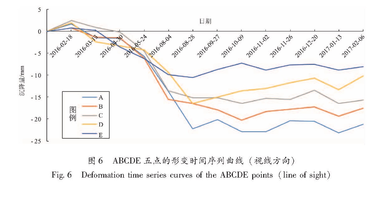
冕宁跨断层水准场地1-1C测段观测曲线从2016年6月开始出现大幅度突降,这是自汶川8.0级地震后四川地区出现的显著巨幅异常。针对该异常,使用Sentinel-1卫星影像数据,利用SBAS技术对冕宁跨断层场地进行沉降监测,通过SBAS-InSAR技术获取了变空间范围和幅度以及形变时间序列曲线。结果 表明:(1)从空间看,形变中心位于西康温泉井附近;(2)从形变时间序列曲线上可以看出,沉降发生的时间与西康温泉井活动一致。因此,认为此形变是由西康温泉井抽水引起的。
The section 1-1C of the Mianning cross-fault site began to undergo a sharp drop in June 2016.It is a significant anomaly that occurred in the Sichuan region since the Wenchuan M8.0 earthquake.In response to the anomaly,this paper uses Sentinel-1 image data to monitor the subsidence of the cross-fault site in Mianning with the SBAS technology.The spatial extent and amplitude of the topographic variations and the time series curves of the deformation in the Mianning cross-fault field are obtained.InSAR deformation field results show that,first,from the perspective of space,the deformation center is located near the well of Xikang Hot Spring.Second,from the time series curve of deformation,it shows that the subsidence time coincides with the Xikang hot spring well activity.Therefore,we believe that the deformation should be caused by the pumping of the Xikang Hot Spring well.