在地质构造研究工作中,特别是针对活动构造,需要精确获取构造地貌的定量参数,如断层陡坎坡度角、断错面貌垂直位移、活动构造长度等信息,从而分析、揭示地质构造运动规律和地震发生机理(邓起东等,2004; 艾明等,2018)。在地质构造定量参数的获取中,皮尺丈量、全站仪实测以及后续发展的GPSRTK等传统测量手段,精度上不仅受限于观测设备的系统误差,还取决于作业外场的环境因素、丈量、人眼读数等偶然误差,且每一个地貌特征点全靠作业员一个个实测完成,作业效率低,大大限制了长距离、大范围地质构造区域测量工作的开展。而高精度数字高程模型(DEM)与高分辨率正射影像图(DOM)能够详细刻画地貌特征,日趋成为活动构造定量参数提取与地貌解译的重要手段,因此,高效获取大范围高精度DEM,已成为今后地质构造研究领域的又一重要工作内容。无人机机载激光雷达扫描(LiDAR)技术的出现为快速获取大面积、高精度地形地貌数据提供了一种前所未有的解决方案,机载LiDAR不仅解决了高效数据采集的问题,还在地表点位垂直方向上有着较高的测量精度。虽然机载LiDAR以其多次回波信号的特点可有效剔除地表植被,然而高昂的作业成本严重限制了该技术的推广与应用(刘静等,2013; Cunningham et al,2006; Zielke et al,2010; Oskin et al,2012; Chen et al,2014; Ren et al,2016)。
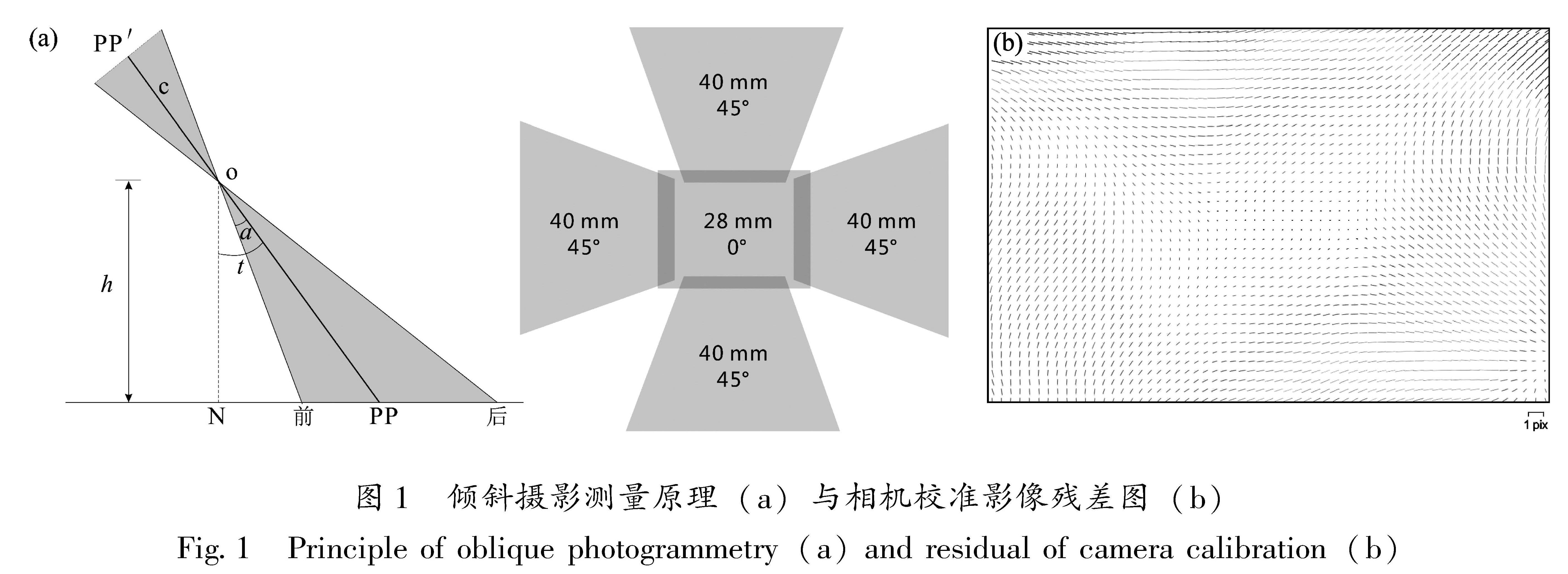
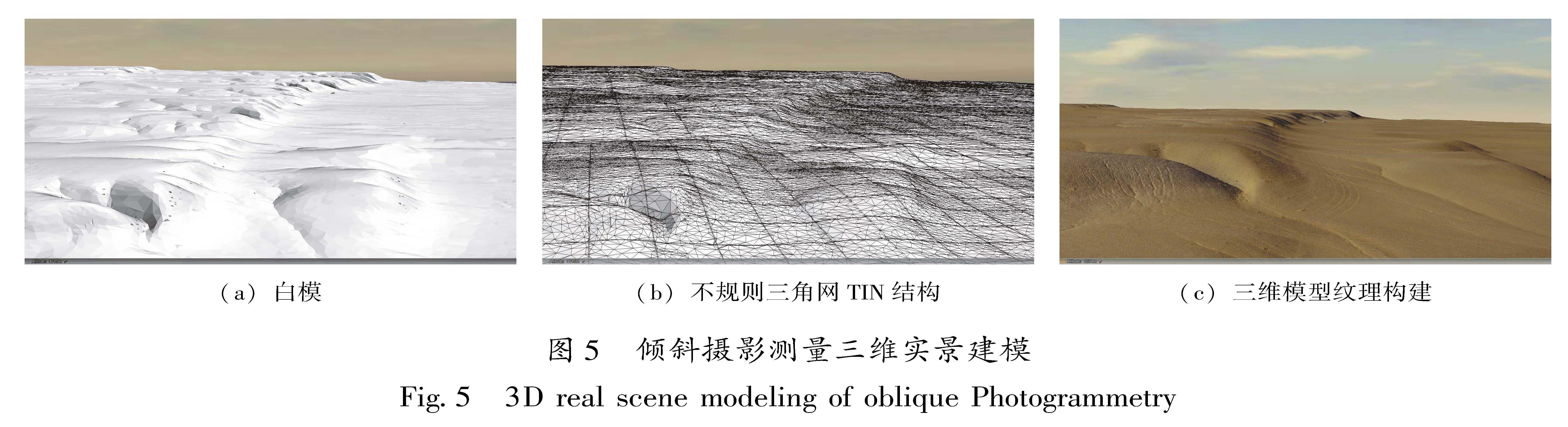
近年来,倾斜摄影测量作为一项服务于测绘领域的高新技术从航空摄影测量中脱颖而出,它搭载多台传感器,具有传统航测垂直摄影相机,能够同时从前、后、左、右4个方向采集地物侧面纹理信息,全方位、多角度提取与匹配地物特征,从具有一定重叠度的影像中恢复摄影瞬间相机的相对位置与姿态(姚方芳,2014; 段宗恩,张海生,2019; 张祖勋等,2003),通过三维重建,可获得具有高精度地理坐标与高程的三维实景模型、数字地表模型(DSM)、正射影像图(DOM)。与机载LiDAR技术相比,在点云密度方面二者能够达到同级别水平,但倾斜摄影测量具有航测范围大、操作简便、成本低等优势,且具有更高的平面点位精度,三维实景模型效果更直观。特别在植被低覆盖地区,倾斜摄影测量能够替代机载LiDAR技术,成为获取高精度地形数据的首选测量方案。
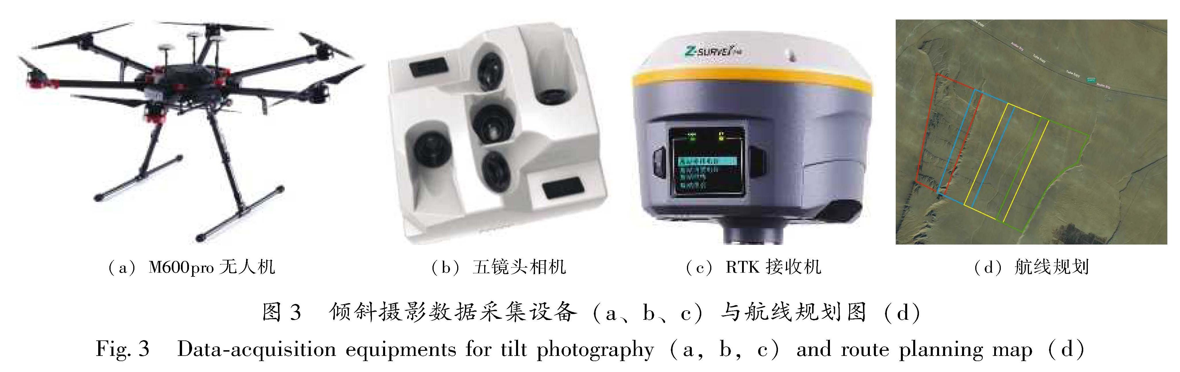
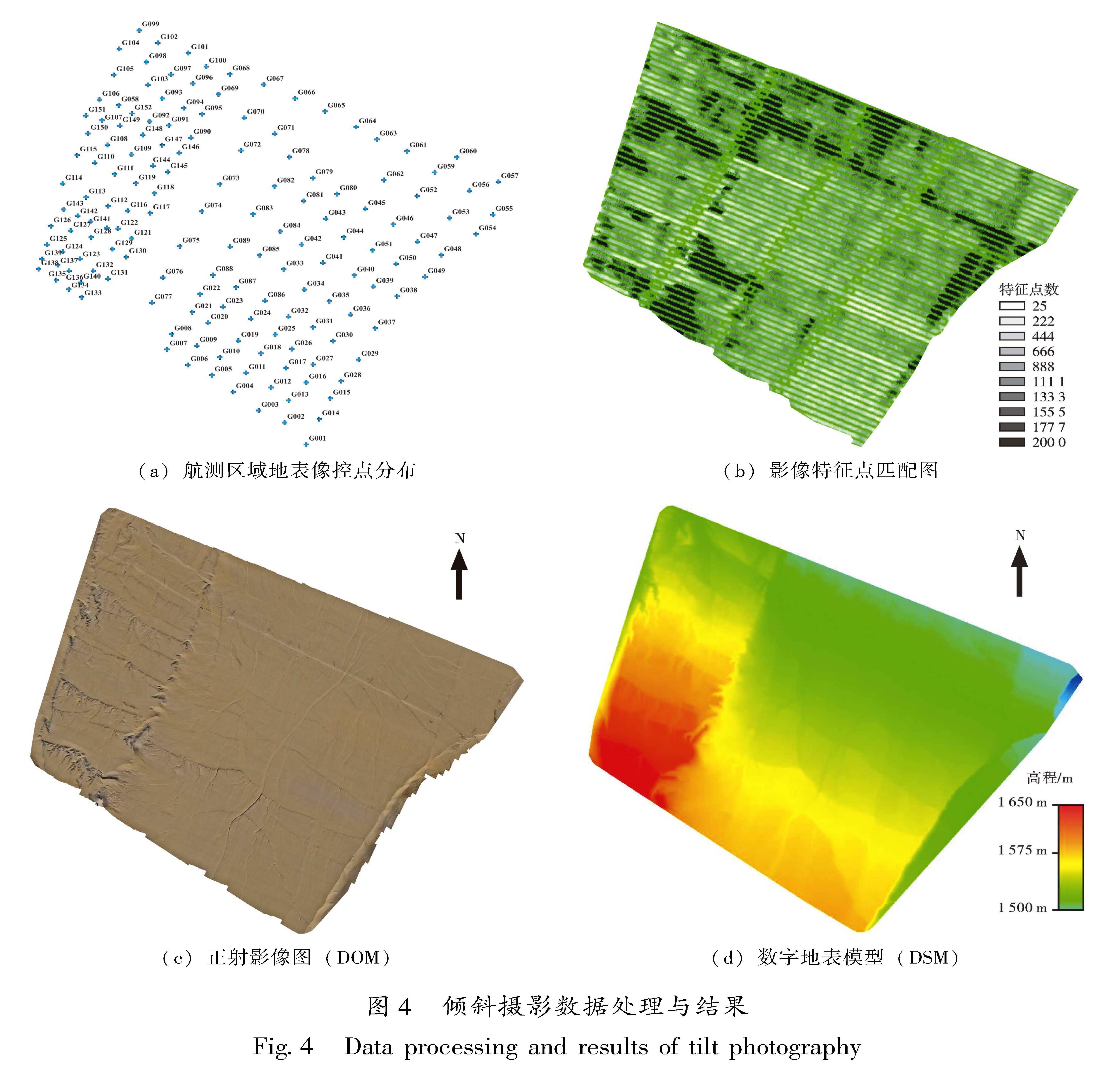
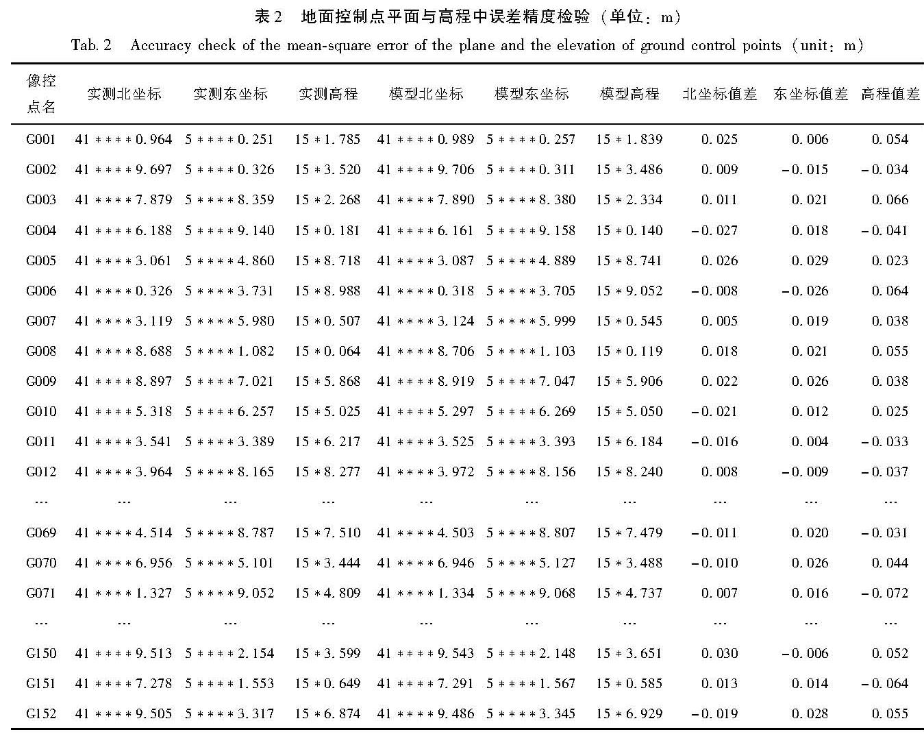
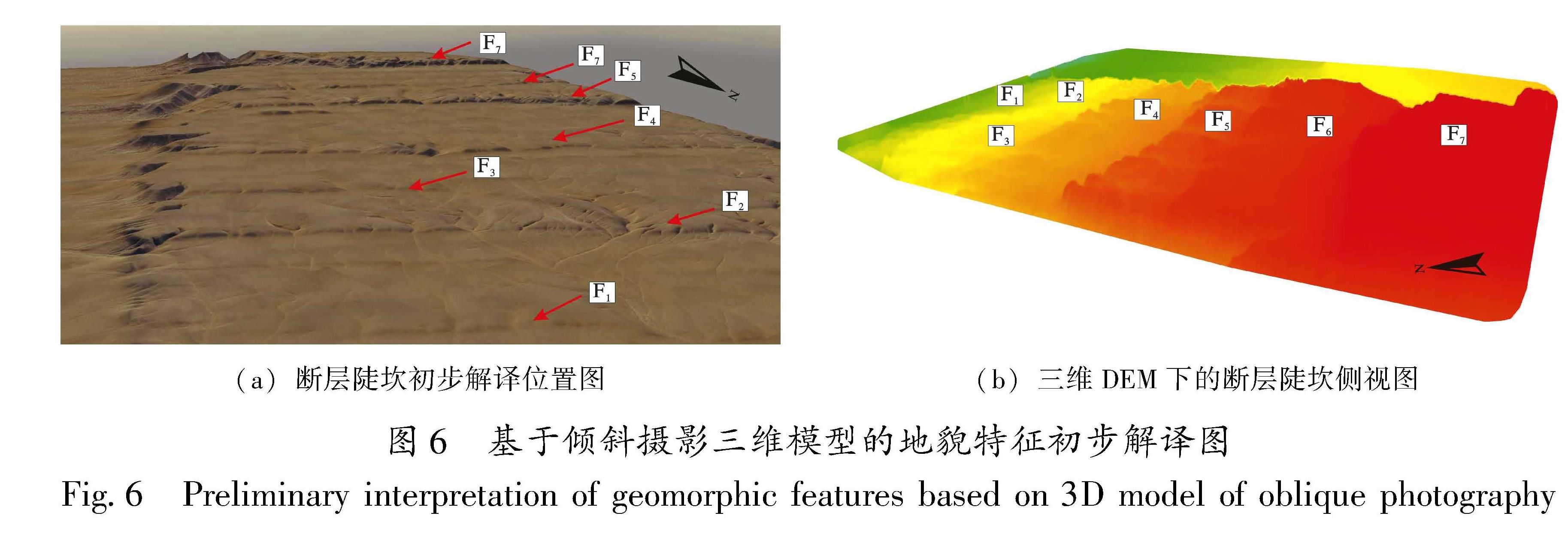
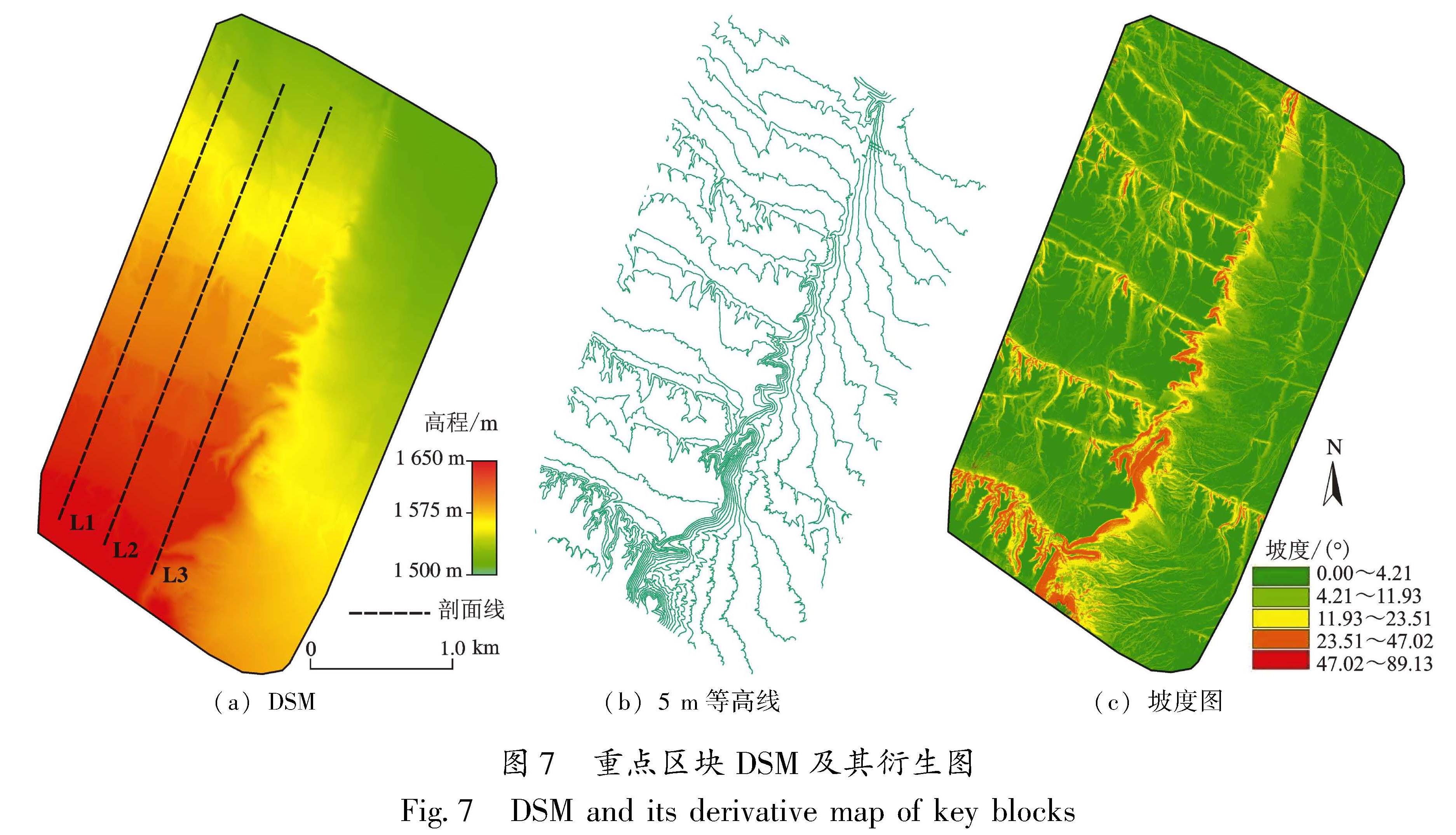
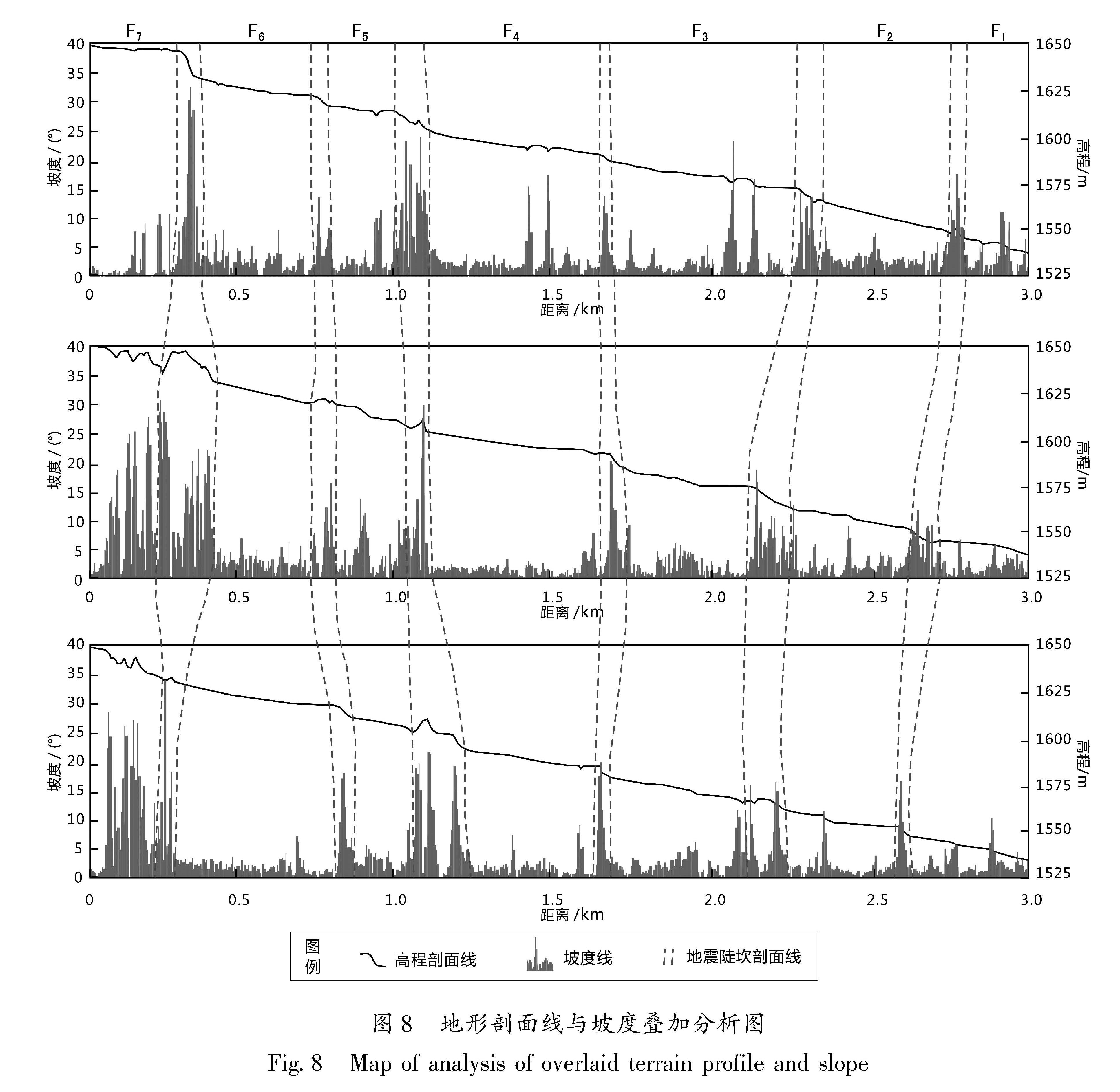
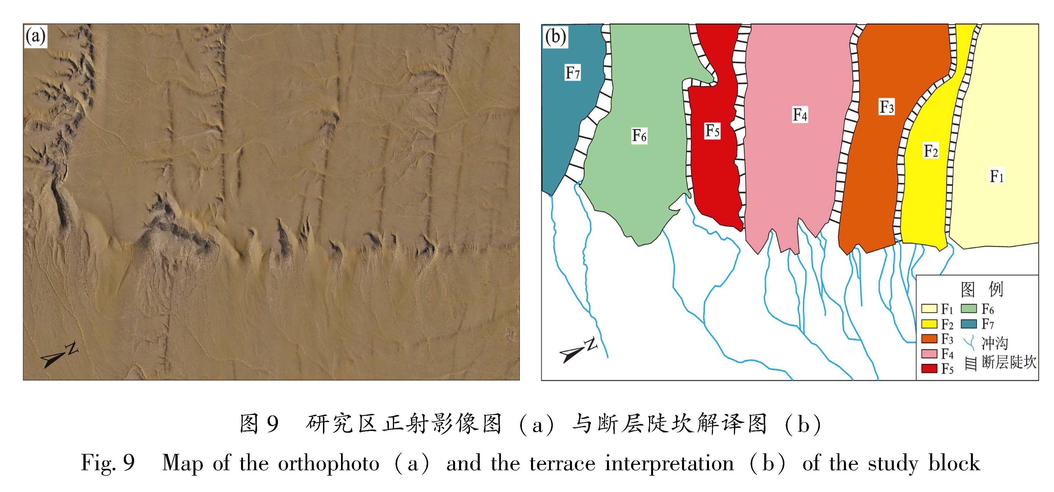
自2008年以来,新疆皮山县及其邻区发生多次强震,造成了巨大的人员伤亡和财产损失。该地区发育多条大型走滑断层,探讨其震后构造运动特征,有助于辨别该地区地震孕育与发生机制,为判断该地区未来地震提供有力支撑。本文利用无人机倾斜摄影测量技术,借助构建三维实景模型、高精度DSM,以新疆西昆仑山前、皮山县西南邻区地貌点为例,进行了地貌信息获取与解译,精确提取了各级断层陡坎的垂直位移值,分析了倾斜摄影测量技术在构造微地貌研究中的应用前景。