地震具有突发性,大部分人震后第一反应就是快速撤离到空旷的地方和应急避难场所。震后房屋倒塌,水、电、气、粮食等中断,加之余震不断,灾民恐慌,不敢也不愿回家,应急转移和避难需求成倍增加。2008年四川汶川8.0级地震,1 993.03万人失去住所(汶川特大地震四川抗震救灾志编纂委员会,2017)。2010年青海玉树7.1级地震,1.5万户民房倒塌,灾区有10万户灾民需要转移安置。2014年云南鲁甸6.5级地震造成大量的房屋倒塌,截至8月18日,紧急转移安置25.4万人(皇甫岗,2015)。2021年云南漾濞6.4级地震导致约21 902人失去住所,2万多人等待转移安置①。2021年青海玛多7.4级地震造成果洛、玉树州、海西州8县45个乡镇38 137户107 500人受灾,政府设置集中安置点126个。2022年四川芦山6.1级地震,四川省抗震救灾指挥部设置转移安置点61个,紧急转移安置受灾群众12 722人。可见,地震造成了大量的灾民流离失所,当重大灾难性突发事件发生时,在短时间内安全地大范围疏散转移高密集人群,合理规划安置方案,实施科学的应急救灾策略,是减轻灾害后果严重性的重要措施之一(蔡娜等,2019)。为了保证群众安全,将人群快速疏散到安全区域,减小灾害造成的损失,制定合理、高效的灾时、灾后人群疏散策略及应急方案十分关键(钟光淳等,2022)。
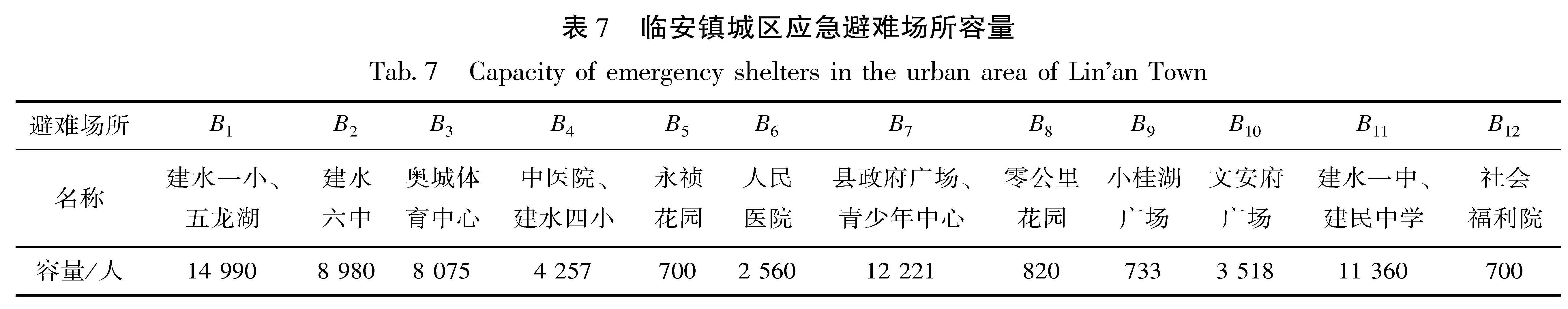
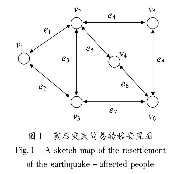
转移安置点是指临时或提前规划建设的专门用于安置受灾群众的场所,其中应急避难场所是应急避险安置点的重要组成部分(王丹丹,徐伟,2018)。我国地震应急避难场所大多选择公园、绿地、广场、体育场馆和学校操场等作为场地,进行相应配套设施建设(杨爽等,2013; 郭兴利等,2017)。震后,应急指挥决策部门通常会把灾民集中的居民区、学校、医院、村庄等作为重点转移区,市民广场、学校操场、体育场馆、公园、空旷地等被划定为震后应急避难场所或灾民安置点。避难场所具备“平、灾”两用的性质,其数量、位置与人口避难需求分布并不能完全匹配,会引起灾时应急转移人员分配的不均衡,从而导致转移滞后甚至无法转移的状况(魏本勇等,2022)。缺少科学合理的紧急避难转移安置方案,将造成灾区应急处置的混乱与无序,甚至激发社会矛盾。因此,一些学者对震后转移安置和应急转移进行了研究,如王女英等(2017)、苏建锋和张庆斌(2021)对城市应急避难场所服务功能的适宜性、空间分布与人口的匹配性进行了宏观研究; 谢旭阳(2007)根据灾害发生时应急疏散范围,利用GIS将需要疏散的建筑物标识出来,建立了应急疏散最优模型; 和仕芳等(2023)利用无人机航拍2021年云南漾濞6.4级地震灾区影像,使用加权泰森多边形法对应急避险安置点责任区划分进行了研究; 曹彦波等(2008)基于GIS技术对地震应急异地转移接受能力判断模型进行了研究; 魏本勇等(2022)研究了基于避难场所容量限制的地震应急转移路径规划,采用Dijkstra算法计算疏散需求点与目的地点的最短距离矩阵; 叶永和赵林度(2011)对重大危险源大规模人群转移决策模型进行了研究,采用待疏散点-临时疏散救援点-医疗救治点两阶段疏散模式; 李永义等(2011)对交通生命线系统震后应急调度模型及方法进行了研究,建立了震后多需求点多服务点应急调度的线性规划数学模型; 刘小婵等(2014)基于GIS与多智能体的人群转移进行了模拟,建立了城市重大危险源灾害应急疏散决策模型。
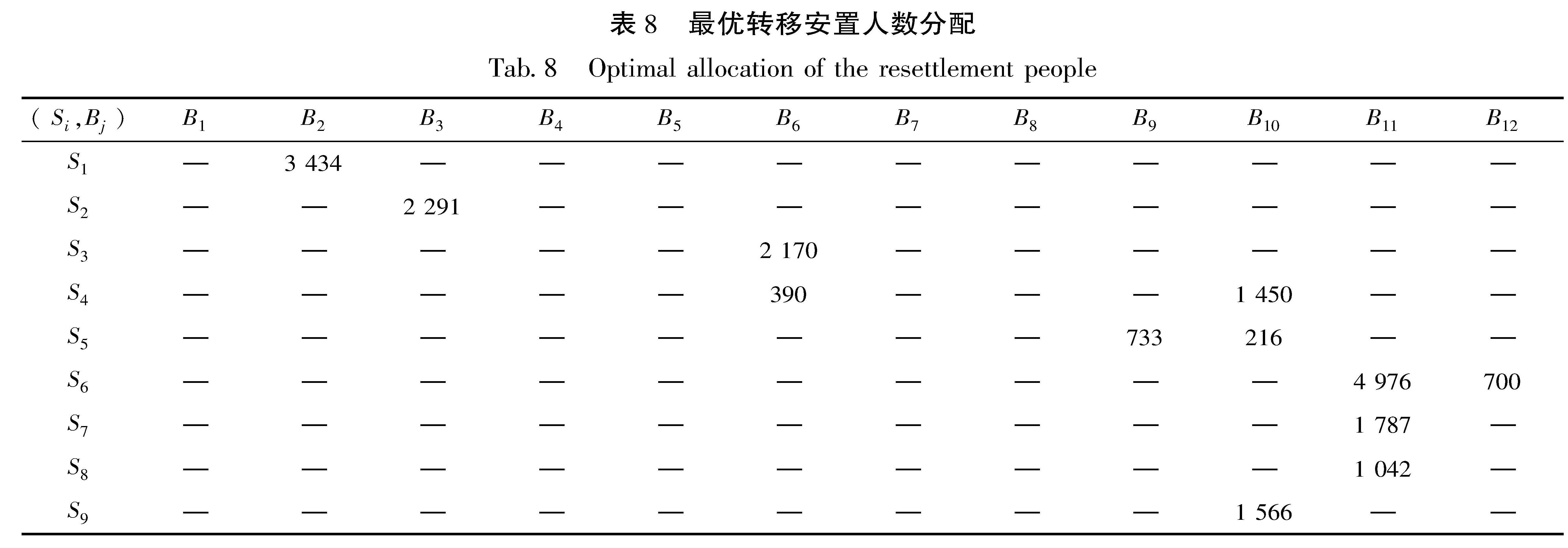
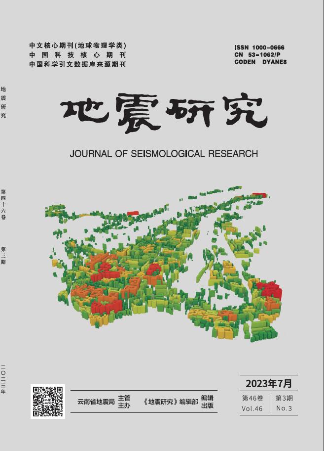
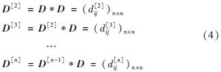
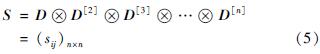
以上研究为突发事件人员转移提供了理论支撑和实践参考,但这些研究大多为宏观对策研究,在应用中缺乏可操作性,部分研究仅考虑了最优转移路径,未给出转移人数,或者考虑了最优转移人数而未给出转移路径,或给出了定性的转移对策和情景模拟,但无法给出定量化的转移安置方案。鉴于此,本文结合联通图理论和线性规划的基本原理,对震后灾民转移安置进行数学模型研究和探讨,并给出定量化的最优转移路径和人数。

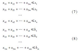
 ,约束条件包含2个方面:①灾民数量约束:该灾民点的转移安置人数不能超过实有人数; ②安置点容量约束:转移到该安置点的人数不能超过设计容量,即: